Other Applications
These mobile and browser applications were developed by other organizations. Recommended by KGS for their usefulness in exploring geologic data from KGS, USGS, and other data providers.

USGS TopoView - Accessing USGS Topographic Maps Has Never Been Easier
"TopoView highlights one of the USGS's most important and useful products, the topographic map. In 1879, the USGS began to map the Nation's topography. This mapping was done at different levels of detail, to support various land use and other purposes. As the years passed, the USGS produced new map versions of each area. TopoView shows the many and varied topographic maps of each of these areas through history. This can be particularly useful for historical purposes, such as finding the names of natural and cultural features that have changed over time." Produced by the USGS.
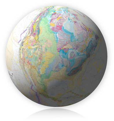
USGS Geologic MapView - Use an interactive map to view and download geologic map publications in the National Geologic Map Database. "For mapView, we've selected the most recent bedrock and surficial maps of the Nation, from the entire collection in the National Geologic Map Database's (NGMDB) national archive. From links in mapView, you can find, view, and download all other maps and reports in the NGMDB (over 106,000 publications)." Produced by the USGS.

Rockd mobile application - Mobile geologic discovery application for Apple iOS or Android. "Explore, learn about, and document your geologic surroundings! Whether you are a professional geoscientist or curious about the rocks around you and the stories they tell, Rockd allows you to explore and learn about the geologic record, contribute your own observations, and log your journey through the geologic record." Produced by the UW Macrostrat Lab.
Flyover Country mobile application - "Learn about the world along the path of your flight, hike, or road trip
with GPS tracking. Offline geologic maps and interactive points of interest reveal the locations of fossils and georeferenced Wikipedia
articles visible from your airplane window seat, vehicle, or hiking trail vista.
Flyover Country is a National Science Foundation funded offline mobile app
for geoscience outreach and data discovery. The app exposes interactive geologic maps from Macrostrat.org, fossil localities
from Neotomadb.org and Paleobiodb.org, core sample localities from LacCore.org, Wikipedia articles, offline base maps, and the
user's current GPS determined location, altitude, speed, and heading. The app analyzes a given flight path and caches relevant map
data and points of interest (POI), and displays these data during the flight, without in flight wifi. By downloading only the data relevant
to a particular flightpath, cache sizes remain reasonable, allowing for a robust experience without an internet connection."
Macrostrat Sift - Explore the Macrostrat platform. "Macrostrat is a platform for the aggregation and distribution of geological data relevant to the spatial and temporal distribution of sedimentary, igneous, and metamorphic rocks as well as data extracted from them. It is linked to the GeoDeepDive digital library and machine reading system, and it aims to become a community resource for the addition, editing, and distribution of new stratigraphic, lithological, environmental, and economic data. Interactive applications built upon Macrostrat are designed for educational and research purposes." Produced by the UW Macrostrat Lab.