McCracken County, Kentucky
GEOLOGIC HAZARDS
There are seven shallow,
concealed faults located throughout McCracken
County. Currently there
is no evidence that these faults are active.
However, because of the proximity of McCracken County
to the New Madrid Seismic Zone, strong earthquake activity is possible. Soil creep, slumps, and landslides along
steep slopes may occur from erosion or ground motion associated with a strong
earthquake. Areas associated
with alluvial material are subject to liquefaction during
a strong earthquake. These areas are also subject to flooding. Soils derived
from alluvial deposits have a moderate to high shrink swell capacity, which may
affect structural foundations and roads. For more technical information about
the engineering geology of the area, see Finch (1968a, b). Flood information is
available from the Kentucky Division of Water, Flood Plain Management Branch, www.water.ky.gov/floods/
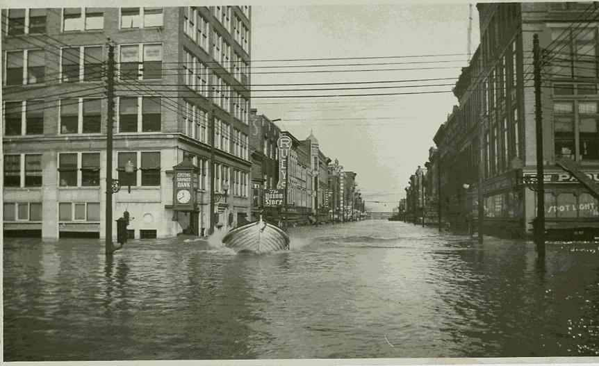
This picture of the 1937 flood in Paducah was taken before the Ohio
River crested on February 2, 1937. Flood waters covered more than
90 percent of the city and flood damage exceeded $22,000,000. Photo courtesy of the William Clark Market
House Museum.
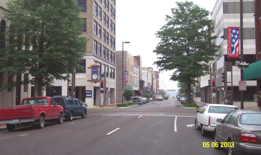
The bank clock (left center) is
located in the same spot as it was in 1937 (see Paducah 1937 flood picture above). Photo by Glynn Beck,
Kentucky Geological Survey.
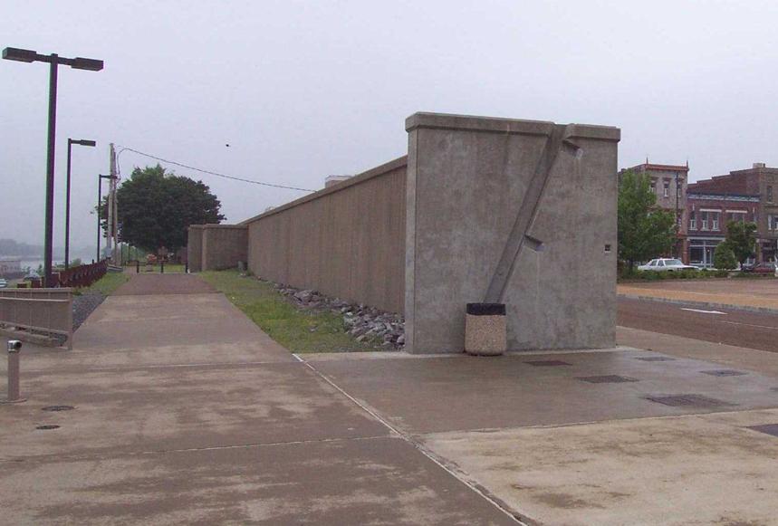
This 12.5 mile long flood wall was
constructed by the U.S. Army Corps of Engineers after the 1937 flood to prevent
future flood damage in Paducah.
Photo by Glynn Beck,
Kentucky Geological Survey.
SURFACE WATER DRAINAGE
Because of the large
percentage of flat to gently sloping areas associated with the Ohio River, development, such as subdivisions, can cause flooding
if proper drainage designs are not implemented as part of the planning and
development process. Watersheds can also be impaired from improper sewage
treatment and urban and industrial runoff.
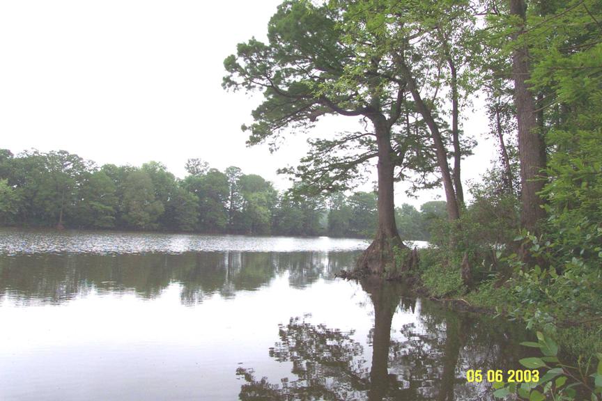
Metropolis
Lake is a natural lake located in the Wabash-Ohio
Bottomlands ecoregion along the Ohio
River (Woods and others, 2002). Metropolis Lake is currently contaminated with
PCB’s and mercury, which demonstrates why industrial planning is necessary. Photo by Glynn Beck,
Kentucky Geological Survey.
EARTHQUAKE HAZARDS
Peak ground acceleration at
the top of rock that will probably occur in the next 500 years in Kentucky
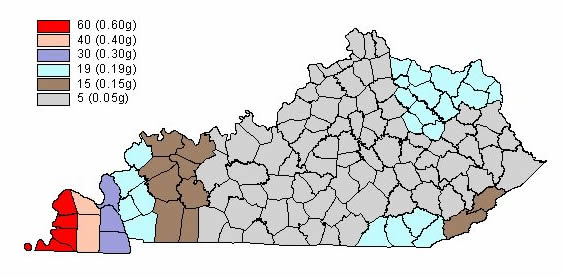
Although we do not know when
and where the next major earthquake will occur, we do know that an earthquake
will cause damage. Damage severity depends on many factors, such as earthquake
magnitude, the distance from the epicenter, and local geology. Information on
earthquake effects is obtained by monitoring earthquakes and performing
research. Such information is vital for earthquake hazard mitigation and risk
reduction.
The most important
information for seismic-hazard mitigation and risk reduction is ground-motion
hazard. One way of predicting ground-motion hazard is by determining the peak
ground acceleration (PGA) that may occur in a particular timeframe. The map
above shows the PGA at the top of bedrock that will likely occur within the
next 500 years in Kentucky
(Street and others, 1996). It shows, as expected, that PGA would be greatest in
far western Kentucky
near the New Madrid Seismic Zone. Ground-motion hazard maps for the central United States
and other areas are available from the U.S. Geological Survey. These maps are
used to set general policies on mitigating damage. For example, maps produced by
the USGS in 1996 were used to determine seismic design in building codes. For
additional information pertaining to earthquake hazards visit the Kentucky
Geological Survey website at www.uky.edu/KGS/geologichazards/geologichazards.html
GROUNDWATER
Groundwater resources in McCracken County are abundant and have fair to
good water quality. All areas of the county have the ability to produce water
from drilled wells at reasonable depths in quantities sufficient for domestic
use. Multiple zones of production are common throughout the county. Depths to
uppermost production range between 30 and 200 feet. Generally, depth to
groundwater is less than 100 feet, except in the uplands of southwestern McCracken County where sufficient groundwater is
obtained at depths greater than 100 feet. Water quality generally is good
except in areas where downward percolation of surface water, fluids from
domestic sewage-disposal systems, and other sources of domestic or industrial
pollution have contaminated the aquifer. Groundwater sometimes contains
naturally occurring iron in objectionable amounts from the deeper zones. In some formations with slightly acidic
groundwater, a chemical reaction between the acidic groundwater, steel well
casings, and pump equipment will produce high iron content in the water which
is not naturally occurring. For more information about groundwater resources in
the county, see Carey and Stickney (2001).
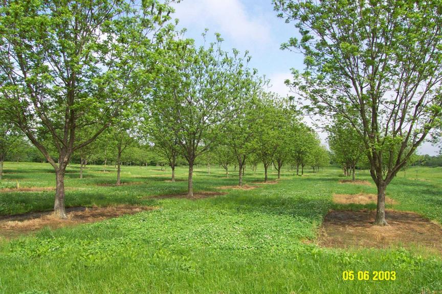
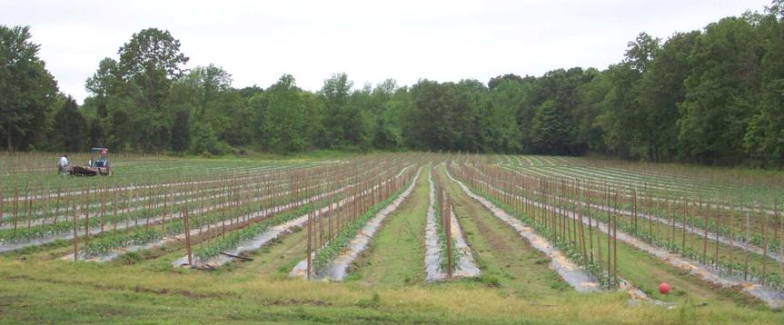
Groundwater is a valuable resource to residents,
industry, and farmers in McCracken
County. Kight Pecan Orchard shown above—the largest pecan orchard
in the state (80 acres)--and the 6.5-acre tomato farm shown below, utilize
groundwater for drip irrigation. Proper resource management and planning will
be essential to preserving good groundwater quality in McCracken County.
Photos by Glynn Beck,
Kentucky Geological Survey.
RESOURCES
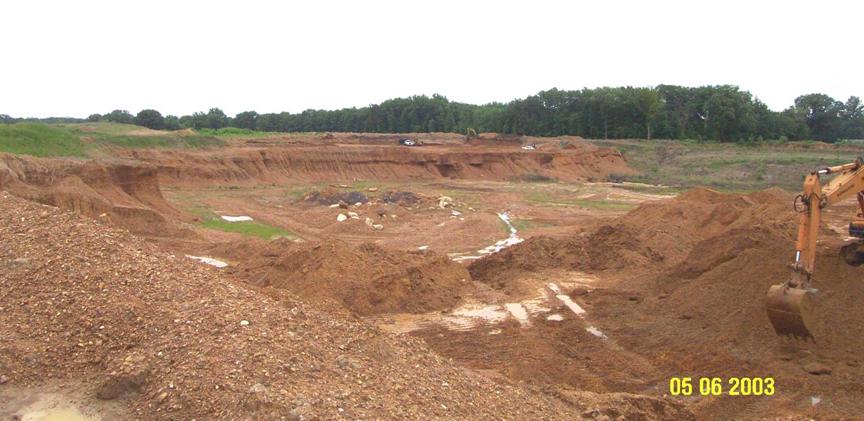
Ohio Valley Gravel and Sand Company quarry in
McCracken County. This quarry is the most
productive gravel and sand quarry in the eight county Jackson
Purchase Region. Photo by Glynn Beck, Kentucky
Geological Survey.