Madison County, Kentucky
Geology
Faults are common geologic structures across Kentucky, and have been mapped in many of the Commonwealth's counties. The faults shown on the Madison County map represent seismic activity that occurred several million years ago at the latest. There has been no activity along these faults in recorded history. Seismic risk associated with these faults is very low. Faults may be associated with increased fracturing of bedrock in the immediately adjacent area. This fracturing may influence slope stability and groundwater flow in these limited areas.
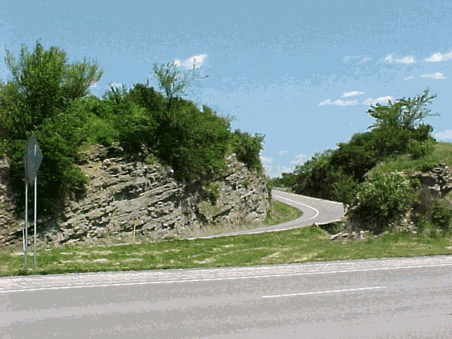
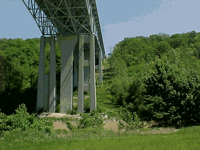
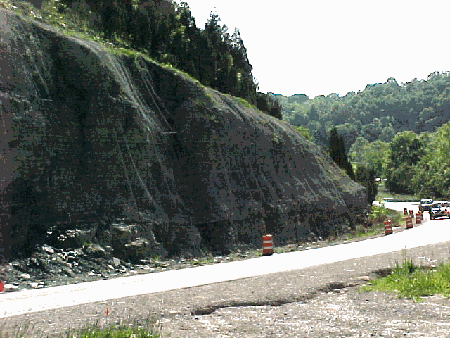
An expression (above) of the Kentucky River Fault occurring in limestone north of Clays Ferry bridge on I-75, which continues under the bridge itself (below). Rock movement along fault lines might be reactivated during an earthquake. Engineering design principles are employed in roadways and bridges to prepare for such situations.
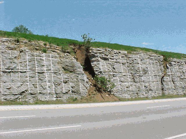
Fractures in limestone are enhanced by slightly acidic rainwater to produce sinkhole collapses, which are infilled with soil from the surface. These fractures can also contribute to roadway failure.
Resources
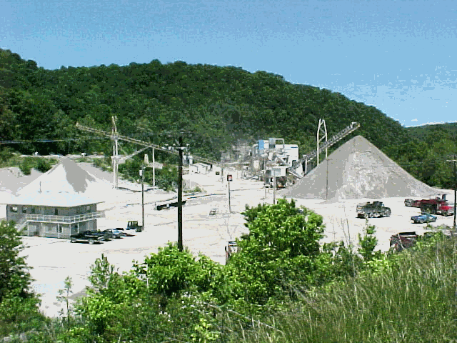
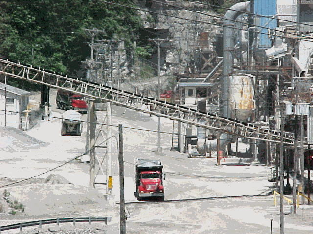
Boonesboro Quarry mines the Camp Nelson Limestone along the Kentucky River. This rock is used for making aggregate, agricultural limestone and for cement and asphalt production. Kentucky is one of the top ten limestone producers in the country.
Groundwater Availability
Within the thin Kentucky River valley along the northern edge of Madison County, and in the lower reaches of the valleys of the larger creeks that empty into the Kentucky River, most drilled wells will produce enough water for a domestic supply at depths of less than 100 feet. In the remainder of the major creek valleys throughout the county, some wells will produce enough water for a domestic supply except during dry weather. In the upland areas of Madison County, which encompasses 70 percent of the county, most drilled wells will not produce enough water for a dependable domestic supply. Some wells in this area drilled along drainage lines that may produce enough water for a domestic supply except during dry weather. Throughout the county ground water is hard or very hard and may contain salt or hydrogen sulfide, especially at depths greater than 100 feet. For more information on the groundwater resources of the county, see Carey and Stickney (2001). http://kgs.uky.edu/kgsweb/download/wrs/MADISON.pdf
Water well information is available at: http://wris.state.ky.us/website/kgs/viewer.htm
Construction
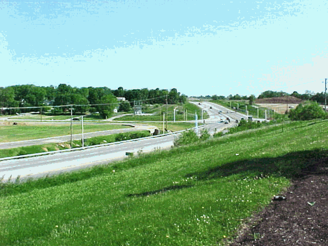
New construction in Richmond represents different land use characteristics than were there previously. Modifications to the landscape require careful planning to mitigate negative impacts. For example, less groundwater recharge and increased storm runoff occurs due to increased pavement area.
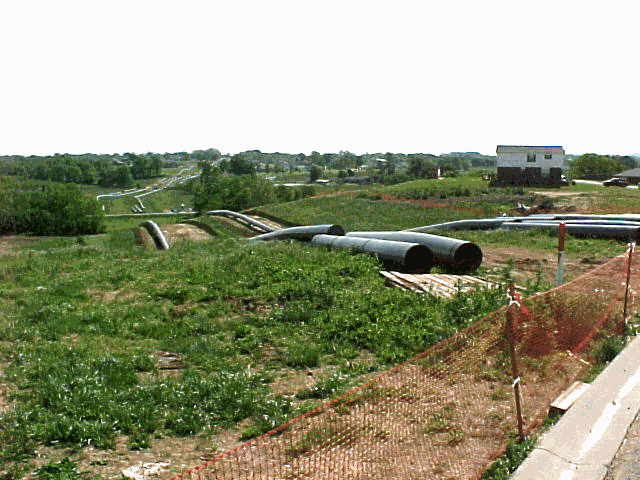
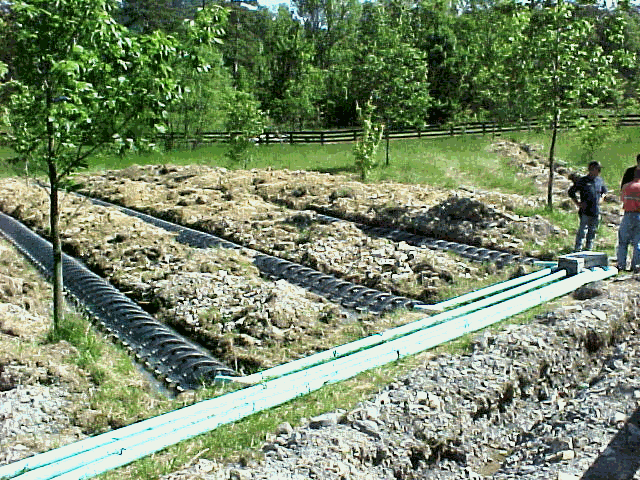
Natural gas piplines (30-inch mains) are laid across a new subdivision in Kingston, Madison County. Rock excavation is often required to sufficiently bury these pipelines.
Lakes and Ponds
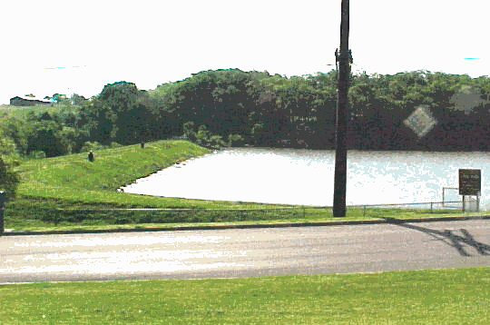
An earthen dam was constructed to contain Lake Reba in Richmond. Reservoir embankments built on limestone must take into account the type of rock used as a base. Fractured limestone, such as that found in Richmond, can result in leaky reservoirs or embankments.
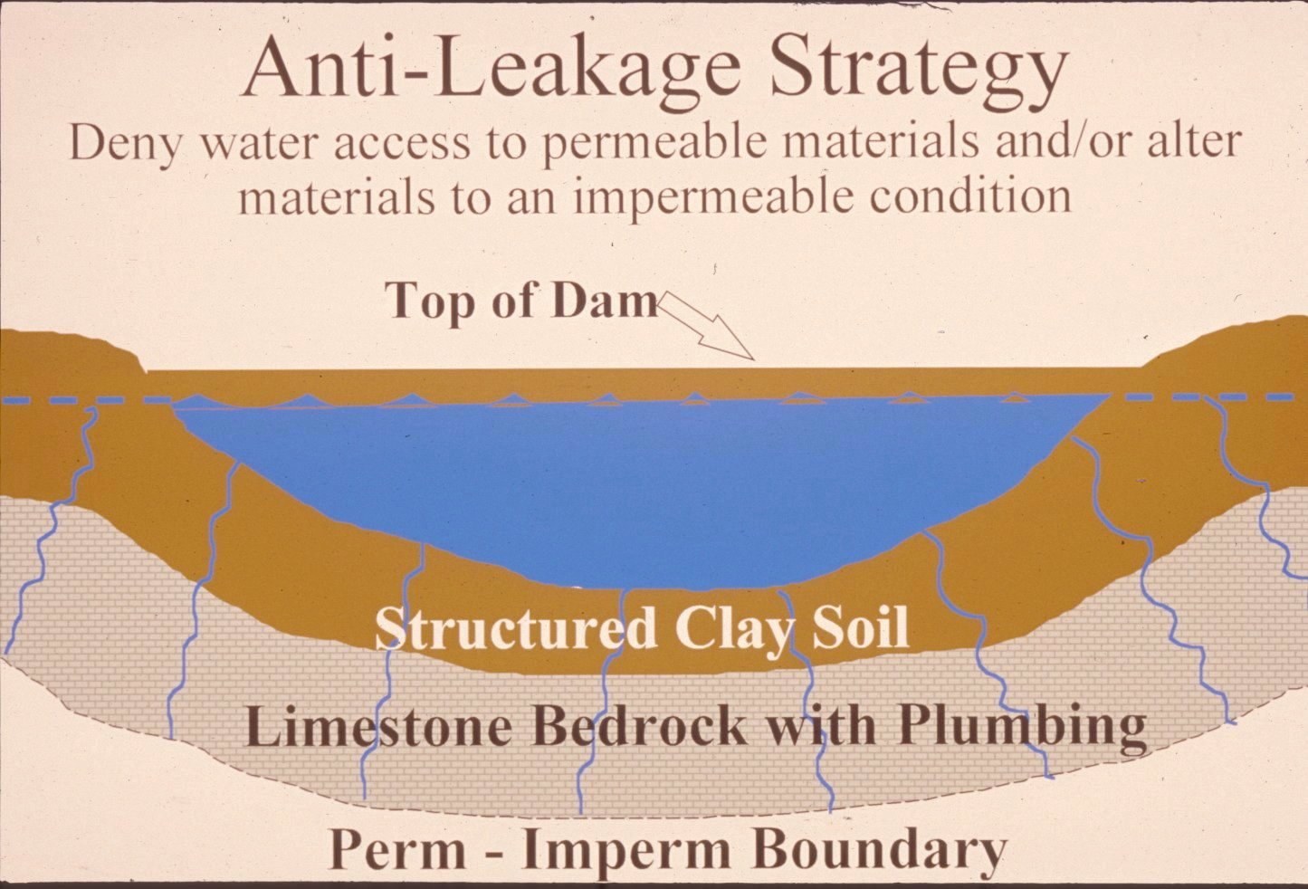
Successful pond construction must prevent water from seeping through structured soils into limestone solution channels below. A compacted clay liner, or artificial liner, may prevent pond failure. Getting the basin filled with water as soon as possible after construction prevents drying and cracking, and possible leakage, of the clayey soil liner. Ponds constructed in dry weather are more apt to leak than ponds constructed in wet weather.
(Illustration by Paul Howell)
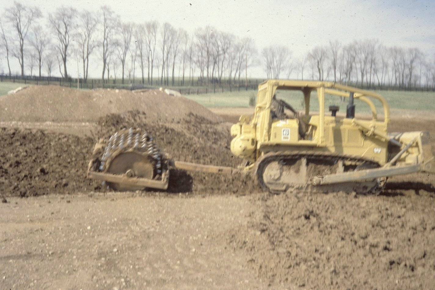
A clayey soil pond liner is placed in loose, moist layers nine inches thick and compacted in six passes with a sheepsfoot roller. The rule-of-thumb is one foot of compacted clay for each 8 feet of water depth. (Photo by Paul Howell)
Other leakage prevention measures include synthetic liners, bentonite, and asphaltic emulsions. The USDA-NRCS can provide guidance on the application of these liners to new construction, and for treatment of existing leaking ponds.
Dams should be constructed of compacted clayey soils at slopes flatter than 3 units horizontal to 1 unit vertical. Ponds with dam heights exceeding 25 feet, or pond volumes exceeding 50 acre-feet require permits. Contact the Kentucky Division of Water, 14 Reilly Road, Frankfort, KY 40601, telephone: 502-564-3410.
Roads and Streets
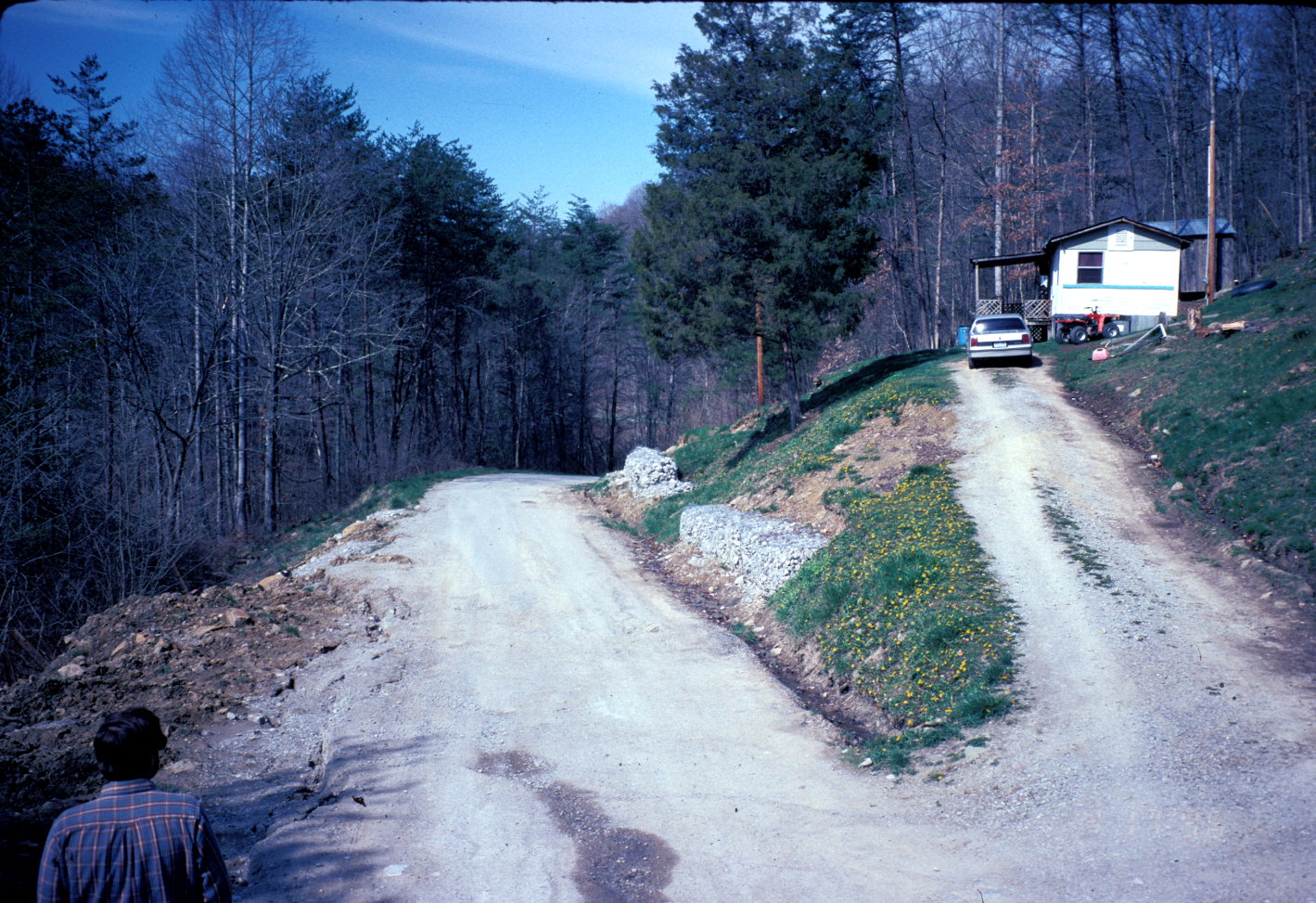
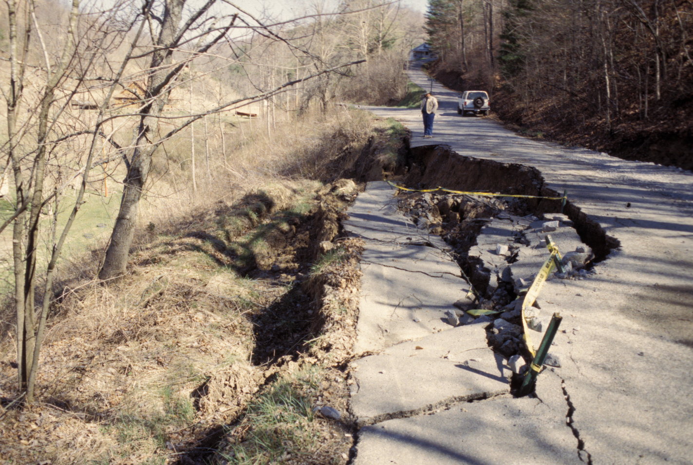
Hillside road construction can cause earth movements if not properly planned, as shown in the photographs above and below. (Photographs by Paul Howell, USDA-NRCS.)
 \
\

Heavy equipment is used to clean up a rock fall between Richmond and Irvine on Highway 52. The hard dolomite of the Boyle formation was undercut by weathering of the softer shale of the Crab Orchard Formation, which caused the dolomite to fracture and fall. Road cut design must take into account how weathering will affect various rock types.
Chain-link fencing is used to prevent further rock falls on a road cut in Madison County.
Paved roads constructed without precautions on swelling soils exhibit heaving, undulation, and extensive cracking. From AIPG (1993). (photo by Edward Nuhfer)
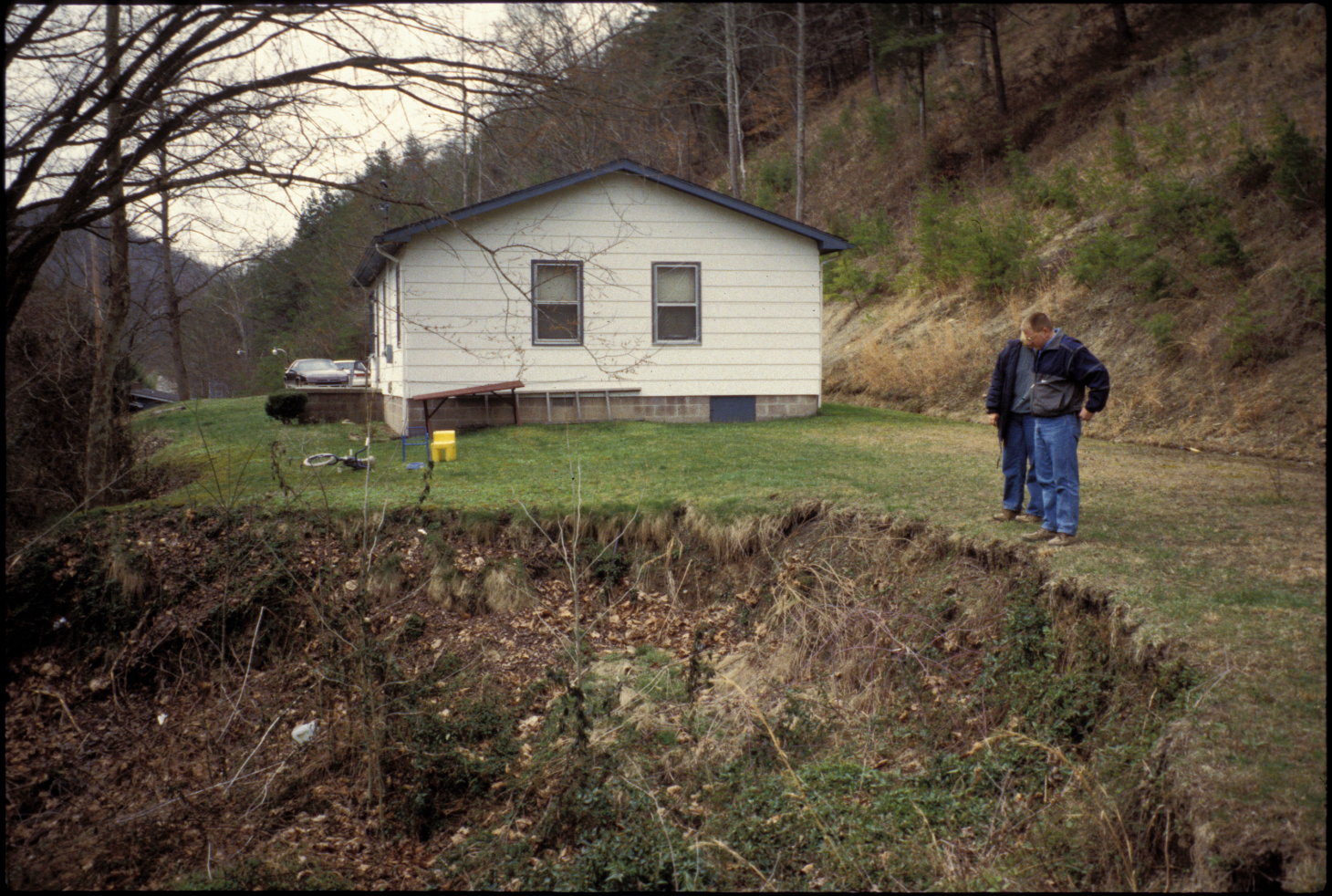
Housing
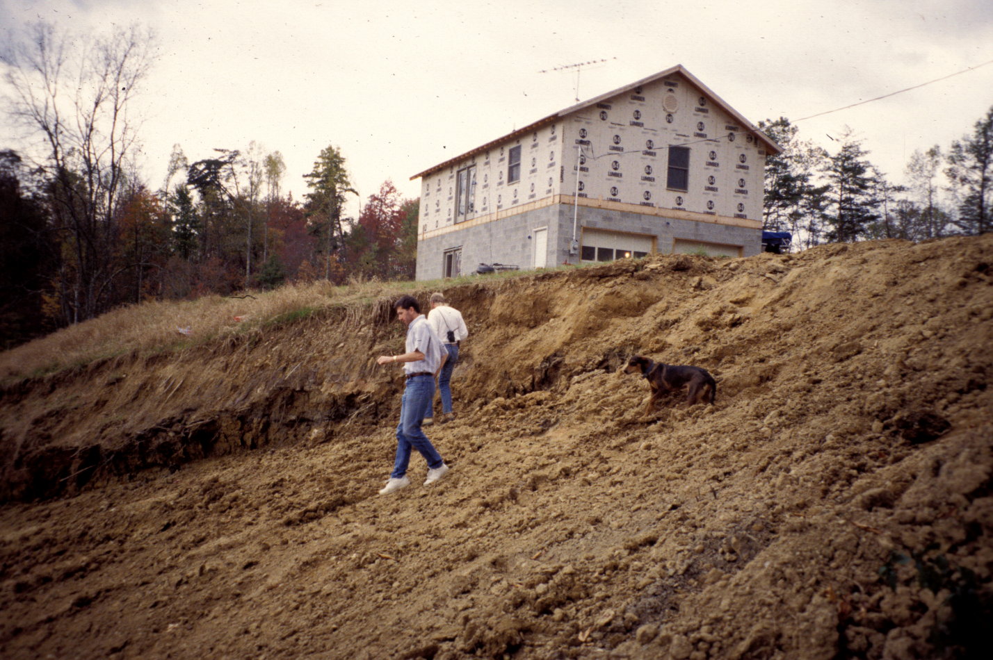
Homes constructed in areas of steep slopes can cause earth movements if not properly planned, as shown in the photographs above and below. (Photographs by Paul Howell, USDA-NRCS.)
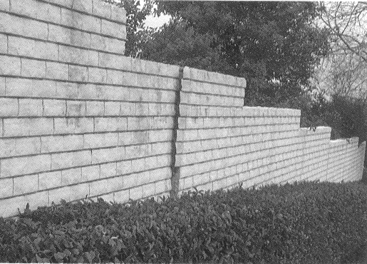
Swelling soils and expansive clay shales can cause construction problems in some areas of the county. Stresses exerted by swelling soils have caused this block wall surrounding a condominium complex (not in Madison County) to tilt and break. From AIPG (1993). (photo by Edward Nuhfer)
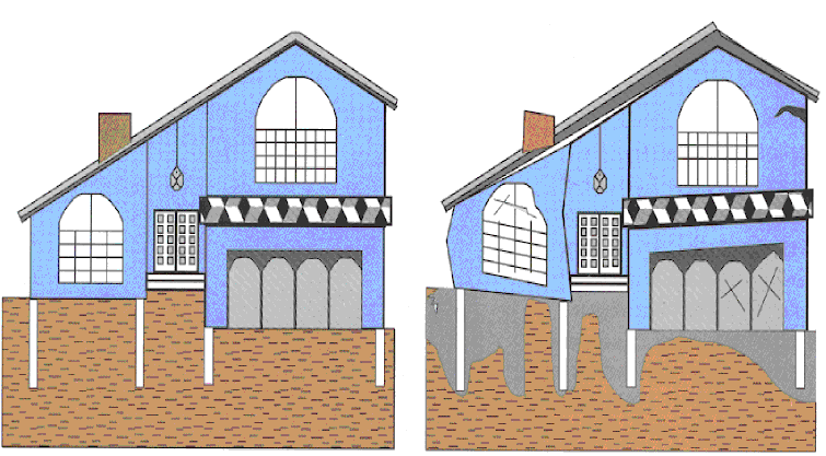
An uplifting experience that will not be appreciated! Left: All is well in this newly built home until water from percolation, drains, lawn sprinklers, leaking sewers, or water mains soaks swelling soil beneath the foundation. Right: With time, expanding soils exert several tons per square foot of pressure on the foundation and shallow pilings. Without remedial measures, the house will actually become deformed and shatter masonry and windows. Remedies vary from mere maintenance that keeps drainage away from the house to expensive reconstruction of foundations. Prior site planning that takes geology into account is always preferable to dealing with problems after a structure is built. From AIPG (1993).
Environmental Issues
A septic system is installed for a public facility near Berea. Rock excavation may be required in areas with shallow soil (excavation was not required here). Underlying shale may restrict percolation in some areas. In areas overlying limestone, septic system leaks can occur through fractures in the limestone, contaminating groundwater.
Radon
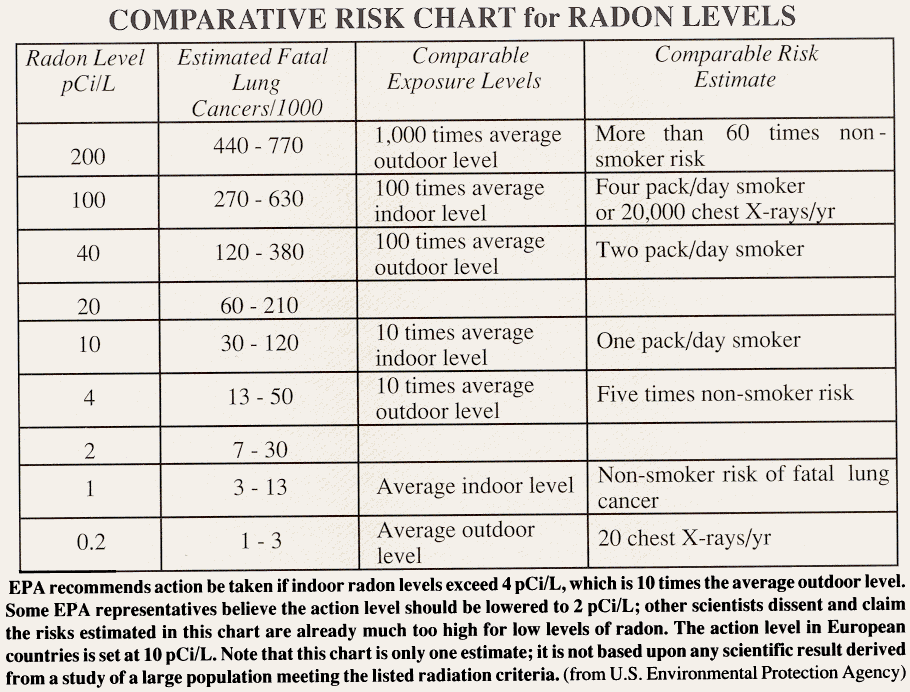
Radon gas, although not widely distributed in Kentucky in amounts above the Environmental Protection Agency's maximum recommended limit of 4 picocuries per liter, can be a local problem. Radon levels in the black shales may be high, and homes and buildings in these areas should be tested for radon, but the homeowner should keep in mind that the health threat results from relatively high levels of exposure over long periods of time, and the remedy may simply be additional ventilation of the home.
References
American Institute of Professional Geologists, 1993, The citizens' guide to geologic hazards: 134 p.
Black, D.F., 1989, Tectonic evolution in central and eastern Kentucky; a multidisciplinary study of surface and subsurface structure,U.S. Geological Survey OF-89-0106, Plate 11, 151 p.
Carey, D.I., and Stickney, J.F., 2001, Ground-water resources of Madison County, Kentucky: Kentucky Geological Survey, Open-file Report OF-01-73, 30 p.
Blue Grass Area Development District, 2003. Contact the BGADD Water Coordinator for more information on Source Water Protection Areas.
Newton, J.H., McDonald, H.P., Preston, D.G., Richardson, A.J., and Sims, R., 1973, Soil survey of Madison County, Kentucky: U.S. Department of Agriculture, Soil Conservation Service, 103 p.
Sparks, T.N., Dever, G.R., Jr., and Anderson, W.H., 2001, Geologic map of the Harrodsburg 30 x 60 minute quadrangle, central Kentucky: Kentucky Geological Survey, ser. 12, Geologic Map 1, scale 1:100,000.
U.S. Fish and Wildlife, 2003, National Wetlands Inventory, http://www.nwi.fws.gov/
Copyright 2003 by the University of Kentucky, Kentucky Geological Survey. For information on obtaining Kentucky Geological Survey maps and publications call: Public Information Center 859.257.3896. 877.778.7827 (toll free). View the KGS World Wide Web site at: www.uky.edu/kgs