Transportation
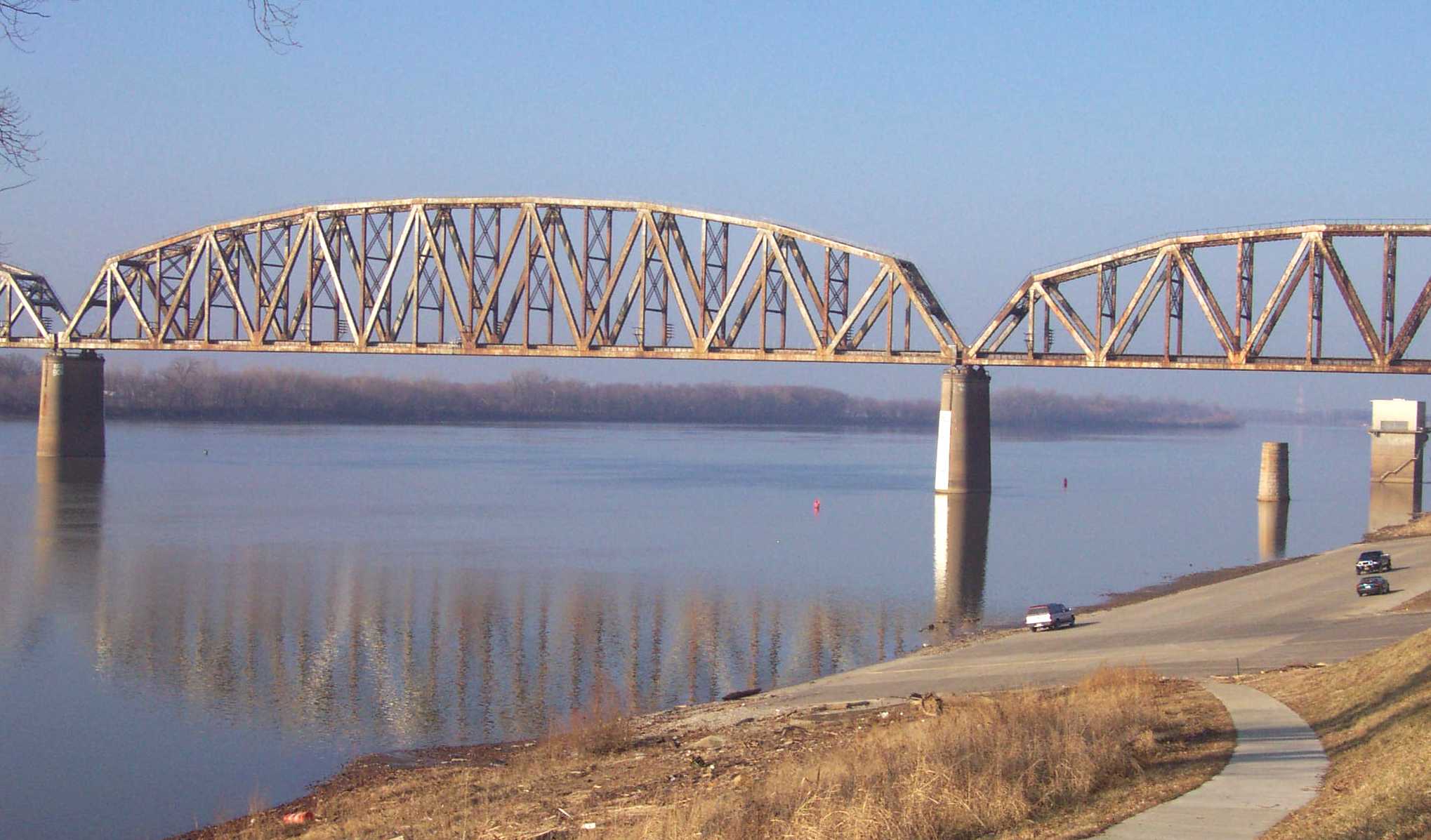
Ohio River and
The
Ohio River and the CSX railroad system are two major modes of transportation
used by industry in
Resources
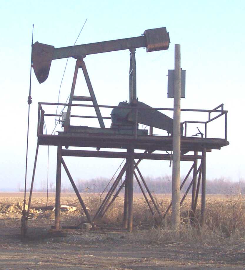
Oil Well "Pump Jack"
This
"pump jack" is located in the
Since
1820, over 60 million tons of coal have been mined in
The Land
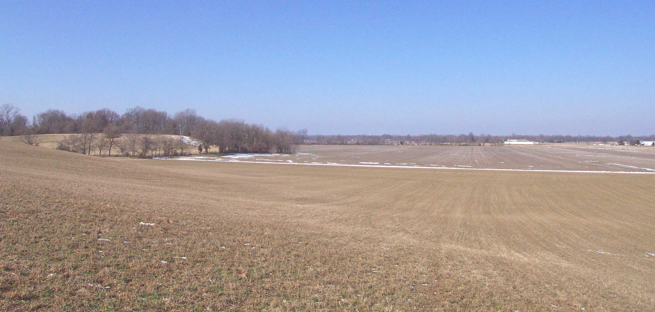
Flat lowlands and rolling uplands
Flat
lowlands and rolling uplands are the two dominant physiographic features in
Flat
lowlands, on the right side of the picture, are associated with
Rolling
uplands, on the left side of the picture, are associated with eroded loess
deposits and are used for cropland, pastureland, and residential and commercial
development.
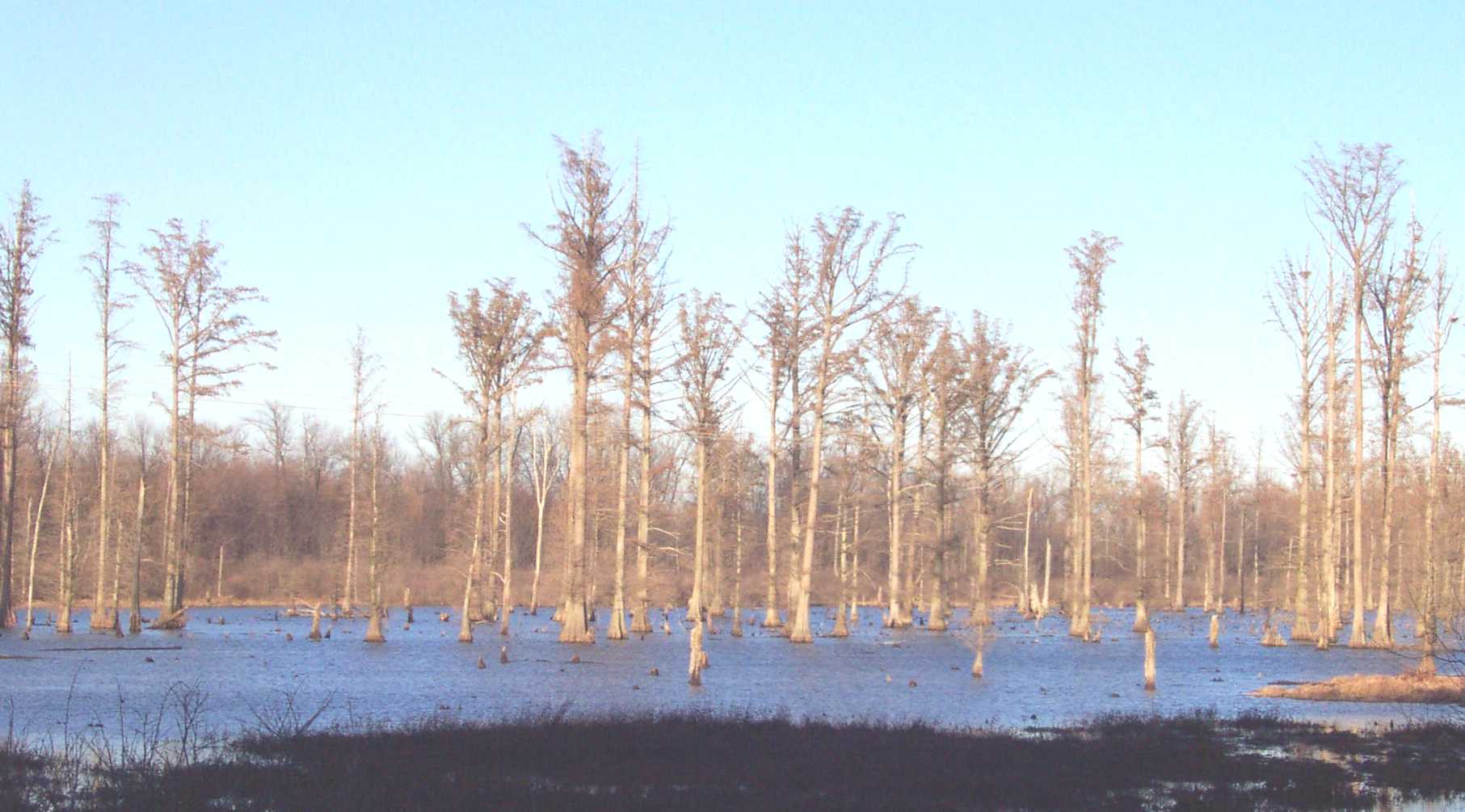
This
cypress swamp, located just north of the
Hazards
Surface Water Drainage
Because
of the large percentage of flat to gently sloping areas associated with the
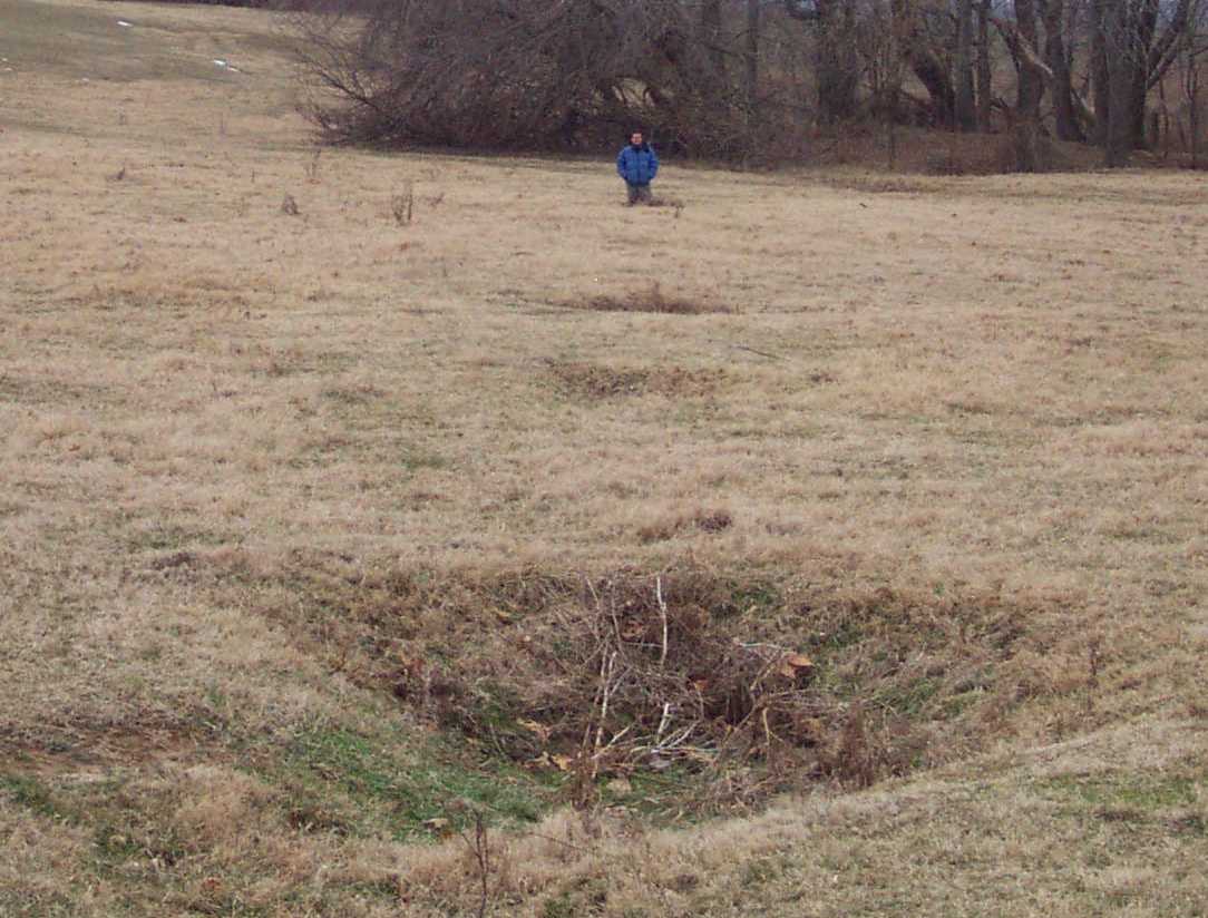
Soil Piping
Soil
piping is a term used to describe the removal of soil by subsurface water. When the soil is removed, small to large holes form, which may
occur along linear paths as seen in the above picture.
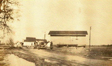
Flooding
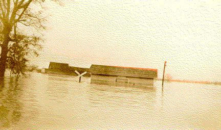
Above:
Flood at Beals Station and Railroad Crossing on
January 30, 1937.
Below:
Same location on February 11, 1937. The white building in the background was
Edgar Simmons Store. This building is still in use today as Cagey's
Store in
Photographs courtesy of the Henderson County Historical
Society.
Geologic Hazards
There
are five concealed faults located in
Soil
creep, slumps, and landslides occurring along steep slopes may occur from
erosion or strong ground motion associated with an earthquake. Areas associated
with alluvium material are subject to liquifaction
during a strong earthquake event. These areas are also subject to flooding.
Soil piping, which may occur in various soil types, produces small to large
holes if left untreated. Soils derived from alluvium deposits have a moderate
to high shrink swell capacity, which may affect structural foundations and
roads.
It
is important to know the location of abandoned deep-coal mines because of the
possibility of mine subsidence. Abandoned deep and surface mine boundaries
shown on the map are approximate and do not represent all the mining that has
occurred in the county. Active deep mines and strip mines are not shown.
References
Carey, D.I., and Stickney,
J.F., 2001, Ground-water resources of
Converse, H.T., Jr., and
Cox, F.R., Jr., 1967, Soil survey of
Solis, M.P., Greb, S.F., and
Woods, A.J., Omernik, J.M., Martin, W.H., Pond, G.J., Andrews, W.M.,
Call, S.M., Comstock, J.A., and Taylor, D.D., 2002, Ecoregions
of Kentucky (color poster with map, descriptive text, summary tables, and
photographs): Reston, VA., U.S. Geological Survey (map scale 1:1,000,000).
Copyright
2003 by the University of