KARST GEOLOGY
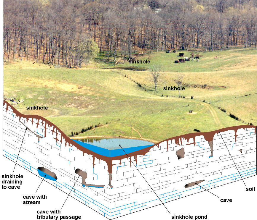
The term "karst" refers to a landscape characterized by
sinkholes, springs, sinking streams (streams that disappear underground), and
underground drainage through solution-enlarged conduits or caves. Karst landscapes form when slightly acidic water from rain
and snow-melt seeps through soil cover into fractured and soluble bedrock
(usually limestone, dolomite, or gypsum). Sinkholes are depressions on the land
surface where water drains underground. Usually circular and often
funnel-shaped, they range in size from a few feet to hundreds of feet in
diameter. Springs occur when water emerges from underground to become surface
water. Caves are solution-enlarged fractures or conduits
large enough for a person to enter.
ENVIRONMENTAL
PROTECTION
Never use sinkholes as
dumps. All waste, but especially pesticides, paints, household chemicals,
automobile batteries, and used motor oil, should be taken to an appropriate
recycling center or landfill.
Make sure runoff from
parking lots, streets, and other urban areas is routed through a detention
basin and sediment trap to filter it before it flows into a sinkhole.
Make sure your home septic
system is working properly and that it's not discharging sewage into a crevice
or sinkhole.
Keep cattle and other
livestock out of sinkholes and sinking streams. There are other methods of
providing water to livestock.
See to it that sinkholes
near or in crop fields are bordered with trees, shrubs, or grass buffer strips.
This will filter runoff flowing into sinkholes and also keep tilled areas away
from sinkholes.
Construct waste-holding
lagoons in karst areas carefully, to prevent the
bottom of the lagoon from collapsing, which would result in a catastrophic
emptying of waste into the groundwater.
If required, develop a
groundwater protection plan (410KAR5:037) or an agricultural water-quality plan
(KRS224.71) for your land use.
(From Currens,
2001)
CONSTRUCTION IN KARST
AREAS

Residential construction off
Ky. 44 near
basements, and septic fields. Photo by Bart
Davidson,
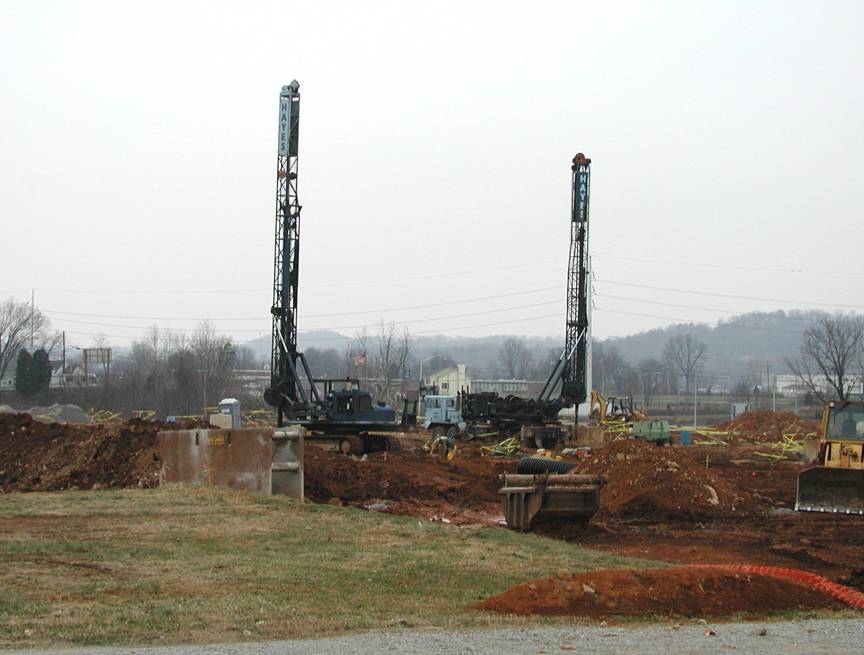
Caissons (concrete columns)
must be constructed to support the weight of industrial buildings in areas with
caves and sinkholes (karst geology). Photo by Bart Davidson,

Cover-collapse sinkholes
(outlined in red) in eastern
RESIDENTIAL CONSTRUCTION
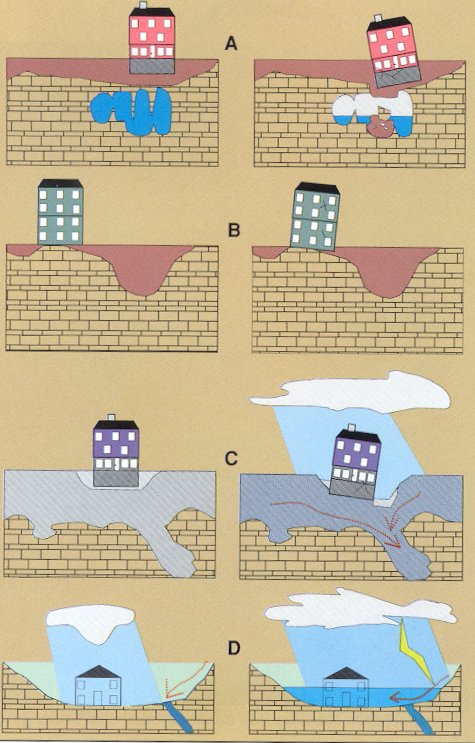
Limestone
terrain can be subject to subsidence hazards, which usually can be overcome by
prior planning and site evaluation. "A" shows
construction above an open cavern, which later collapses. This is one of
the most difficult situations to detect, and the possibility of this situation
beneath a structure warrants insurance protection for homes built on karst terrain. In "B," a heavy structure presumed
to lie above solid bedrock actually is partially supported on soft, residual
clay soils that subside gradually, resulting in damage to the structure. This
occurs where inadequate site evaluation can be traced to lack of geophysical
studies and inadequate core sampling. "C" and "D" show the
close relationship between hydrology and subsidence hazards in limestone
terrain. In "C," the house is situated on porous fill (light shading)
at a site where surface and groundwater drainage move supporting soil (darker
shading) into voids in limestone (blocks) below. The natural process is then accelerated
by infiltration through fill around the home. "D" shows a karst site where normal rainfall is absorbed by subsurface
conduits, but water from infrequent heavy storms cannot be carried away quickly
enough to prevent flooding of low-lying areas. Adapted from
AIPG (1993).
DEVELOPMENT

Commercial
parks and development are common in the flat land in the northern part of the
county and along the Interstate. Likewise, there has been considerable suburban
residential growth in these areas because of the county’s proximity to
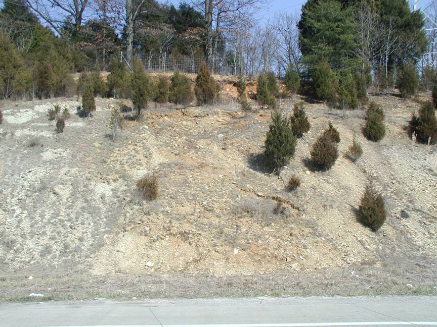
EROSION CONTROL

During
construction, erosion-control fences such as these may be needed to prevent
silt from entering local streams. Photo by
Bart
Davidson,
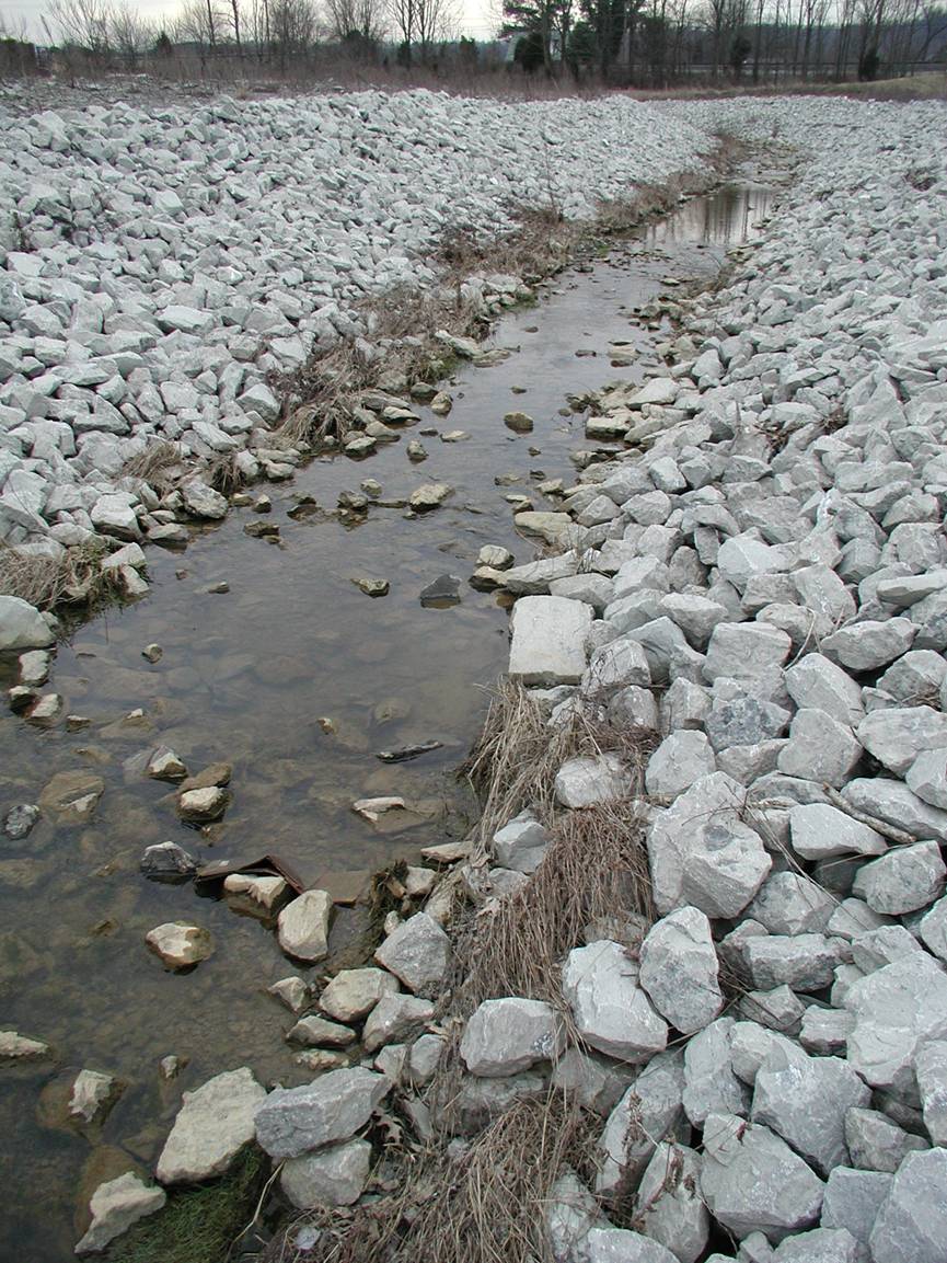
Riprap
drainage control and erosion protection. Photo by Stephen Greb,
SLUMPS AND SLIDES
Steep-sided
hills with deeply incised drainages are common in the county. The shales and siltstones from which the hills are formed are
susceptible to slumping and sliding, especially where clay shales
occur in slopes. Clay shales can become plastic when
wet and may yield or slump if construction or roads built on them are not
adequately drained. Builders should avoid cutting into the toe (base) of hills
or past slides. Bent trees on slopes and water seeps at the base of slopes may
indicate past or potential movement.
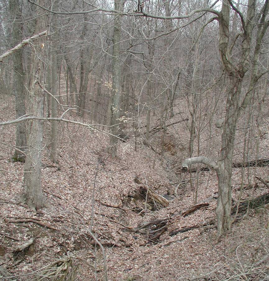
Steep-sided drainages and
washouts are common in the hills of northeastern
GROUNDWATER
In the
Throughout the county,
groundwater is hard or very hard, and may contain salt or hydrogen sulfide,
especially at depths greater than 100 feet.
For more information on
groundwater in the county, see Carey and Stickney (2001).

An abandoned limestone
quarry near
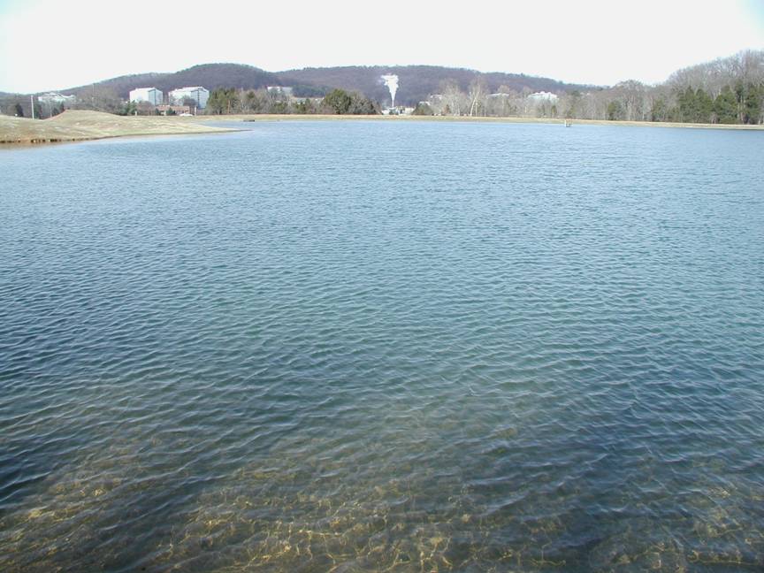
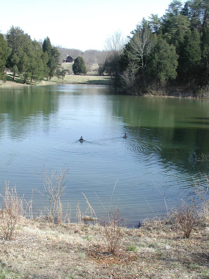
POND CONSTRUCTION
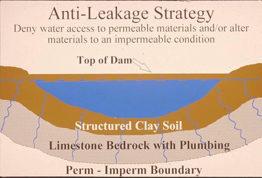
Successful pond construction
must prevent water from seeping through structured soils into limestone
solution channels below. A compacted clay liner, or artificial liner, may
prevent pond failure. Getting the basin filled with water as soon as possible
after construction prevents drying and cracking, and possible leakage, of the
clayey soil liner. Ponds constructed in dry weather are more apt to leak than
ponds constructed in wet weather. The
Dams should be constructed
of compacted clayey soils at slopes flatter than 3 units horizontal to 1 unit
vertical. Ponds with dam heights exceeding 25 feet, or pond volumes exceeding
50 acre-feet, require permits. Contact the
A distillery near the
entrance of
Bernheim Arboretum and

ECONOMIC RESOURCES
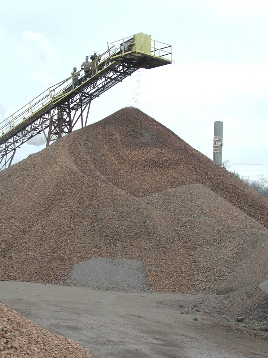
Shale is quarried in the
northern part of the county to make a lightweight aggregate for use in
construction materials. The shale is the latest in a long history of natural
resources that have been excavated in the county, including salt and pig iron
(in the1800’s), limestone for aggregate, siltstone for dimension stone, and
clay shales for bricks and tiles. Photos
by Stephen Greb,
