Wayne County, Kentucky
KARST GEOLOGY
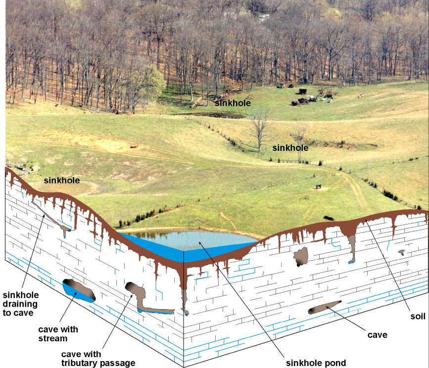
The term "karst" refers to a landscape characterized by
sinkholes, springs, sinking streams (streams that disappear underground), and
underground drainage through solution-enlarged conduits or caves. Karst landscapes form when slightly acidic water from rain
and snow-melt seeps through soil cover into fractured and soluble bedrock
(usually limestone, dolomite, or gypsum). Sinkholes are depressions on the land
surface where water drains underground. Usually circular and often
funnel-shaped, they range in size from a few feet to hundreds of feet in
diameter. Springs occur when water emerges from underground to become surface
water. Caves are solution-enlarged fractures or conduits
large enough for a person to enter.
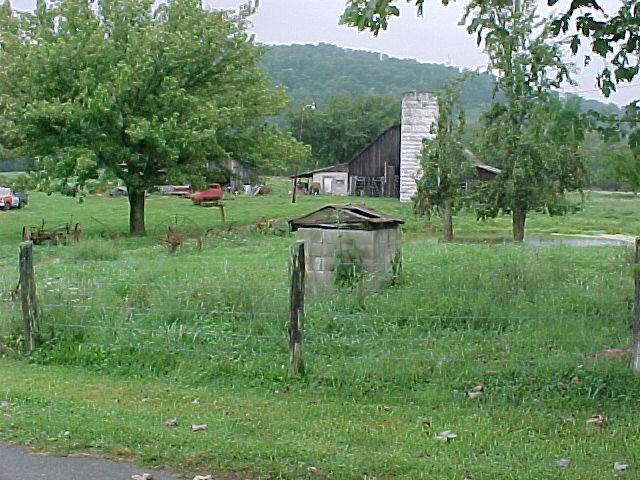
This well-house is situated
near a pond that is probably a "sinkhole pond", meaning that it is
connected to the limestone aquifer by fractures in the bedrock, but is
currently plugged with soil. Cattle feedlots or pastures near this well or pond
can cause increased nitrate concentrations in groundwater. Photograph by Bart
Davidson,
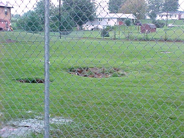
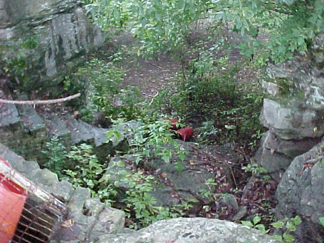
Cover-collapse inkholes such as this one may appear overnight when the
soil plug at their base collapses into a fracture or cave in the underlying
limestone. These are direct conduits to the local aquifer, and as such are
susceptible to contamination by garbage dumping and accidental spills. They are
also hazards to public safety. Photograph by Bart Davidson,
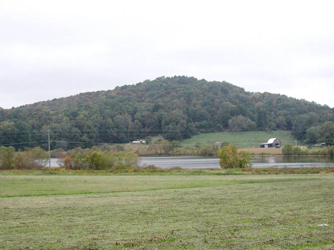
This pond was a sinkhole on
dry land in the early 1970's, but filled with water in a few days after the
sinkhole became plugged with clayey soil. Photo by Bart
Davidson,
ENVIRONMENTAL
PROTECTION
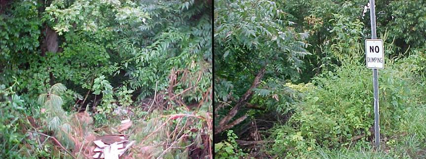
Never use sinkholes as
dumps. All waste, but especially pesticides, paints, household chemicals,
automobile batteries, and used motor oil, should be taken to an appropriate
recycling center or landfill.
Make sure runoff from
parking lots, streets, and other urban areas is routed through a detention
basin and sediment trap to filter it before it flows into a sinkhole.
Make sure your home septic
system is working properly and that it's not discharging sewage into a crevice
or sinkhole.
Keep cattle and other
livestock out of sinkholes and sinking streams. There are other methods of
providing water to livestock.
See to it that sinkholes
near or in crop fields are bordered with trees, shrubs, or grass buffer strips.
This will filter runoff flowing into sinkholes and also keep tilled areas away
from sinkholes.
Construct waste-holding
lagoons in karst areas carefully, to prevent the
bottom of the lagoon from collapsing, which would result in a catastrophic
emptying of waste into the groundwater.
If required, develop a
groundwater protection plan (410KAR5:037) or an agricultural water-quality plan
(KRS224.71) for your land use.
(From Currens,
2001)
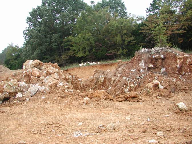
A small cave is located in
This sinkhole near the new
courthouse in
CONSTRUCTION IN KARST
AREAS
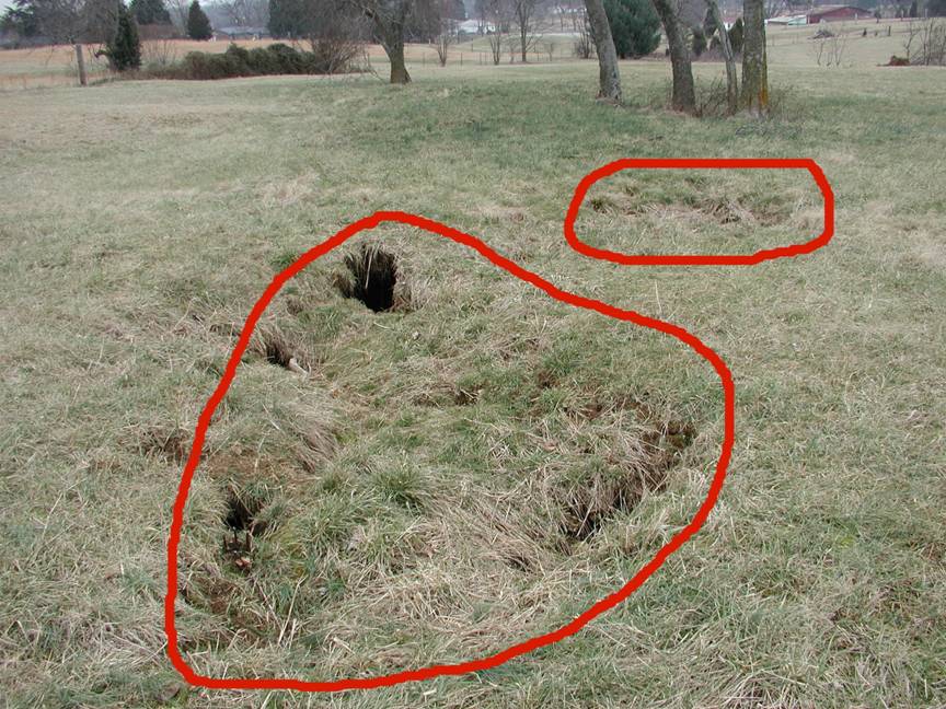
Cover-collapse sinkholes
(outlined in red) are typical in areas of karst
geology. Many sinkholes such as these have not been mapped. The construction
implications of these features must be addressed for any type of development. Photo by Bart Davidson,
RESIDENTIAL
CONSTRUCTION

Limestone
terrain can be subject to subsidence hazards, which usually can be overcome by
prior planning and site evaluation. "A" shows
construction above an open cavern, which later collapses. This is one of
the most difficult situations to detect, and the possibility of this situation
beneath a structure warrants insurance protection for homes built on karst terrain. In "B," a heavy structure presumed
to lie above solid bedrock actually is partially supported on soft, residual
clay soils that subside gradually, resulting in damage to the structure. This
occurs where inadequate site evaluation can be traced to lack of geophysical
studies and inadequate core sampling. "C" and "D" show the
close relationship between hydrology and subsidence hazards in limestone
terrain. In "C," the house is situated on porous fill (light shading)
at a site where surface and groundwater drainage move supporting soil (darker
shading) into voids in limestone (blocks) below. The natural process is then
accelerated by infiltration through fill around the home. "D" shows a
karst site where normal rainfall is absorbed by
subsurface conduits, but water from infrequent heavy storms cannot be carried
away quickly enough to prevent flooding of low-lying areas. Adapted
from AIPG (1993).
Karst topography is common in
RADON
Radon
gas, although not widely distributed in
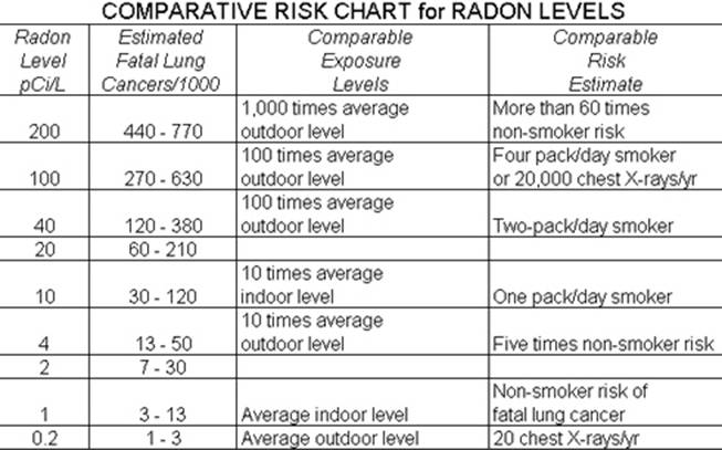
EPA
recommends action be taken if indoor levels exceed 4 picocuries per liter, which is 10 times the average outdoor
level. Some EPA representatives believe the action level should be lowered to 2
picocuries per liter; other scientists dissent and
claim the risks estimated in this chart are already much too high for low
levels of radon. The action level in European countries is set at 10 picocuries per liter. Note that this chart is only one
estimate; it is not based upon any scientific result from a study of a large
population meeting the listed criteria. (From the U.S.
Environmental Protection Agency, 1986.)
EROSION CONTROL
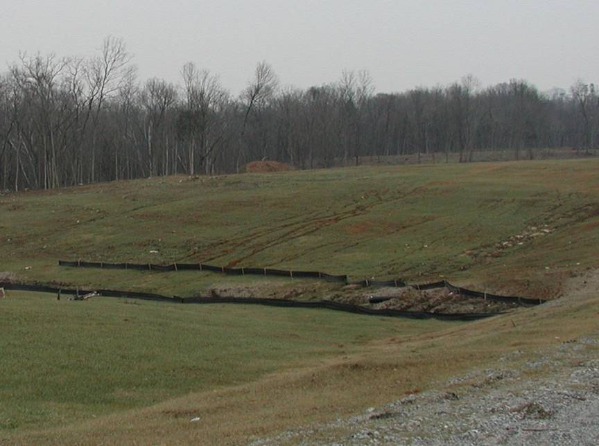
During
construction, erosion-control fences such as these may be needed to prevent
silt from entering local streams. Photo by
Bart
Davidson,
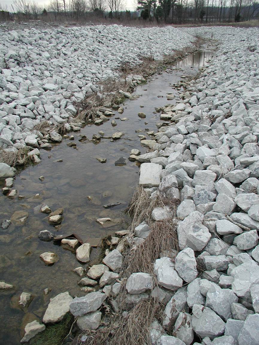
Riprap
drainage control and erosion protection. Photo by Stephen Greb,
GROUNDWATER
In the eastern half of
In the western half of the
county, about three-quarters of the drilled wells in the uplands yield enough
water for domestic use. In low-lying areas, very few wells yield adequate
amounts of water for a domestic supply. Some wells close to
For more information on the
groundwater resources of the county, see Carey and Stickney (2004).
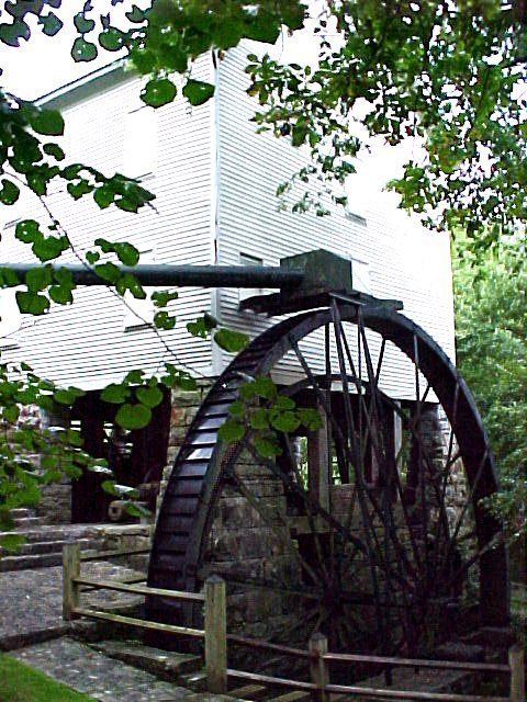
A National Historic Site,
Mill Springs is the location of one of the first important battles of the Civil
War in 1862. It is named after 13 springs that feed a creek which powers the
gristmill, constructed in 1839. The mill is still in operation, and is
considered one of the largest in the world. Photo by Bart
Davidson,
POND CONSTRUCTION
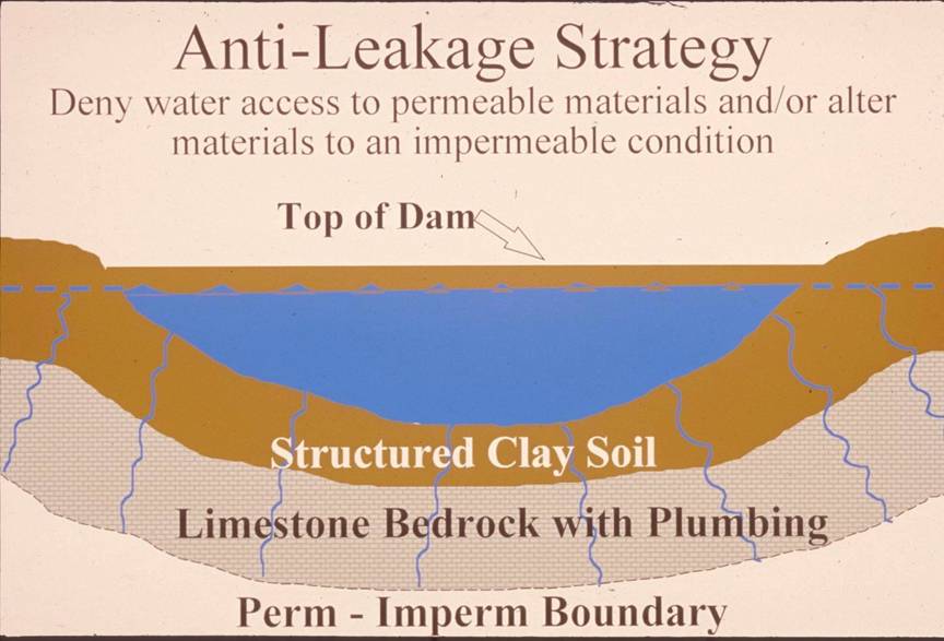
Successful pond construction
must prevent water from seeping through structured soils into limestone solution
channels below. A compacted clay liner, or artificial liner, may prevent pond
failure. Getting the basin filled with water as soon as possible after
construction prevents drying and cracking, and possible leakage, of the clayey
soil liner. Ponds constructed in dry weather are more apt to leak than ponds
constructed in wet weather. The
Dams should be constructed
of compacted clayey soils at slopes flatter than 3 units horizontal to 1 unit
vertical. Ponds with dam heights exceeding 25 feet, or pond volumes exceeding
50 acre-feet, require permits. Contact the
MAPPED SURFACE FAULTS
Faults are common geologic
structures across
THE LAND
Although located primarily
in the Mississippian Plateau,
NATURAL RESOURCES
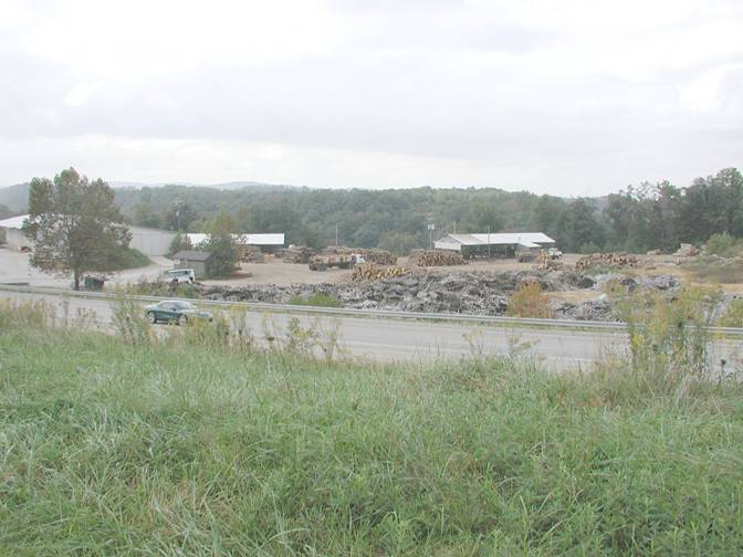
The lumber industry is a
common land-use feature of
AGRICULTURE
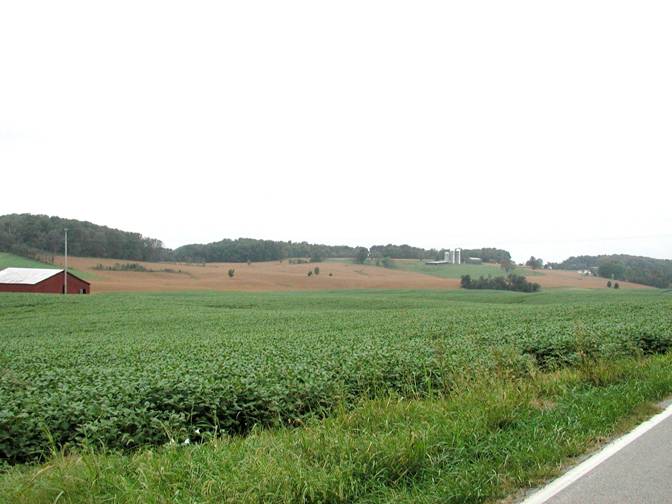
The majority of