Trigg County, Kentucky
Geologic Hazards
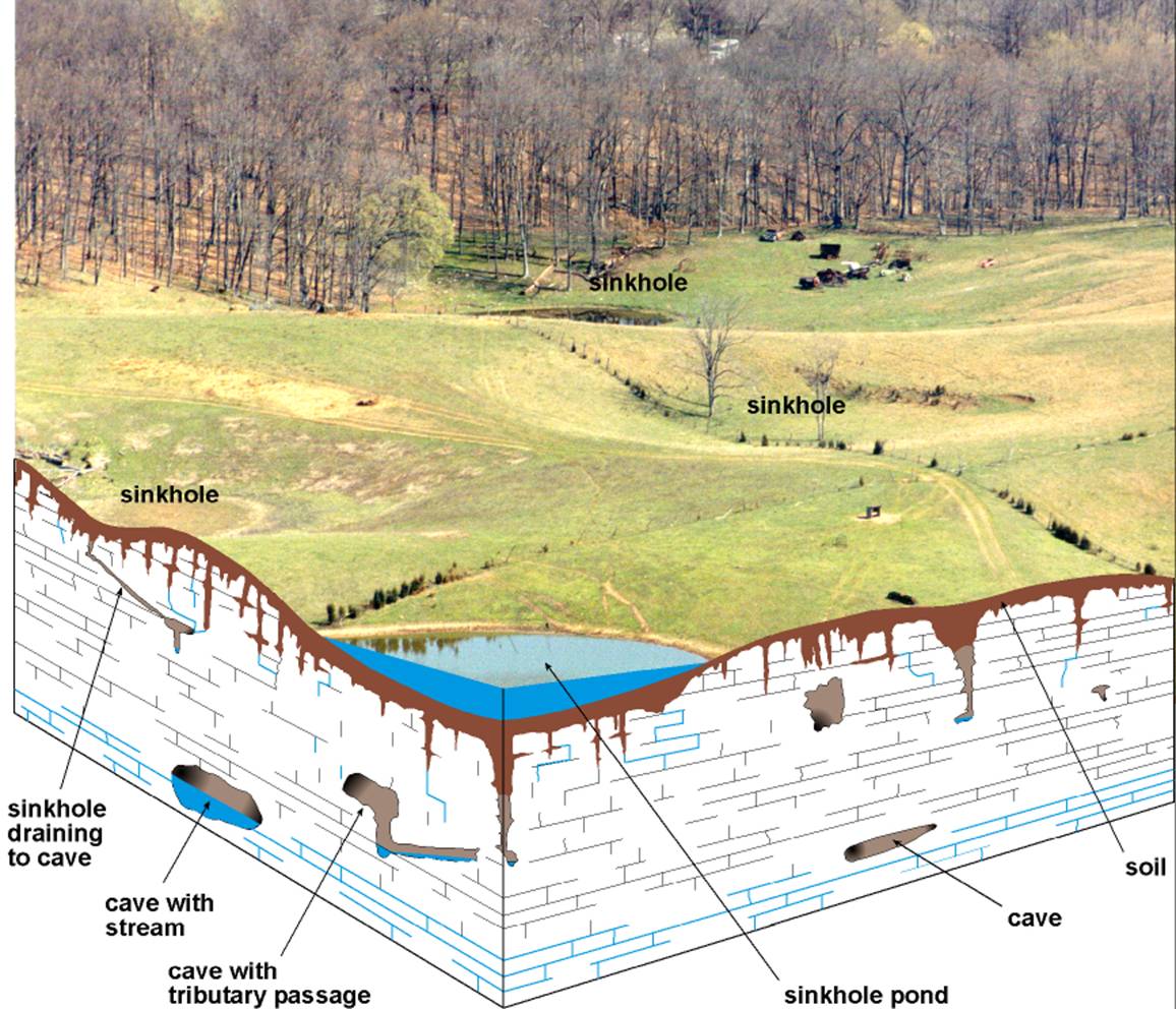
The most
prominent geologic hazard for Trigg
County is the karst development on the terrain underlain by thick
limestone, unit 5 on the map. Sinkholes shown in red on the map are the surface
expression of solution cavities such as caves and flow channels. Karst can be
particularly hazardous if not treated properly during urban development.
Significant damage can occur if sinkholes open beneath a structure, and
flooding can worsen if subsurface drainage through sinkholes and caves are
plugged or impaired. Groundwater supplies may be polluted if waste is
improperly dumped into sinkholes, which ultimately affects surface water.
Never use sinkholes
as dumps. All waste, but especially pesticides, paints, household chemicals,
automobile batteries, and used motor oil, should be taken to an appropriate
recycling center or landfill.
Make sure
runoff from parking lots, streets, and other urban areas is routed through a
detention basin and sediment trap to filter it before it flows into a sinkhole.
Make sure
your home septic system is working properly and that it's not discharging
sewage into a crevice or sinkhole.
Keep cattle
and other livestock out of sinkholes and sinking streams. There are other
methods of providing water to livestock.
See to it
that sinkholes near or in crop fields are bordered with trees, shrubs, or grass
buffer strips. This will filter runoff flowing into sinkholes and also keep
tilled areas away from sinkholes.
Construct
waste-holding lagoons in karst areas carefully, to
prevent the bottom of the lagoon from collapsing, which would result in a
catastrophic emptying of waste into the groundwater.
If
required, develop a groundwater protection plan (410KAR5:037) or an
agricultural water-quality plan (KRS224.71) for your land use.
(From Currens, 2001)
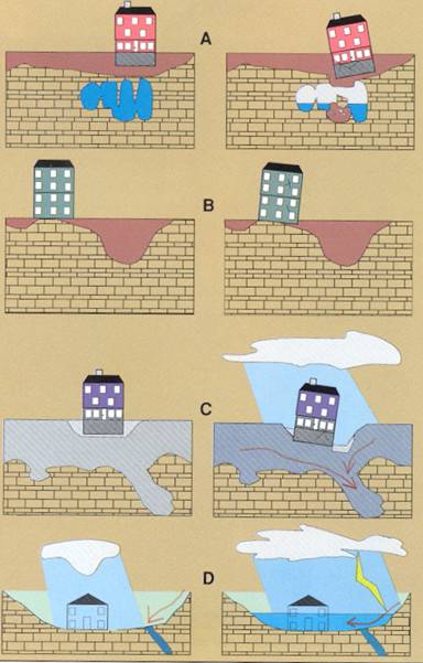
Limestone
terrain can be subject to subsidence hazards, which usually can be overcome by
prior planning and site evaluation. "A" shows
construction above an open cavern, which later collapses. This is one of
the most difficult situations to detect, and the possibility of this situation
beneath a structure warrants insurance protection for homes built on karst terrain. In "B," a heavy structure presumed
to lie above solid bedrock actually is partially supported on soft, residual
clay soils that subside gradually, resulting in damage to the structure. This
occurs where inadequate site evaluation can be traced to lack of geophysical
studies and inadequate core sampling. "C" and "D" show the
close relationship between hydrology and subsidence hazards in limestone
terrain. In "C," the house is situated on porous fill (light shading)
at a site where surface and groundwater drainage move supporting soil (darker
shading) into voids in limestone (blocks) below. The natural process is then
accelerated by infiltration through fill around the home. "D" shows a
karst site where normal rainfall is absorbed by
subsurface conduits, but water from infrequent heavy storms cannot be carried
away quickly enough to prevent flooding of low-lying areas. Adapted
from AIPG (1993).
Other Geologic Hazards
None of the
faults in Trigg County
are considered to be active; however, the proximity of active seismic zones,
such as the New Madrid, Wabash, or East Tennessee,
calls for precautions to be taken for earthquake damage mitigation.
Flooding
may be a problem in Trigg
County, especially, along
major streams. Urban development often exacerbates flooding, and therefore
potential flooding should always be considered in urban development plans.
Areas of steep walled drainage, such as that formed in terrain underlain by
limestone, are conducive to flash flooding, especially in developed areas.
Areas underlain by alluvium are generally subject to flooding. Also, alluvium
contains abundant clay minerals, which may result in significant shrink/swell
conditions.
Steep
slopes are present, especially along streams, in areas underlain by limestone
in the western part of Trigg
County. Steep slopes can
develop soil creep and landslides if not properly treated during development.
Proper engineering techniques should be followed when developing on hillsides,
and care should be taken not to affect property above and below a development
site on a hillside.
Earthquake Hazard
Information
Peak ground
acceleration at the top of rock that will probably occur in the next 500 years
in Kentucky
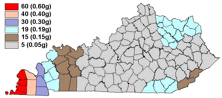
Although we
do not know when and where the next major earthquake will occur, we do know
that an earthquake will cause damage. Severity depends on many factors, such as
earthquake magnitude, distance from the epicenter, and local geology.
Information on earthquake effects is obtained by monitoring earthquakes and
performing research. Such information is vital for earthquake hazard mitigation
and risk reduction.
The most
important information for seismic-hazard mitigation and risk reduction is
ground-motion hazard. One way of predicting ground-motion hazard is by
determining the peak ground acceleration (PGA) that may occur in a particular
timeframe. The map above shows the PGA at the top of bedrock that will likely
occur within the next 500 years in Kentucky
(Street and others, 1996). It shows, as expected, that PGA would be greatest in
far western Kentucky
near the New Madrid Seismic Zone. Ground-motion hazard maps for the central United States
and other areas are available from the U.S. Geological Survey. These maps are
used to set general policies on mitigating damage. For example, maps produced
by the USGS in 1996 were used to determine seismic design in building codes.
For additional information about earthquake hazards, visit the Kentucky
Geological Survey Web site at www.uky.edu/KGS/geologichazards/geologichazards.html.
Development
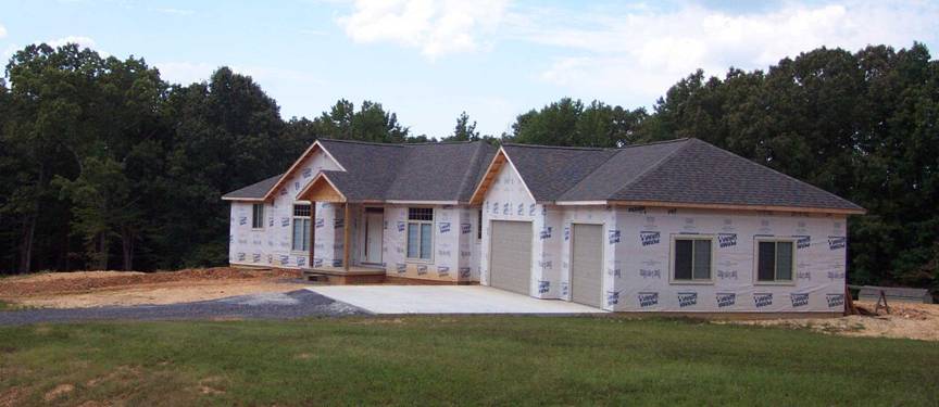
The
population of Trigg
County grew 21.6 percent
between 1990 and 2000, according to the U.S. Census Bureau. Because of this
growth, home construction is a growing land use through out the county. Photo by Glynn Beck,
Kentucky Geological Survey.
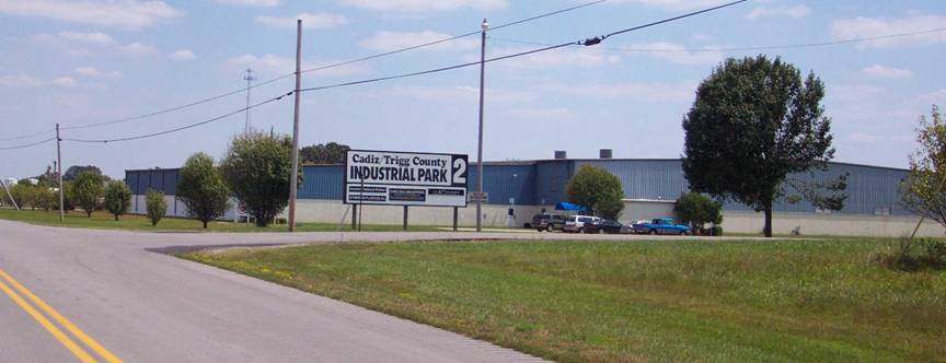
Two
developed industrial parks are in Trigg
County, and one park is
under construction. Eleven businesses
are located on 230 acres. Photo by Glynn Beck,
Kentucky Geological Survey.
Water Resources
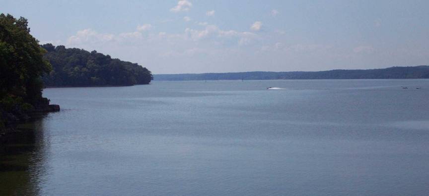
Lake Barkley was formed
when the Cumberland River was impounded in the
early 1960’s. Over 18,500 acres of the
lake are located in Trigg
County. Lake
Barkley is an excellent
resource for boating, fishing, and other activities. Photo by Glynn Beck, Kentucky
Geological Survey.
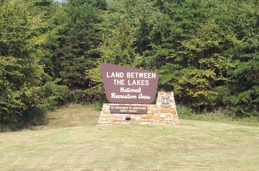
Land Between The Lakes (LBL) is an inland peninsula, which was
formed after the Cumberland and Tennessee Rivers
were impounded to create Kentucky Lake and Lake
Barkley. In 1963 the area
was deemed a National Recreation Area. Approximately 68,800 acres of the
170,000 acres comprising LBL are located in Trigg County. Photo by Glynn Beck, Kentucky
Geological Survey.
Groundwater
In the
eastern two-thirds of Trigg
County, more than
three-quarters of the drilled wells in the uplands are adequate for a domestic
supply. Yields as high as 50 gallons per minute have been
reported from wells penetrating large solution channels. In the
low-lying areas of the Little River and its major tributaries, most wells are
inadequate for domestic use unless the well intercepts a major solution opening
in the limestone; in that case, the yield could be very large. Wells in the
uplands of the Land Between the Lakes in the western third
of the county generally do not yield enough water for domestic use. In the
lowlands adjacent to Kentucky and Barkley Lakes, however, three-fourths of the
wells yield enough for a domestic supply and can sometimes produce more than 5
gallons per minute.
Springs
with flows ranging from a few gallons per minute to 3,000 gallons per minute
are found in the county. Minimum flow generally occurs in early fall, and
maximum flows in late winter. For more information on groundwater in the
county, see Carey and Stickney (2001).
Agriculture

Agriculture
is a major land use in Trigg
County. In 2002, 445
acres of burley tobacco (light green above) and 475 acres of dark fired tobacco
(dark green above) were grown. Also, out
of the 269,658 land acres available in Trigg County,
36,700 acres (14 percent) where planted in corn and soybeans, according to 2002
statistics from the Kentucky Agricultural Statistics Service. Photo by Glynn
Beck, Kentucky Geological Survey.