McLean County, Kentucky
Agriculture
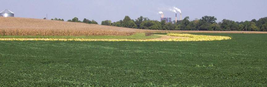
Agriculture
is a major part of the McLean
County economy. According
to the 2002-2003 Kentucky Agricultural Statistics Service 129,175 acres (79 percent)
of the 164,045 acres available were planted in corn, soybeans and tobacco.
Photograph by Glynn Beck, Kentucky Geological Survey.
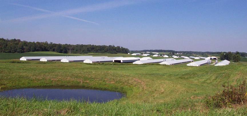
There are
approximately 340 chicken houses in McLean
County. Each house holds
5 to 6 flocks per year. One flock equals about 27,000 birds. Chicken litter
associated with these operations is used as a substitute for synthetic
fertilizers on row crop fields. Proper nutrient management is extremely
important to ensure that local soil and water resources are not impaired.
Photograph by Glynn Beck, Kentucky Geological Survey.

The Perdue
grain elevator and poultry feed mill located at Livermore, Kentucky. Photograph by Glynn Beck, Kentucky
Geological Survey.
Wood Products
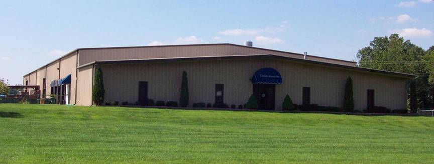
Twin
Rivers, Inc. is a manufacturer of high quality hardwood furniture. This
facility is located in Livermore,
which is historically known for the manufacturing of hardwood furniture.
Photograph by Glynn Beck, Kentucky Geological Survey.
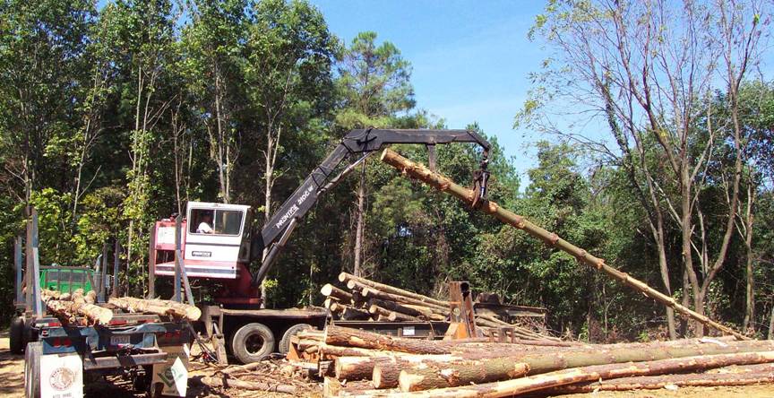
Along with
row crop agriculture, harvesting hardwood trees for furniture and pulp is a
sustainable land use in McLean
County. Photograph by Glynn Beck, Kentucky
Geological Survey.
Water Resources

The Green
River Lock and Dam No. 2 located at Calhoun,
Kentucky. The Green River is the
major drinking water supply for the residents of McLean County.
Groundwater is also used by rural residents for drinking water. Photograph by Glynn Beck, Kentucky
Geological Survey.
Source Water
Protection
Source-water
protection areas are areas in which activities are likely to affect the quality
of the
drinking-water source. For more information, see
kgsweb.uky.edu/download/water/swapp/swapp.htm.
Groundwater
In McLean County,
most wells less than 300 feet deep are adequate for a domestic supply.
Wells
located in the Green River floodplain can
produce as much as 100 gallons of hard water per minute. In a thin, highly
faulted zone running east-west across the county, between the towns of Beach
Grove and Nuckols, yields to drilled wells are
unpredictable because of faulting.
Generally,
groundwater is hard, to very hard and iron and salt may be present in
objectionable amounts. Groundwater often becomes saltier with depth. For more
information on groundwater in the county, see Carey and Stickney (2001).
Geologic Hazards
The most
prominent geologic hazard for McLean
County is flooding. Areas
underlain by alluvium are subject to regular flooding. Urban development often
exacerbates flooding, and therefore potential flooding should always be
considered in urban development plans. Areas of steep-walled drainage, such as
that formed in terrain underlain by sandstone, shale, and limestone, are
conducive to flash flooding, especially in developed areas. Flood information
is available from the Kentucky
Division of Water, Flood Plain Management Branch (www.water.ky.gov/floods/).
None of the
faults in McLean County
are considered to be active; however, the proximity of active seismic zones,
such as the New Madrid, Wabash, or East Tennessee,
calls for precautions to be taken for earthquake damage mitigation. The
presence of thick alluvium, which normally has a high water table, should also
be treated with special concern, because of the possibility of augmented
shaking and liquefaction during a strong earthquake. In addition, alluvium
often contains high amounts of clay minerals, which can give a soil a high
shrink/swell capacity.
Steep
slopes are present, especially along streams in areas underlain by sandstone,
shale, and limestone throughout the county. Steep slopes can develop soil creep
and landslides if not properly treated during development. Proper engineering
techniques should be followed when developing on hillsides, and care should be
taken not to affect property above and below a development site on a hillside.
Several
small underground coal mines are in McLean
County. The locations of
known mine workings, shafts, and adits are shown on
the map. Precautions need to be taken when developing over old mined areas,
because of the possibility of mine subsidence. Mine subsidence insurance is
available in Kentucky.
Surface
coal mine areas are prone to settling after reclamation, which may affect
structural foundations and roads. Surface mine areas also lack soil structure,
which inhibits the growth of vegetation during summer months. Abandoned deep and surface mine boundaries
shown on the map are approximate and do not represent all the mining that has
occurred in the county.
Topography

The
topography of McLean
County ranges from flat
broad lowlands to very steep sloped uplands. The elevation ranges from
approximately 610 feet to 370 feet above mean sea level. Photograph by Glynn Beck, Kentucky
Geological Survey.