Livingston County, Kentucky
GEOLOGIC HAZARDS
Many concealed and exposed
faults are located throughout Livingston
County. Currently there
is no evidence that these faults are active. Because of the close proximity of Livingston County to the New Madrid Seismic
Zone, however, strong earthquake activity is a possibility.
Soil creep, slumps, and
landslides along steep slopes may occur from erosion or ground motion
associated with a strong earthquake. Areas associated with alluvium material
are subject to liquefaction during a strong earthquake. These areas are also
subject to flooding. Soils derived from alluvium deposits have a moderate to
high shrink-swell capacity, which may affect structural foundations and roads.
Flood information is available from the Kentucky Division of Water, Flood Plain
Management Branch, www.water.ky.gov/floods/.
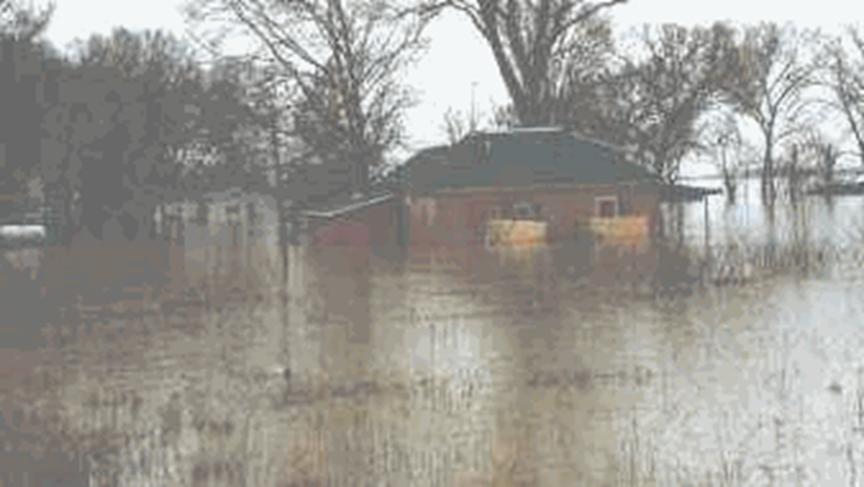
As seen in this picture, lowing lying areas
along the Ohio, Cumberland,
and Tennessee Rivers,
in Livingston County, are prone to flooding. During the 1997 flood, Ohio River flood water was 3.5 feet deep in this house.
(Photo courtesy of Sheena Thomas- Brown, Livingston County
4-H/Youth Development Agent.)
EARTHQUAKE HAZARDS
Peak ground acceleration at
the top of rock that will probably occur in the next 500 years in Kentucky
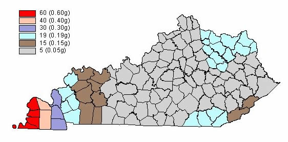
Although we do not know when
and where the next major earthquake will occur, we do know that an earthquake
will cause damage. Damage severity depends on many factors, such as earthquake
magnitude, the distance from the epicenter, and local geology. Information on
earthquake effects is obtained by monitoring earthquakes and performing
research. Such information is vital for earthquake hazard mitigation and risk
reduction.
The most important
information for seismic-hazard mitigation and risk reduction is ground-motion
hazard. One way of predicting ground-motion hazard is by determining the peak
ground acceleration (PGA) that may occur in a particular timeframe. The map
above shows the PGA at the top of bedrock that will likely occur within the
next 500 years in Kentucky
(Street and others, 1996). It shows, as expected, that PGA would be greatest in
far western Kentucky
near the New Madrid Seismic Zone. Ground-motion hazard maps for the central United States
and other areas are available from the U.S. Geological Survey. These maps are
used to set general policies on mitigating damage. For example, maps produced
by the USGS in 1996 were used to determine seismic design in building codes.
For additional information pertaining to earthquake hazards visit the Kentucky
Geological Survey website at www.uky.edu/KGS/geologichazards/geologichazards.html.
GROUNDWATER
Wells in the Ohio River alluvium yield several hundred gallons per
minute; compound horizontal wells have a potential yield as high as 5,000
gallons per minute. In most of Livingston
County, drilled wells in
the uplands are adequate for a domestic supply. Yields as
high as 50 gallons per minute have been reported from wells penetrating large
solution channels or fault zones. In the low-lying areas along the Cumberland and Tennessee
Rivers and the tributaries to the Ohio River, most wells are inadequate for domestic use,
unless the well intercepts a major solution opening in the limestone, and then
the yield could be very large. In the uplands of the southern section of the
county, between the Tennessee and Cumberland Rivers, most wells in gravel do not
yield enough water for a domestic supply. Springs with flows ranging from a few
gallons per minute to 177 gallons per minute are found in the county. Minimum
flow generally occurs in early fall; maximum flows in late winter. For more
information on groundwater in the county, see Carey and Stickney (2001).
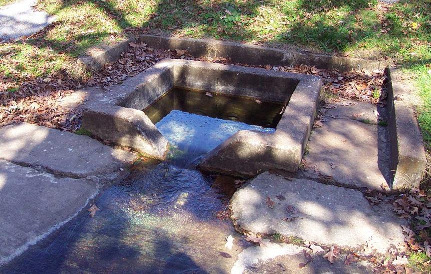
Limestone springs, such as Gum Spring
pictured above, are located throughout Livingston County.
Most of these springs flow year around and are used as drinking-water sources. Photo by Glynn Beck,
Kentucky Geological Survey.
KARST
Never use sinkholes as dumps. All waste, but
especially pesticides, paints, household chemicals, automobile batteries, and
used motor oil, should be taken to an appropriate recycling center or landfill.
Make sure runoff from parking lots, streets, and other
urban areas is routed through a detention basin and sediment trap to filter it
before it flows into a sinkhole.
Make sure your home septic system is working properly
and that it's not discharging sewage into a crevice or sinkhole.
Keep cattle and other livestock out of sinkholes and
sinking streams. There are other methods of providing water to livestock.
See
to it that sinkholes near or in crop fields are bordered with trees, shrubs, or
grass buffer strips. This will filter runoff flowing into sinkholes and also
keep tilled areas away from sinkholes.
Construct waste-holding lagoons in karst areas carefully, to prevent the bottom of the lagoon
from collapsing, which would result in a catastrophic emptying of waste into
the groundwater.
If required, develop a groundwater protection plan
(410KAR5:037) or an agricultural water-quality plan (KRS224.71) for your land
use.
(From Currens, 2001)
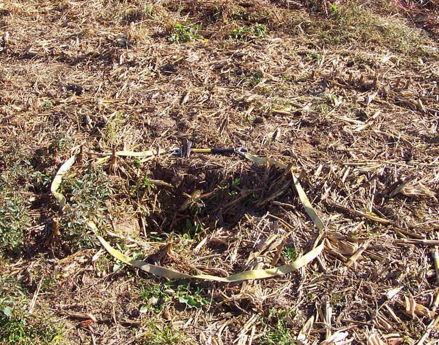
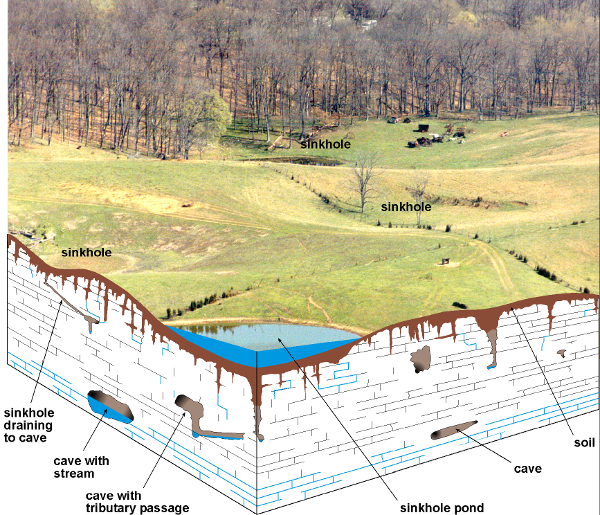
Sinkholes are common karst
features throughout Livingston
County. Sinkholes
commonly form in row crop fields as small openings, 1 to 2 feet in diameter, as
seen above. Without proper management, these sinkholes can form depressions
that are tens of feet in diameter. Photo by Glynn Beck, Kentucky
Geological Survey.
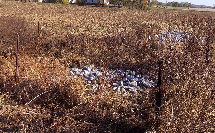
Sinkholes
are natural drainage points for groundwater and should never be used as trash
dumps. One way to protect sinkholes is by using geosynthetic
materials and rip-rap, which help to control further soil erosion. Pictured
above is a sinkhole that has been protected on the T.L. Maddux
Farm in Livingston
County. This sinkhole
protection was funded by the Kentucky Soil Erosion and Water Quality Cost Share
Program through the Livingston County Conservation District. Photo
by Glynn Beck, Kentucky Geological Survey.
About karst
More about karst
RESOURCES
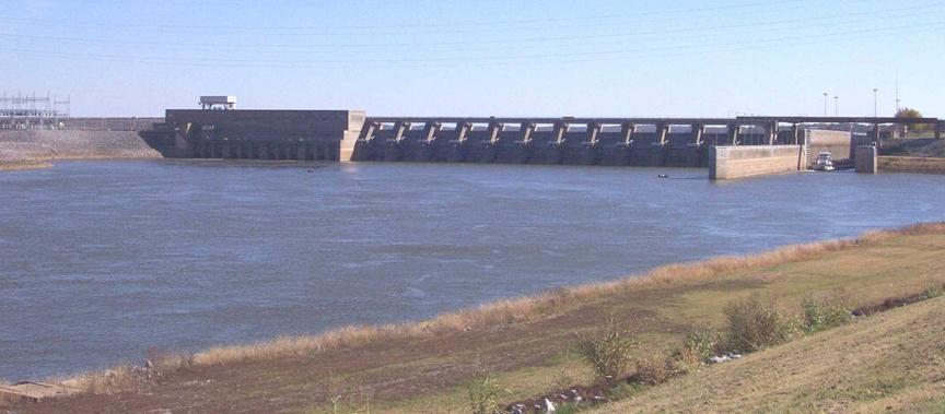
The 40-year-old Barkley Dam, constructed by
the U.S. Army Corps of Engineers, provides flood protection along the Cumberland River,
and produces hydroelectric power. Barkley Dam has a generating capacity of 148
megawatts. Photo by Glynn
Beck, Kentucky
Geological Survey.
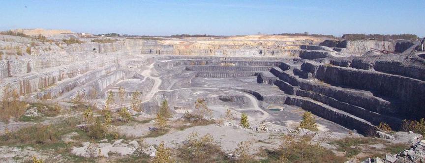
Limestone
is an abundant rock in Livingston
County. Currently, there
are two active limestone quarries in Livingston
County; Vulcan Materials
Reed Quarry (pictured above) and Martin Marietta Aggregates' Three Rivers
Quarry. Combined, these companies employ approximately 350 people and produce
approximately 13 million tons of crushed stone per year. Photo
by Glynn Beck, Kentucky Geological Survey.