Hickman County, Kentucky
GEOLOGIC HAZARDS
There are many concealed
faults located throughout Hickman
County. Currently there
is no evidence that these faults are active. However,
because of the proximity of Hickman County
to the New Madrid Seismic Zone, strong earthquake activity is a possibility.
Soil creep, slumps, and landslides along steep slopes may occur from erosion or
ground motion associated with a strong earthquake.
Areas associated with
saturated alluvium and other unconsolidated deposits are subject to
liquefaction during a strong earthquake. Alluvium deposits are also subject to
flooding. Soils derived from alluvium deposits have a moderate to high shrink
swell capacity, which may affect structural foundations and roads. Flood
information is available from the Kentucky
Division of Water, Flood Plain Management Branch,
www.water.ky.gov/floods/
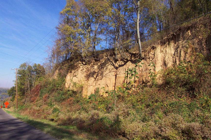
Landslides and slumps are associated with
tall bluffs during strong earthquakes. The bluff pictured above is located just
south of Columbus-
Belmont State
Park on Ky. 58 in Hickman
County. The bluff is
capped by approximately 30 feet of loess (wind blown) material. Photo by Glynn Beck, Kentucky
Geological Survey.
EARTHQUAKE HAZARDS
Peak ground acceleration at
the top of rock that will probably occur in the next 500 years in Kentucky
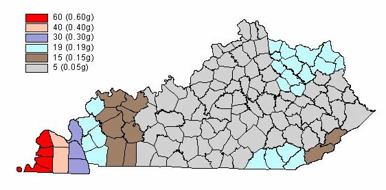
Although we do not know when
and where the next major earthquake will occur, we do know that an earthquake
will cause damage. Damage severity depends on many factors, such as earthquake
magnitude, the distance from the epicenter, and local geology. Information on
earthquake effects is obtained by monitoring earthquakes and performing
research. Such information is vital for earthquake hazard mitigation and risk
reduction.
The most important
information for seismic-hazard mitigation and risk reduction is ground-motion
hazard. One way of predicting ground-motion hazard is by determining the peak
ground acceleration (PGA) that may occur in a particular timeframe. The map
above shows the PGA at the top of bedrock that will likely occur within the
next 500 years in Kentucky
(Street and others, 1996). It shows, as expected, that PGA would be greatest in
far western Kentucky
near the New Madrid Seismic Zone. Ground-motion hazard maps for the central United States
and other areas are available from the U.S. Geological Survey. These maps are
used to set general policies on mitigating damage. For example, maps produced by
the USGS in 1996 were used to determine seismic design in building codes. For
additional information pertaining to earthquake hazards visit the Kentucky
Geological Survey website at www.uky.edu/KGS/geologichazards/geologichazards.html
GROUNDWATER
Abundant groundwater is
available for domestic, irrigation, and industrial uses in Hickman County,
from depths of a few feet down to 750 feet. Generally, depth to groundwater is under 100 feet except in the uplands and in the western part
of the county, where water is found in the 100 to 250 foot range. Yields in
some of the deeper wells (250-750 feet) are greater than 1,000 gallons per
minute, which is sufficient for a community or industrial supply. Groundwater sometimes contains
naturally-occurring iron in objectionable amounts from the deeper zones. In
some formations with slightly acidic groundwater, a chemical reaction between
the groundwater, steel well casing, and pump equipment will produce high iron
content in the water. In general, the chemical quality of the water is good.
Water from alluvium is generally hard to very hard. Water from the sand and/or
gravel, non-alluvium aquifers is considered soft and slightly acidic, with low
dissolved solids.
THE LAND
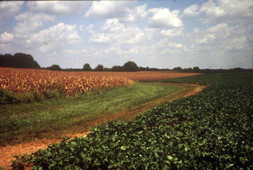
Agriculture is a major part of the Carlisle County economy. There are 122,112 acres
in the county and 49,300 of them were planted with either corn or soybeans in
2002 (Kentucky Agriculture Statistics 2002--2003). Photo
courtesy of Jerry McIntosh, U.S. Department of Agriculture--Natural Resources
Conservation Service.
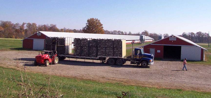
Approximately 140 chicken houses are in Hickman County. Each house holds about 27,000
birds. Chicken litter associated with these operations is used as a substitute
for synthetic fertilizers on row crops. Photo by Glynn Beck, Kentucky
Geological Survey.
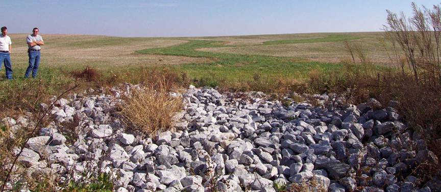
A typical way to control gully erosion,
common in Hickman
County, is to construct a
grassed waterway with a rock chute outlet. Funding for this structure was
provided by the CRP CP-21 program through the U.S. Department of Agriculture
Conservation Reserve Program. Photo by Glynn Beck, Kentucky
Geological Survey.
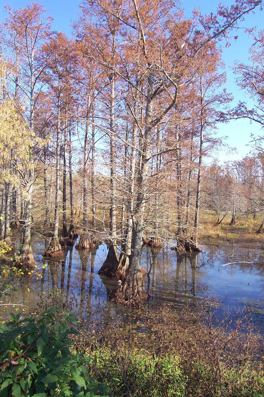
A typical cypress swamp in
the Obion Creek drainage. Most of Obion Creek drains the Loess Plains ecoregion (Woods, 2002) in Hickman County.
Photo by Glynn Beck,
Kentucky Geological Survey.