Graves County, Kentucky
GEOLOGIC HAZARDS
Many concealed and exposed
faults are located throughout Graves
County. Currently, there
is no evidence that these faults are active. Because of the proximity of Graves County
to the New Madrid Seismic Zone, however, strong earthquake activity is a
possibility. Soil creep, slumps, and landslides along steep slopes may occur
from erosion or ground motion associated with a strong earthquake.
Areas associated with
saturated alluvium and other unconsolidated deposits are subject to
liquefaction during a strong earthquake. Alluvium deposits are also subject to
flooding. Soils derived from alluvium deposits have a moderate to high
shrink-swell capacity, which may affect structural foundations and roads. Flood
information is available from the Kentucky Division of Water, Flood Plain
Management Branch, www.water.ky.gov/floods/.
EARTHQUAKE HAZARDS
Peak ground acceleration at
the top of rock that will probably occur in the next 500 years in Kentucky

Although we do not know when
and where the next major earthquake will occur, we do know that an earthquake
will cause damage. Severity depends on many factors, such as earthquake
magnitude, the distance from the epicenter, and local geology. Information on
earthquake effects is obtained by monitoring earthquakes and performing
research. Such information is vital for earthquake hazard mitigation and risk
reduction.
The most important
information for seismic-hazard mitigation and risk reduction is ground-motion
hazard. One way of predicting ground-motion hazard is by determining the peak
ground acceleration (PGA) that may occur in a particular timeframe. The map
above shows the PGA at the top of bedrock that will likely occur within the
next 500 years in Kentucky
(Street and others, 1996). It shows, as expected, that PGA would be greatest in
far western Kentucky
near the New Madrid Seismic Zone. Ground-motion hazard maps for the central United States
and other areas are available from the U.S. Geological Survey. These maps are
used to set general policies on mitigating damage. For example, maps produced by
the USGS in 1996 were used to determine seismic design in building codes. For
additional information pertaining to earthquake hazards visit the Kentucky
Geological Survey website at www.uky.edu/KGS/geologichazards/geologichazards.html
GROUNDWATER
Abundant quantities of groundwater
are available for domestic, irrigation, and industrial uses in Graves County
from depths of a few feet to below 700 feet; most wells set at the 100 foot
range. Yields in some of the deeper wells (250 to 1,500 feet) are greater than
1,000 gallons per minute, which is sufficient for a community or industrial
supply. A few wells obtain shallow, perched water from gravel or alluvial
deposits. These zones often will not yield an adequate domestic supply during
dry periods in late summer and fall.
Water quality generally is
good, except in areas where downward percolation of surface water and fluids
from domestic sewage-disposal systems and other sources of domestic or
industrial pollution have contaminated the aquifer. Water from alluvium is
generally hard to very hard with moderate to high levels of dissolved solids.
Water from the sand or gravel, non-alluvium aquifers is considered soft and
slightly acidic, with low dissolved solids content. In a few wells, harmful
amounts of nitrate have been detected. Groundwater from the deeper zones
sometimes contains naturally-occurring iron in objectionable amounts. In some
formations with slightly acidic groundwater, a chemical reaction between the
acidic groundwater, steel well casing, and pump equipment will produce a high iron content in the water. For more information on
groundwater resources in the county, see Carey and Stickney (2001).

The well-drained soils in Graves County
are conducive to the use of septic tanks with lateral lines. The unconsolidated
sediment makes for easy excavation. In
areas where the soils are not well-drained, unconventional methods to handle
waste may be needed. Photo
by Glynn Beck, Kentucky Geological Survey.
THE LAND
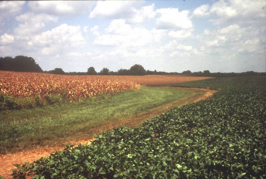
Agriculture is a major part of the Graves County
economy. There are 356,224 acres in Graves
County, and 124,200 of
them were planted with either corn or soybeans in 2002 (Kentucky Agriculture
Statistics 2002--2003). Photo courtesy of Jerry McIntosh,
U.S. Department of Agricultural--Natural Resources Conservation Service.
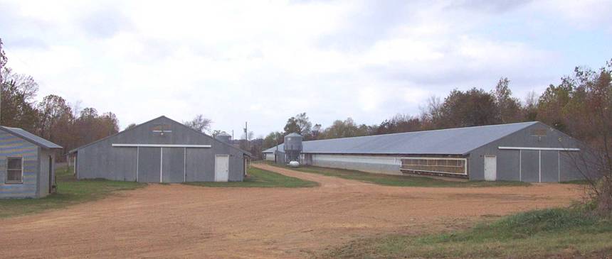
Approximately 230 chicken houses are in Graves County. Each house holds about 27,000 birds. Chicken
litter associated with these operations is used as a substitute for synthetic
fertilizers on row crops. Photo by Glynn Beck, Kentucky
Geological Survey.
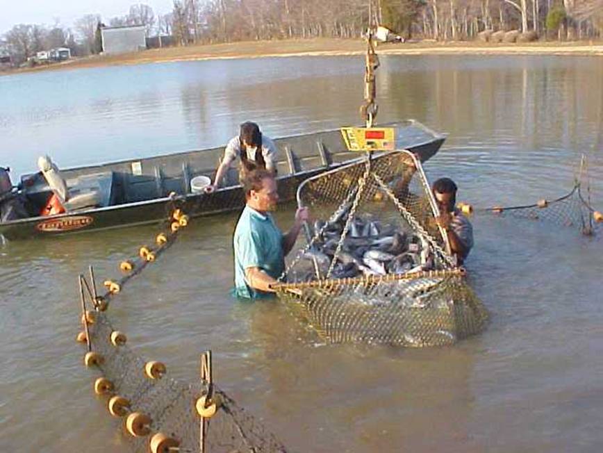
Currently, 61 catfish ponds are in Graves County. After harvesting, the fish are trucked to the
processing plant, located at the Purchase Area Aquaculture Cooperative. The
processing plant is currently running at 30 percent capacity. To get the plant
to 80 percent capacity 1000 more acres of ponds are needed. Photo
courtesy of Roberta Bonk, Purchase Area Aquaculture Cooperative.
RESOURCES
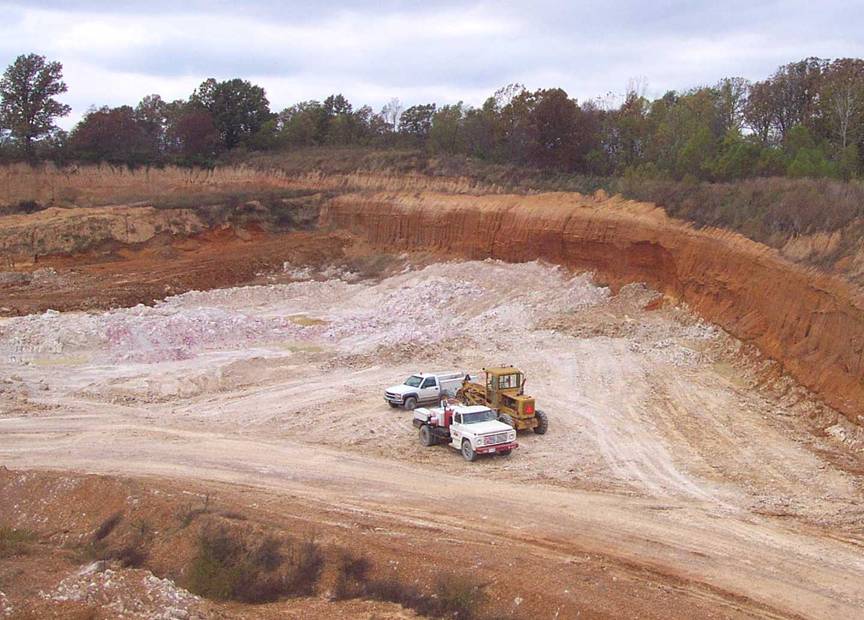
The Kentucky-Tennessee Clay Company has been
mining ball clay in Graves
County since 1887and is
currently one of three ball clay mining companies in the county. Ball clay has
a high percentage of aluminum, which makes it suitable for the production of
toilets, sinks, floor tile, bathtubs, and fine dinnerware. Photo
by Glynn Beck, Kentucky Geological Survey.