SWELLING SHALES AND
SOILS
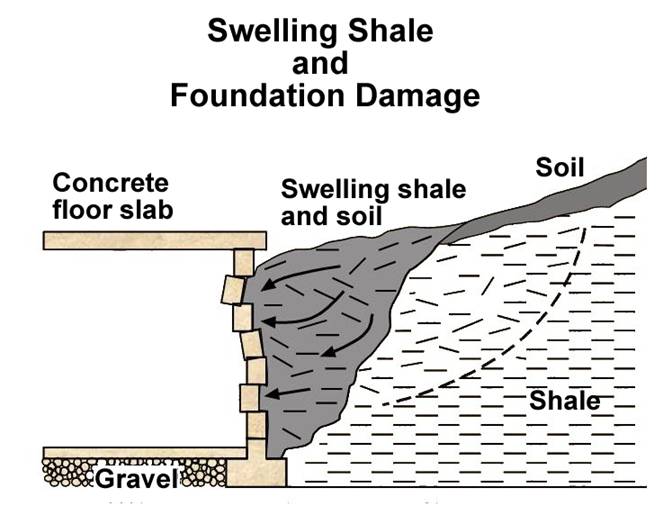
A
problem of considerable concern in this area is the swelling of some of the
clay minerals in shales. This process is exacerbated
when the shale contains the mineral pyrite (fool's gold), such as is the case
in the Chattanooga Shale. Pyrite is a common mineral and can be found
distributed throughout the black shale, although it is not always present and
may be discontinuous both vertically and horizontally. In the presence of
moisture and oxygen, pyrite oxidizes and produces sulfuric acid. The acid
reacts with calcium carbonates found in water, the rock itself, crushed
limestone, and concrete. This chemical reaction produces sulfate and can form
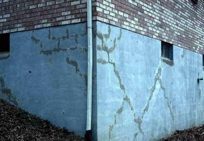
the mineral gypsum, whose crystallization can cause layers of shale to expand
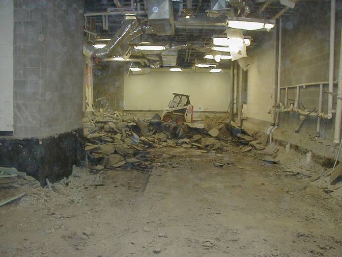
and burst, backfill to swell, and concrete to crack and crumble. It can heave
the foundation, the slab and
interior partitions resting on it, and can even damage upper
floors and interior partitions. This phenomenon has been responsible for
extensive damage to schools, homes, and businesses in
We
strongly suggest that anyone planning construction on these shales
seek professional advice from a geologist or engineer familiar with the problem.
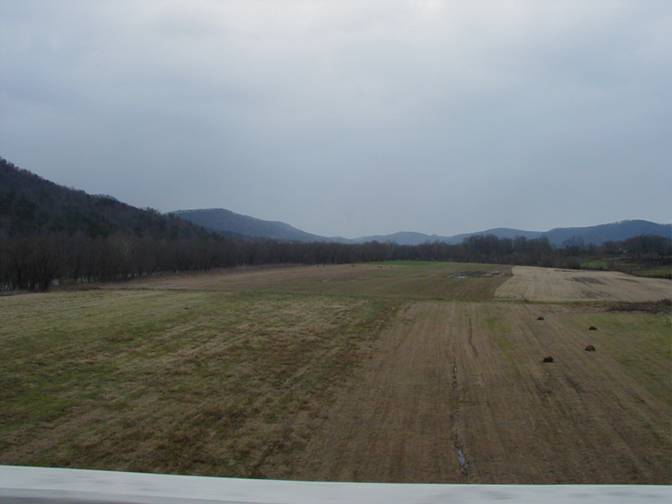
Expanding shales in
Some shales, and the soils derived from them, swell when
exposed to water or air. These swelling shales and
soils can have severe impacts on building foundations and other structures
(e.g., bridges, dams, roads). Photograph by John Kiefer,
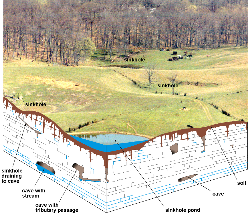
KARST GEOLOGY
The term "karst" refers to a landscape characterized by
sinkholes, springs, sinking streams (streams that disappear underground), and
underground drainage through solution-enlarged conduits or caves. Karst landscapes form when slightly acidic water from rain
and snow-melt seeps through soil cover into fractured and soluble bedrock
(usually limestone, dolomite, or gypsum). Sinkholes are depressions on the land
surface where water drains underground. Usually circular and often
funnel-shaped, they range in size from a few feet to hundreds of feet in
diameter. Springs occur when water emerges from underground to become surface
water. Caves are solution-enlarged fractures or conduits large enough for a
person to enter.
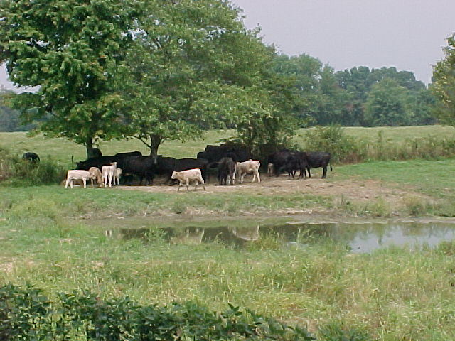
These cattle are resting
near a pond that is probably a sinkhole pond, meaning that it is connected to
the limestone aquifer by fractures in the bedrock, but is plugged with soil.
Cattle feedlots or pastures such as this can cause increased nitrates in
groundwater if the ponds or feedlots drain into the aquifer. Photo
by Bart Davidson,
CONSTRUCTION IN KARST
AREAS
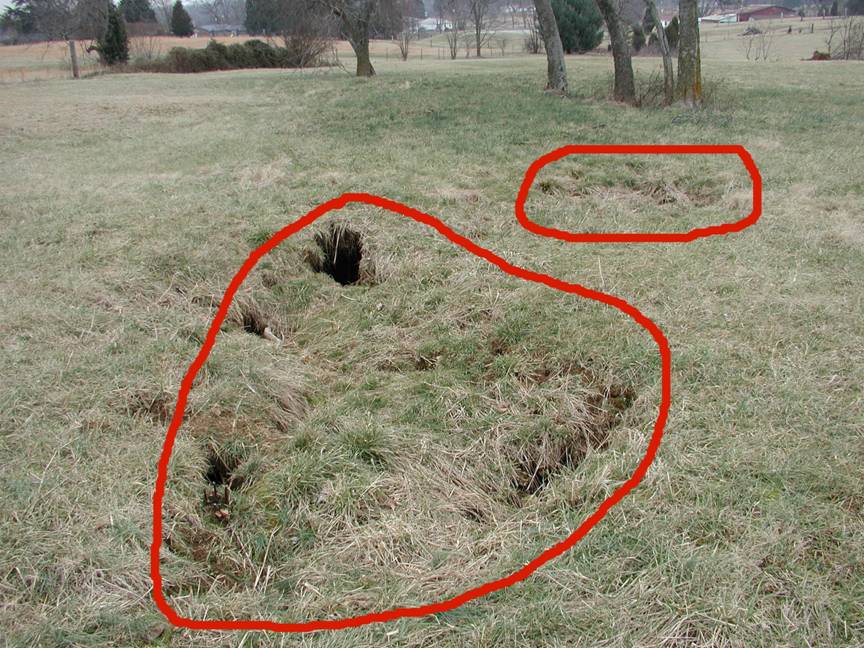
Cover-collapse sinkholes
(outlined in red) are typical in areas of karst geology.
Many sinkholes such as these have not been mapped. The construction
implications of these features must be addressed for any type of development. Photo by Bart Davidson,
RESIDENTIAL
CONSTRUCTION
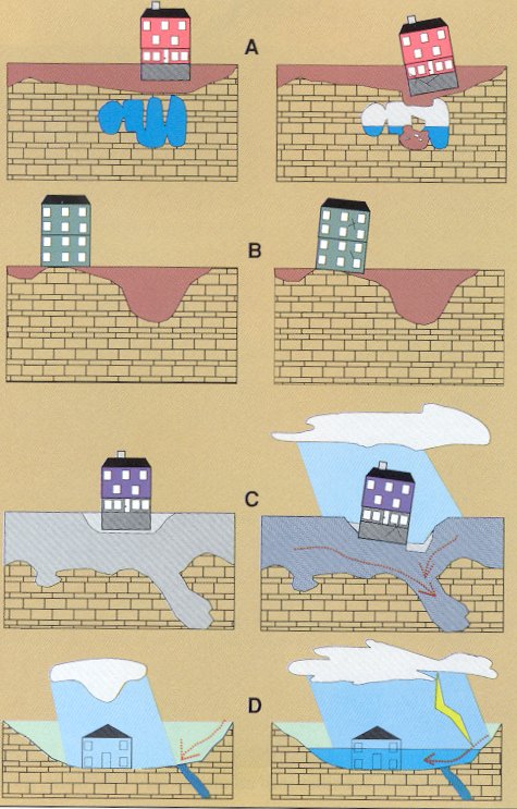
Limestone
terrain can be subject to subsidence hazards, which usually can be overcome by
prior planning and site evaluation. "A" shows
construction above an open cavern, which later collapses. This is one of
the most difficult situations to detect, and the possibility of this situation
beneath a structure warrants insurance protection for homes built on karst terrain. In "B," a heavy structure presumed
to lie above solid bedrock actually is partially supported on soft, residual
clay soils that subside gradually, resulting in damage to the structure. This
occurs where inadequate site evaluation can be traced to lack of geophysical
studies and inadequate core sampling. "C" and "D" show the
close relationship between hydrology and subsidence hazards in limestone
terrain. In "C," the house is situated on porous fill (light shading)
at a site where surface and groundwater drainage move supporting soil (darker
shading) into voids in limestone (blocks) below. The natural process is then
accelerated by infiltration through fill around the home. "D" shows a
karst site where normal rainfall is absorbed by
subsurface conduits, but water from infrequent heavy storms cannot be carried
away quickly enough to prevent flooding of low-lying areas. Adapted
from AIPG (1993).
DEVELOPMENT
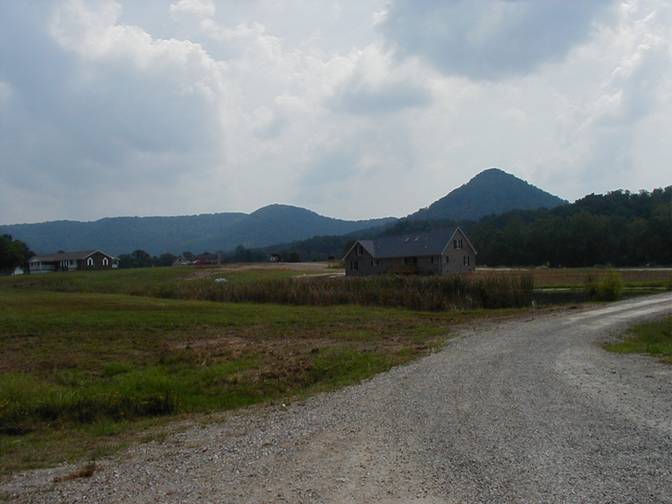
New residential development
near Hargett in northern
ENVIRONMENTAL
PROTECTION
Never use sinkholes as
dumps. All waste, but especially pesticides, paints, household chemicals,
automobile batteries, and used motor oil, should be taken to an appropriate
recycling center or landfill.
Make sure runoff from
parking lots, streets, and other urban areas is routed through a detention
basin and sediment trap to filter it before it flows into a sinkhole.
Make sure your home septic
system is working properly and that it's not discharging sewage into a crevice
or sinkhole.
Keep cattle and other
livestock out of sinkholes and sinking streams. There are other methods of
providing water to livestock.
See to it that sinkholes
near or in crop fields are bordered with trees, shrubs, or grass buffer strips.
This will filter runoff flowing into sinkholes and also keep tilled areas away
from sinkholes.
Construct waste-holding
lagoons in karst areas carefully, to prevent the
bottom of the lagoon from collapsing, which would result in a catastrophic
emptying of waste into the groundwater.
If required, develop a
groundwater protection plan (410KAR5:037) or an agricultural water-quality plan
(KRS224.71) for your land use.
(From Currens,
2001)
RADON
Radon gas, although not
widely distributed in
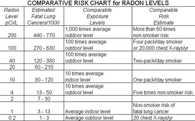
EPA recommends action be taken if indoor levels exceed 4 picocuries
per liter, which is 10 times the average outdoor level. Some EPA
representatives believe the action level should be lowered to 2 picocuries per liter; other scientists dissent and claim
the risks estimated in this chart are already much too high for low levels of
radon. The action level in European countries is set at 10 picocuries
per liter. Note that this chart is only one estimate; it is not based upon any
scientific result from a study of a large population meeting the listed
criteria. (From the U.S. Environmental Protection Agency,
1986.)
EROSION CONTROL
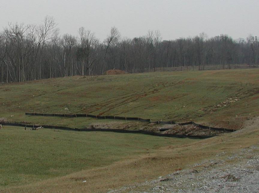
During
construction, erosion-control fences such as these may be needed to prevent
silt from entering local streams. Photo by
Bart
Davidson,
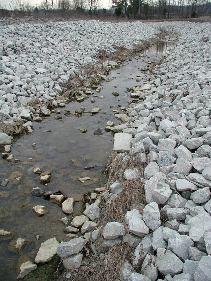
Riprap
drainage control and erosion protection. Photo by Stephen Greb,
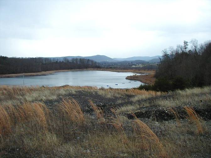
This pond on a ridge of the
RESOURCES
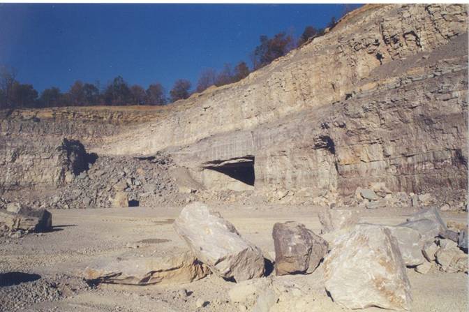
The Tipton Ridge Quarry and
Mine near
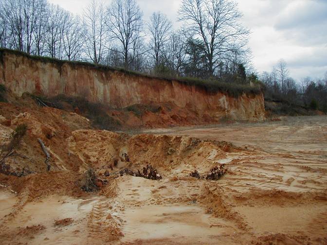
The high-level gravel unit
exposed here along Ky. 52 west of
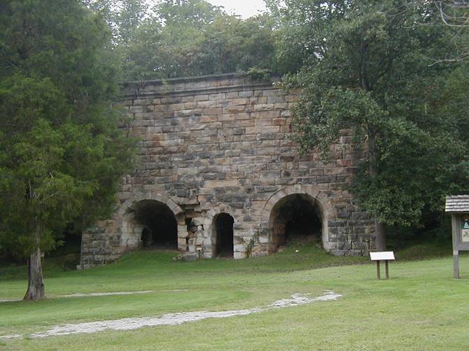
The Fitchburg Iron Furnace
produced pig iron from 1870 to 1874, and was the largest furnace built in
GROUNDWATER
In the
Throughout the county,
groundwater is hard or very hard and may contain salt or hydrogen sulfide,
especially at depths greater than 100 feet. For more information on groundwater
in the county, see Carey and Stickney (2001).
A cattle watering trough,
probably fed from the nearby water well. Such wells are often the most
economical source of water for rural communities. Photo by
Bart Davidson,
SOURCE WATER
PROTECTION AREAS
In source-water protection
areas, activities are likely to affect the quality of the drinking-water
source. For more information, see
kgsweb.uky.edu/download/water/swapp/swapp.htm.
POND CONSTRUCTION
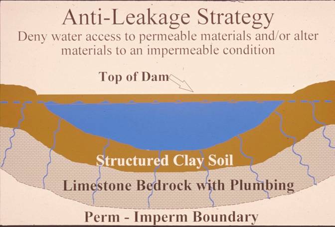
Successful pond construction
must prevent water from seeping through structured soils into limestone
solution channels below. A compacted clay liner, or artificial liner, may
prevent pond failure. Getting the basin filled with water as soon as possible
after construction prevents drying and cracking, and possible leakage, of the
clayey soil liner. Ponds constructed in dry weather are more apt to leak than
ponds constructed in wet weather. The
Dams should be constructed
of compacted clayey soils at slopes flatter than 3 units horizontal to 1 unit
vertical. Ponds with dam heights exceeding 25 feet, or pond volumes exceeding
50 acre-feet, require permits. Contact the
MAPPED SURFACE FAULTS
Faults are common geologic
structures across
FLOODING