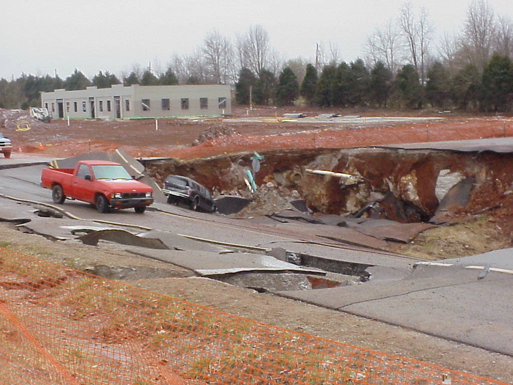
Major Construction
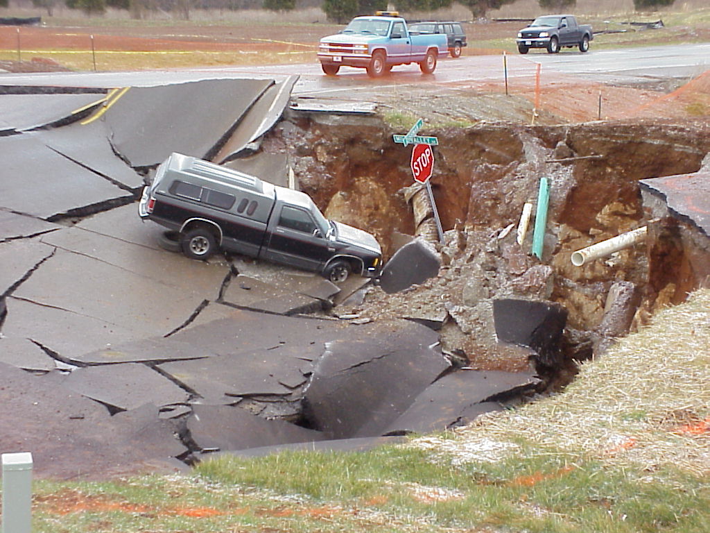
An
understanding of the geology of an area can help prevent costly construction failures.
Constructing this road in
Pond Construction
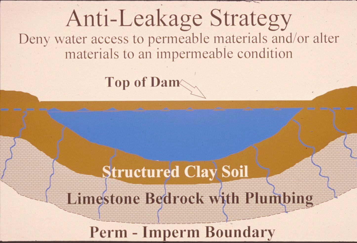
Successful
pond construction must prevent water from seeping through structured soils into
limestone solution channels below. A compacted clay liner, or artificial liner,
may prevent pond failure. Getting the basin filled with water as soon as
possible after construction prevents drying and cracking, and possible leakage,
of the clayey soil liner. Ponds constructed in dry weather are more apt to leak
than ponds constructed in wet weather. Illustration and
discussion by Paul Howell, USDA-NRCS.
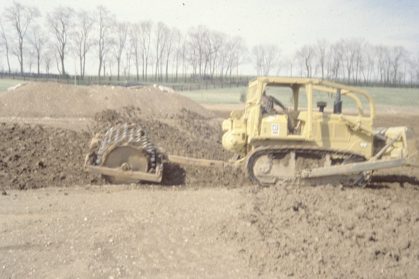
A
clayey-soil pond liner is placed in loose, moist layers and compacted with a sheepsfoot roller. A geotechnical engineer or geologist
should be consulted regarding the requirements of a specific site. Other
leakage prevention measures include synthetic liners, bentonite,
and asphaltic emulsions. The U.S. Department of
Agriculture-Natural Resources Conservation Service can provide guidance on the
application of these liners to new construction, and for treatment of existing
leaking ponds. (photo and discussion by Paul Howell,
USDA-NRCS)
Dams
should be constructed of compacted clayey soils at slopes flatter than 3 units
horizontal to 1 unit vertical. Ponds with dam heights exceeding 25 feet, or
pond volumes exceeding 50 acre-feet, require permits. Contact the Kentucky
Division of Water,
Environmental Protection
- Never use sinkholes as dumps.
All waste, but especially pesticides, paints, household chemicals,
automobile batteries, and used motor oil should be taken to an appropriate
recycling center or landfill.
- Make sure runoff form parking
lots, streets, and other urban areas is routed through a detention basin
and sediment trap to filter it before it flows into a sinkhole.
- Make sure your home septic
system is working properly and that it's not discharging sewage into a
crevice or hole.
- Keep your cattle and other
livestock out of sinkholes and sinking streams. There are other methods of
providing water to livestock.
- See to it that sinkholes near
or in crop fields are bordered with trees, shrubs, or grass "buffer
strips." This will filter runoff flowing into sinkholes and also keep
tilled areas away from sinkholes.
- Construct waste-holding
lagoons in karsst areas carefully, to prevent
the bottom of the lagoon fromcollapsing, which
would result in a catastrophic emptying of waste into the groundwater.
- If required, develop a
ground-water protection plan (410KAR5:037) or an agricultural
water-quality plan (KRS224.71) for your land use. (From Currens, 2001).
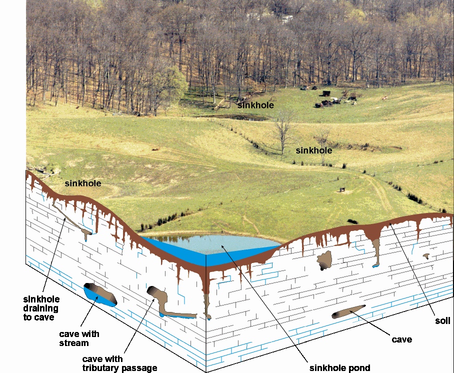
Geologic
Hazards
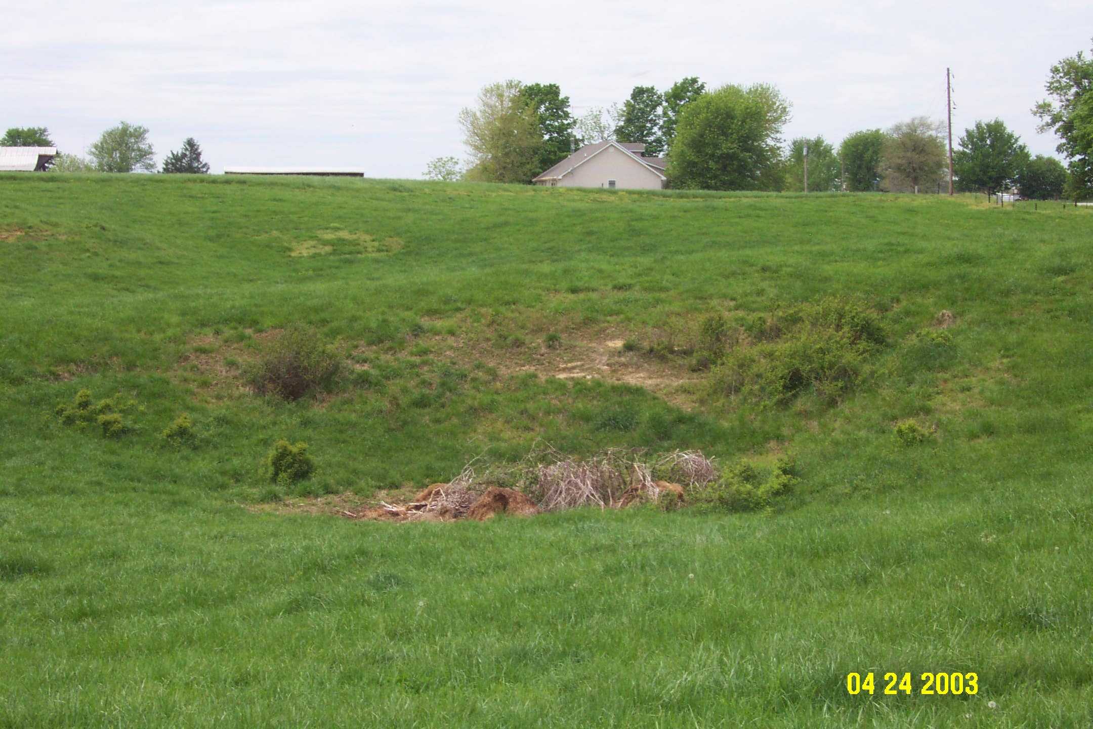
Karst sinkholes
are common features in
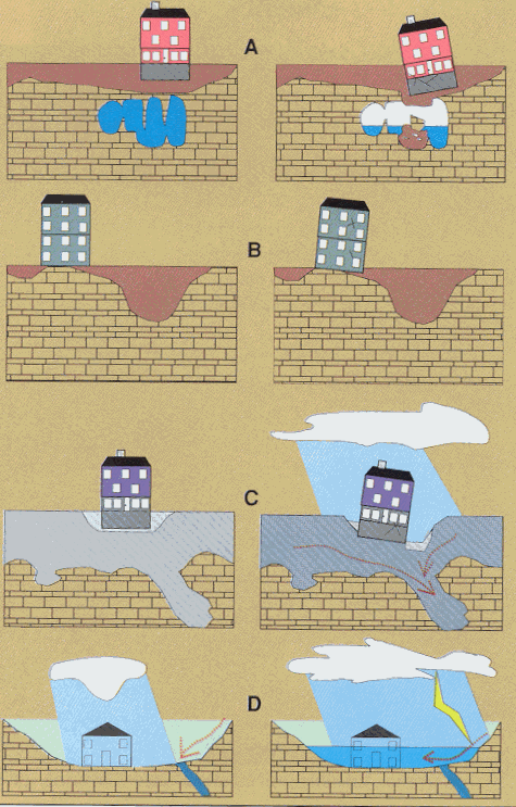
Limestone terrain can be subject to subsidence
hazards, which usually can be overcome by prior planning and site evaluation. "A" shows construction above an open cavern, which later
collapses. This is one of the most difficult situations to detect, and
the possibility of this situation beneath a structure warrants insurance
protection for homes built on karst terrain. In
"B," a heavy structure presumed to lie above solid bedrock actually
is partially supported on soft, residual clay soils that subside gradually,
resulting in damage to the structure. This occurs where inadequate site
evaluation can be traced to lack of geophysical studies and inadequate core
sampling. "C" and "D" show the close relationship between
hydrology and subsidence hazards in limestone terrain. In "C", the house
is situated on porous fill (light shading) at a site where surface and
groundwater drainage move supporting soil (darker shading) into voids in
limestone (blocks) below. The natural process is then accelerated by
infiltration through fill around the home. "D" shows a karst site where normal rainfall is absorbed by subsurface
conduits, but water from an infrequent heavy storm cannot be carried away
quickly enough to prevent flooding of lowlying areas.
(Adapted from American Institute of Professional Geologists,
1993.)
Other
Hazards
Faults are common geologic structures across
Soil creep, slumps, and landslides occurring along
steep slopes may occur from erosion or ground motion associated with a strong
earthquake.
Areas associated with alluvium are subject to liquefaction
during a strong earthquake event. These areas are also subject to flooding.
Soils derived from alluvium deposits may have a
moderate to high shrink swell capacity, which may affect structural foundations
and roads.
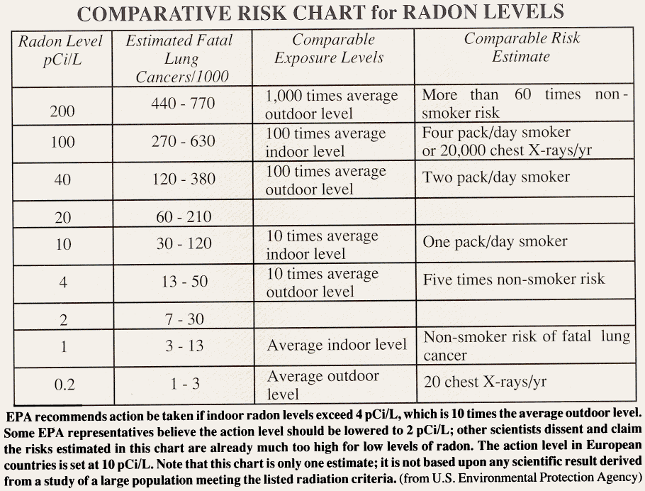
Radon gas can be a local problem, although it is not
widely distributed in
RESOURCES
Groundwater
In karst areas such as
southern and eastern
In this highly karstic,
limestone rich county, most of the drilled wells in
the southern half of
Surface
Water
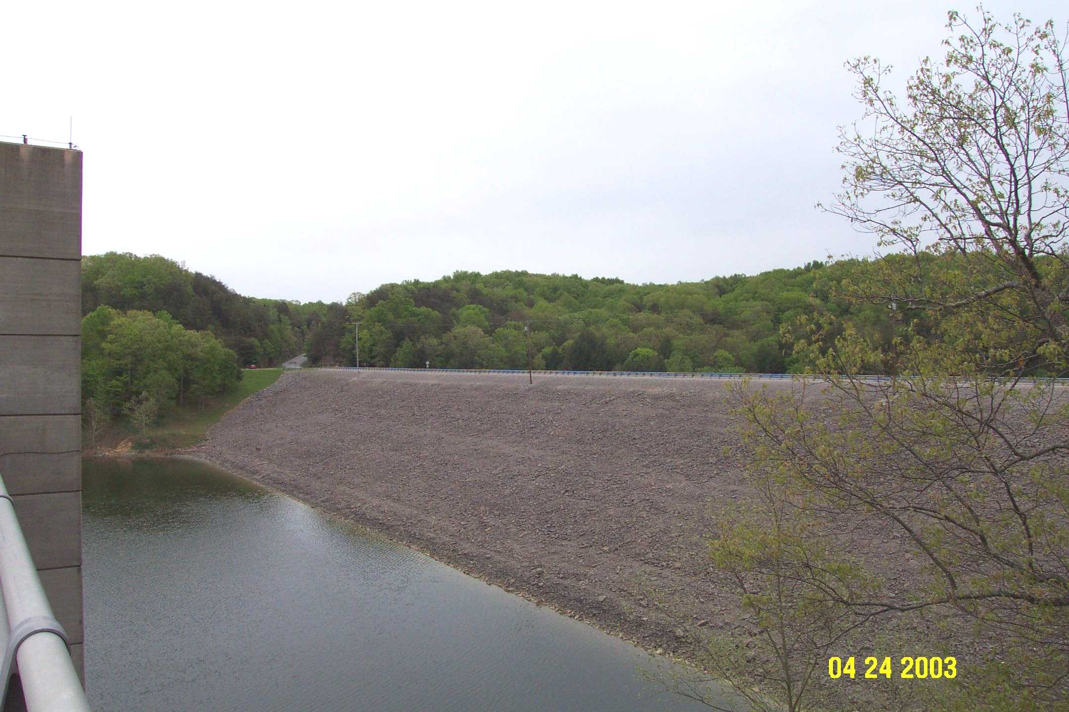
The U.S. Army Corps of Engineers constructed the Nolin River Dam in 1959 to prevent flood damage along the Nolin and
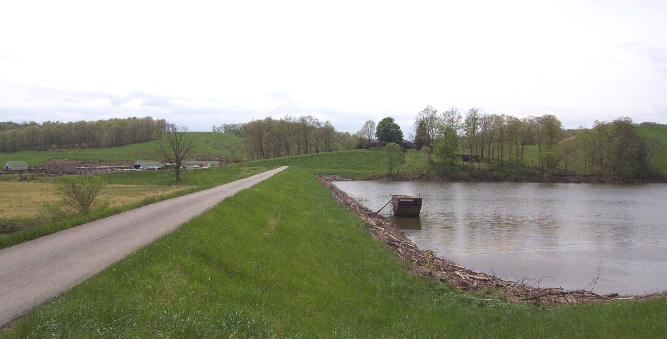
This levee was constructed to control flooding along
the Big Reedy Creek drainage in
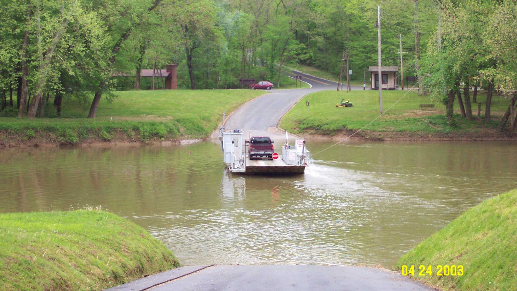
Houchins Ferry
(above) is one of two ferries within
Energy
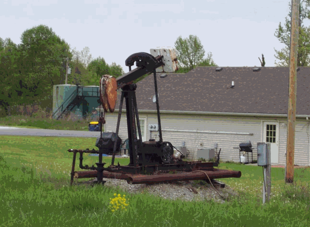
As demonstrated in this picture, oil well "pump
jacks" (foreground) and tanks (background) are a familiar site to
residents in
REFERENCES
American
Carey,
Daniel I., and Stickney, John F., 2001, Ground-water resources of
Currens, James C., 2001, Protecting Kentucky's Karst
Aquifers from Nonpoint-Source Pollution: Kentucky
Geological Survey, Map and Chart Series 27, Series XII, poster.
Mitchell,
Michael J., 2001, Soil Survey of
Paylor, R.L., Florea, L.J., Caudill,
M.J., and Currens, J.C., 2003, A GIS coverage of
sinkholes in karst areas of
Ray,
Joseph A., and Currens, James C., 1998, Karst Ground-Water Basins in the Beaver Dam 30x60 Minute
Quadrangle: Kentucky, Kentucky Geological Survey, Map and Chart 19, Series XI,
Mapped scale 1:100,000.
Thompson,
Mark F., Plauche, Stephen T., and Crawford, Matthew
M., 2003, Geologic map of the Beaver Dam 30 x 60 minute quadrangle:
Kentucky Geological Survey, ser. 12, Geologic Map 1, scale 1:100,000.
Woods,
A.J., Omernik, J.M., Martin, W.H., Pond, G.J.,
Andrews, W.M., Call, S.M., Comstock, J.A., and Taylor, D.D., 2002, Ecoregions of Kentucky (color poster with map, descriptive
text, summary tables, and photographs): Reston, VA., U.S. Geological Survey
(map scale 1:1,000,000).
Copyright
2003 by the University of