Agriculture
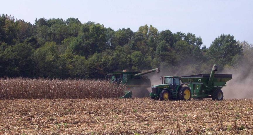
Agriculture is a
major part of the
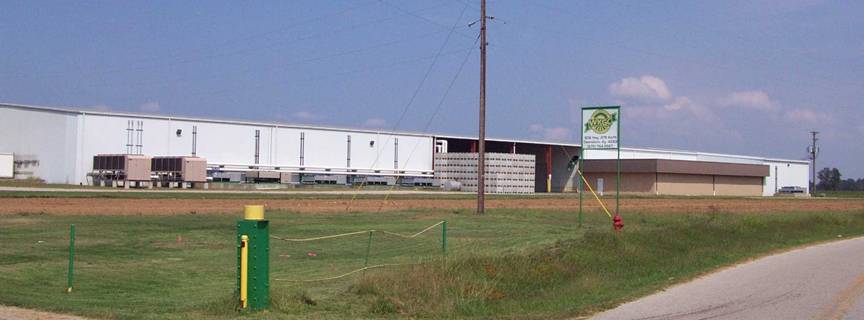
An
estimated 600 to 700 acres of fresh market produce is grown annually in
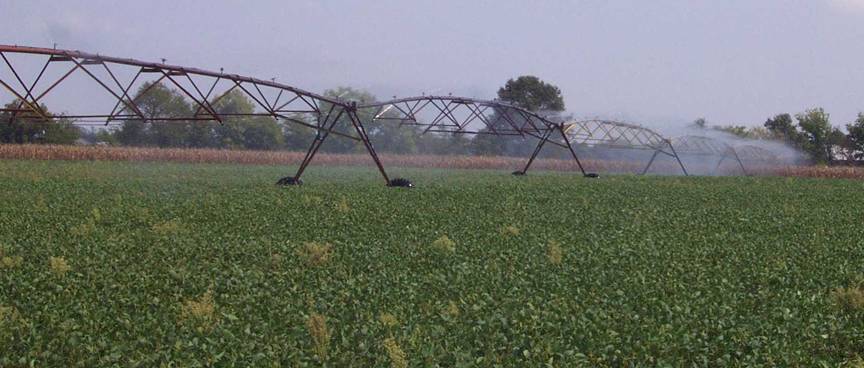
Farmers use
groundwater to irrigate their crops planted in bottomlands along the
Groundwater
Availability
The
alluvium along the
Generally,
groundwater is hard to very hard, and iron and salt may be present in
objectionable amounts. In deep wells, ground water is often too mineralized to
use. For more information on groundwater resources in the county, see Carey and
Stickney (2001).
Geologic
Hazards
The most
prominent geologic hazard for
by alluvium
are subject to regular flooding. Urban development often exacerbates flooding,
and therefore potential flooding should always be considered in urban
development plans. Areas of steep walled drainage, such as that formed in
terrain underlain by chert gravel, are conducive to
flash flooding, especially in developed areas. Flood information is available
from the Kentucky Division of Water, Flood Plain Management Branch, www.water.ky.gov/floods/.

Parts of
Photograph by
Earthquake Hazards
None of the
faults which occur within
proximity
of active seismic zones, such as the New Madrid, Wabash, or
however,
calls for precautions to be taken for earthquake damage mitigation. The
presence of
thick alluvium, which normally has a high water table, should also be treated
with
special concern, because of the possibility of augmented shaking and
liquefaction
during a
strong earthquake. In addition, alluvium often contains high amounts of clay
minerals,
which can give a soil a high shrink/swell capacity.
Peak ground
acceleration at the top of rock that will
probably occur in the
next 500 years in
Although we
do not know when and where the next major earthquake will occur, we do know
that an earthquake will cause damage. Damage severity depends on many factors, such
as earthquake magnitude, the distance from the epicenter, and local geology.
Information on earthquake effects is obtained by monitoring earthquakes and
performing research. Such information is vital for earthquake hazard mitigation
and risk reduction.
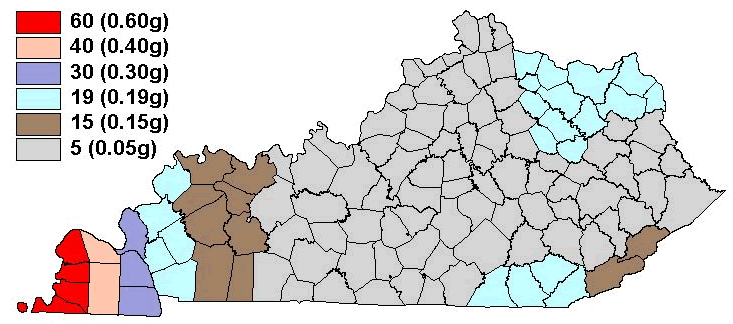
The most
important information for seismic-hazard mitigation and risk reduction is
ground-motion hazard. One way of predicting ground-motion hazard is by
determining the peak ground acceleration (PGA) that may occur in a particular
timeframe. The map above shows the PGA at the top of bedrock that will likely
occur within the next 500 years in
by the USGS
in 1996 were used to determine seismic design in building codes. For additional
information pertaining to earthquake hazards visit the Kentucky Geological
Survey website at www.uky.edu/KGS/geologichazards/geologichazards.html
Other Hazards
Steep
slopes are present throughout the county, especially along streams in areas underlain
by chert gravel. Steep slopes can develop soil creep
and landslides if not properly treated during development. Proper engineering
techniques should be followed when developing on hillsides, and care should be
taken not to affect property above and below a development site on a hillside.
There are
several underground coal mines located in
Surface
coal mine areas are prone to settle after reclamation, which may affect
structural foundations and roads. Surface mine areas also lack soil structure,
which inhibits the growth of vegetation during summer months. Abandoned deep
and surface mine boundaries shown on the map are approximate and do not represent
all the mining that has occurred in the county.
Soil
piping, which may occur in various soil types, but particularly in alluvium and
loess, produces small to large holes if left untreated. The only way to treat
soil piping is to fill the holes with rock or soil to keep the holes from
enlarging and to divert drainage from the area.
Transportation

The Owensboro Riverport, located on the
Resources
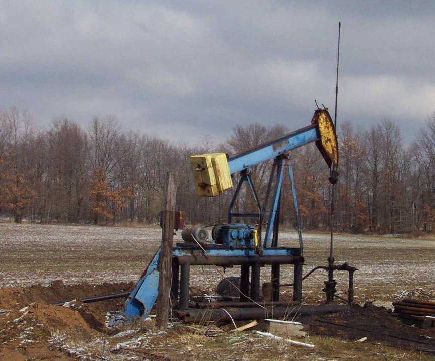
Oil well "pump
jacks" are located throughout
Housing
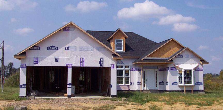
According to the U.S.
Census Bureau the population of