Carlisle County, Kentucky
GEOLOGIC HAZARDS
There is one mapped
concealed fault in Carlisle
County. Currently there
is no evidence that this fault is active. However, because of the proximity of Carlisle County to the New Madrid Seismic Zone strong
earthquake activity is a possibility. Soil creep, slumps, and landslides along
steep slopes may occur from erosion or ground motion associated with a strong
earthquake. Areas associated with saturated alluvium and other unconsolidated
deposits are subject to liquefaction during a strong earthquake.
Alluvium deposits are also
subject to flooding. Soils derived from alluvium deposits have a moderate to
high shrink swell capacity, which may affect structural foundations and roads. Flood
information is available from the Kentucky Division of Water, Flood Plain
Management Branch, www.water.ky.gov/floods/
EARTHQUAKE HAZARDS
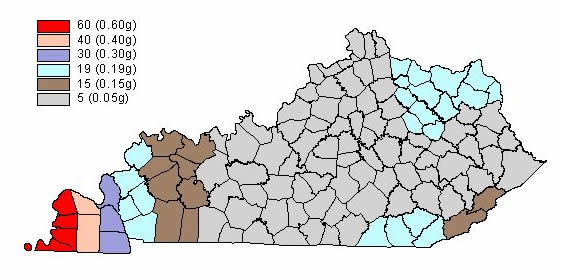
Peak ground acceleration at
the top of rock that will probably occur in the next 500 years in Kentucky
Although we do not know when
and where the next major earthquake will occur, we do know that an earthquake
will cause damage. Damage severity depends on many factors, such as earthquake
magnitude, the distance from the epicenter, and local geology. Information on
earthquake effects is obtained by monitoring earthquakes and performing
research. Such information is vital for earthquake hazard mitigation and risk
reduction.
The most important
information for seismic-hazard mitigation and risk reduction is ground-motion
hazard. One way of predicting ground-motion hazard is by determining the peak
ground acceleration (PGA) that may occur in a particular timeframe. The map
above shows the PGA at the top of bedrock that will likely occur within the
next 500 years in Kentucky
(Street and others, 1996). It shows, as expected, that PGA would be greatest in
far western Kentucky
near the New Madrid Seismic Zone. Ground-motion hazard maps for the central United States
and other areas are available from the U.S. Geological Survey. These maps are
used to set general policies on mitigating damage. For example, maps produced by
the USGS in 1996 were used to determine seismic design in building codes. For
additional information pertaining to earthquake hazards visit the Kentucky
Geological Survey website at www.uky.edu/KGS/geologichazards/geologichazards.html
GROUNDWATER
Abundant ground water is
available for domestic, irrigation, and industrial uses in Carlisle County
from depths of a few feet down to 600 feet. Generally, depth to groundwater is
less than 100 feet, except in the uplands of Carlisle County
where sufficient groundwater is obtained at depths greater than 100 feet.
Yields in some of the deeper wells are greater than 1,000 gallons per minute,
which is sufficient for a community or industrial supply.
Water from the thick Mississippi River alluvium is generally hard to very
hard. Water from the non-alluvium aquifers is considered soft and slightly
acidic with low dissolved solids. Water
quality generally is good, except in areas where downward percolation
of surface water and fluids from domestic sewage-disposal systems, and other
sources of domestic or industrial pollution, have contaminated the
aquifer. Groundwater sometimes contains iron and manganese naturally in
objectionable amounts from the deeper zones. In some formations with slightly
acidic groundwater, a chemical reaction between the acidic groundwater and
steel well casing and pump equipment will produce a high
iron content in the water which is not naturally occurring. For more
information on groundwater in the county, see Carey and Stickney (2001).
THE LAND
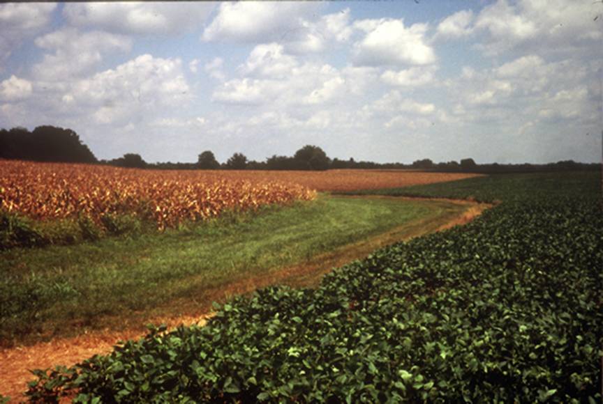
Agriculture is a major part of the Carlisle County economy. There are 122,112 acres
in Carlisle County and 49,300 of them were planted with either corn or soybeans in 2002
(Kentucky Agriculture Statistics 2002--2003). Photo courtesy
of Jerry McIntosh, U.S. Department of Agriculture--Natural Resources
Conservation Service.
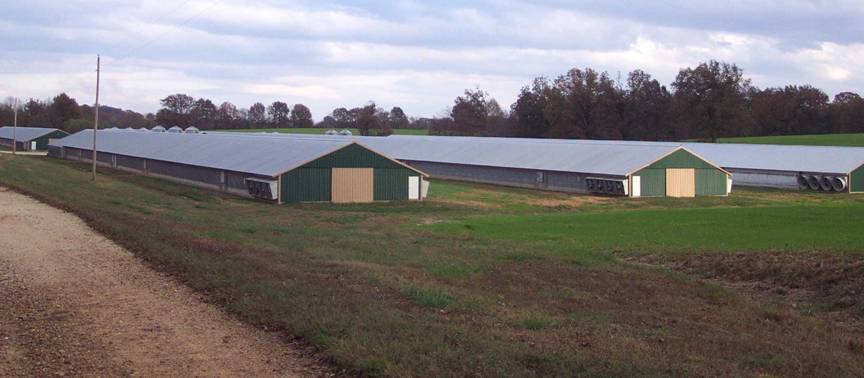
Approximately 40 chicken houses are in Carlisle County. Each house holds about 27,000
birds. Chicken litter associated with these operations is used as a substitute
for synthetic fertilizers on row crop fields. Photo by Glynn Beck, Kentucky
Geological Survey.
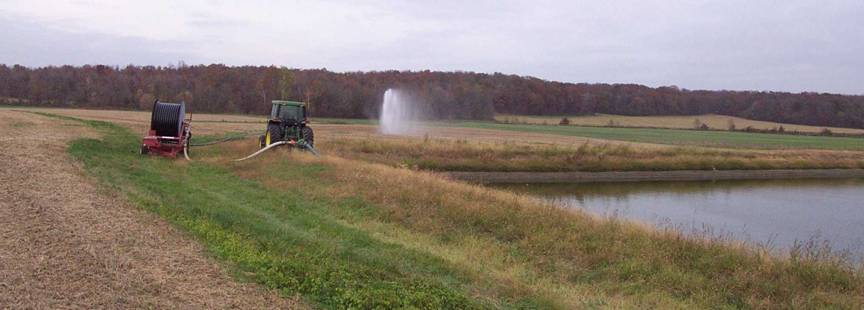
An abandoned hog lagoon is being pumped to
utilize the nutrient-rich waste water on nearby row crops. To control runoff of
the waste water, the lagoon can only be pumped during certain times of the
year. Photo by Glynn
Beck, Kentucky
Geological Survey.
RESOURCES
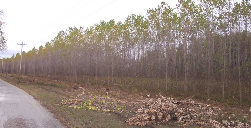
MeadWestvaco has a
fine grade paper mill in Ballard County, which uses the bottomlands in Carlisle County to grow cottonwood and sycamore
trees for paper production. MeadWestvaco owns
approximately 3,500 acres in Carlisle
County. Photo by Glynn Beck,
Kentucky Geological Survey.
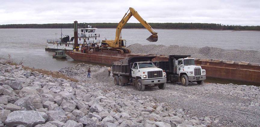
The new Burkley
Boat Ramp will make the Mississippi River more accessible to residents of Carlisle County. Ramp construction is a
cooperative effort between the U.S. Army Corps of Engineers, Kentucky
Department of Fish and Wildlife, and Carlisle
County. Photo by Glynn
Beck, Kentucky Geological Survey.