Local Issues
Seepage and Geology

Seepage at the boundary between
overlying permeable and underlying impermeable rocks.
Often not evident during dry weather construction, it can produce a variety of
problems, including foundation disturbance, flooding, soil movement, wet
basements, and failure of onsite wastewater treatment systems. Photo by Paul
Pond Construction and
Geology
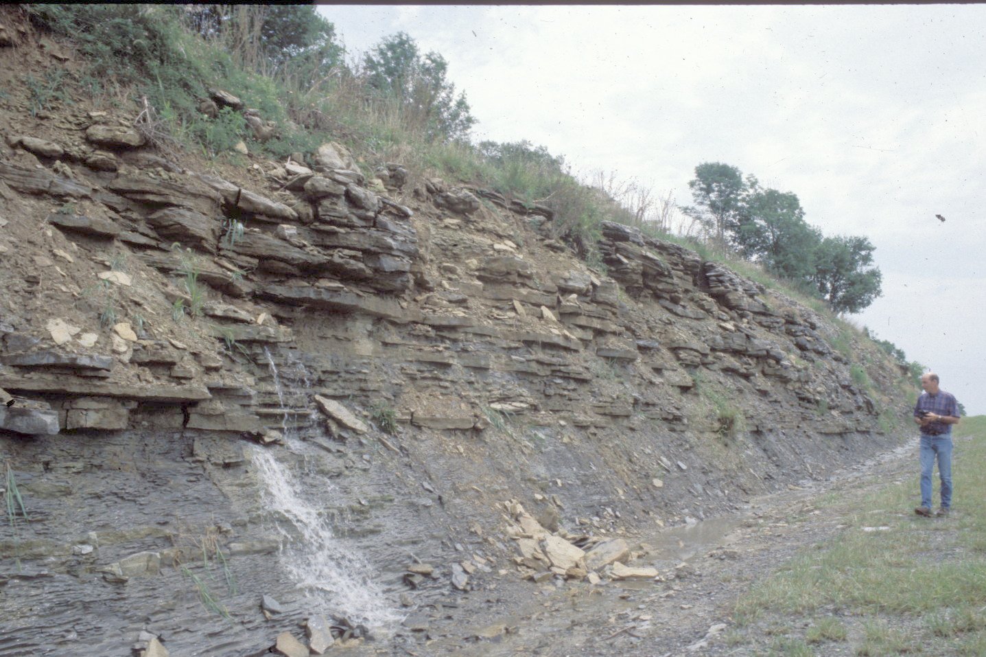
Seepage at the interface of
evenly-bedded limestone above shale and limestone, permeable rock overlying
relatively impermeable rock. Successful ponds are
often located below this seepage zone, as shown on the map below.
(Photo
by Paul Howell)
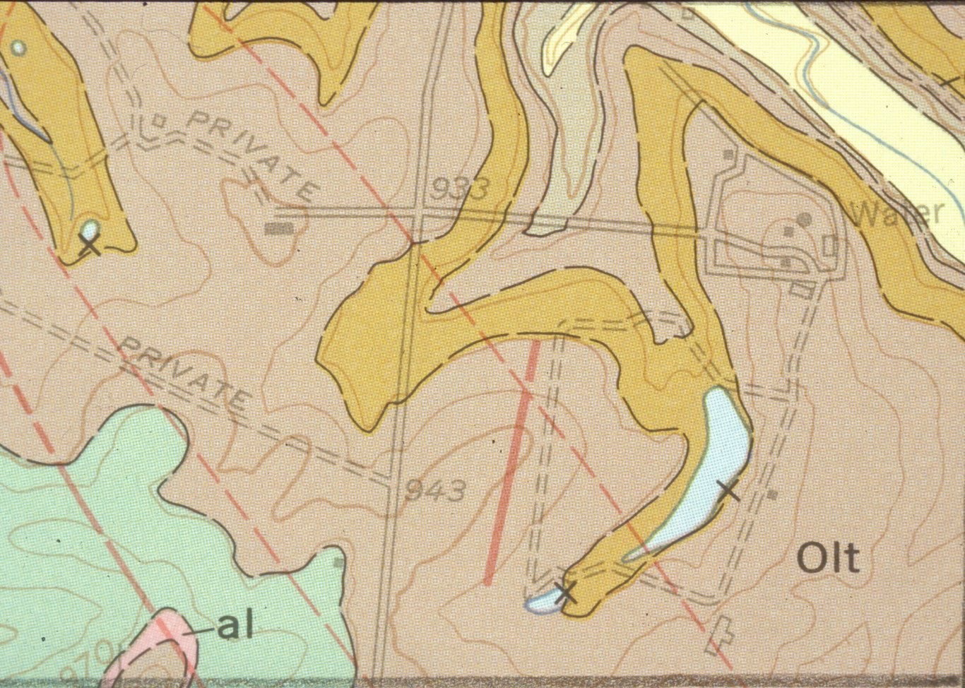
Geologic
map showing existing ponds located below the seepage zone in the photo above.
Ponds should be constructed so that the springs or seeps will always be above
the level of the pond surface.
(Illustration
by Paul Howell)
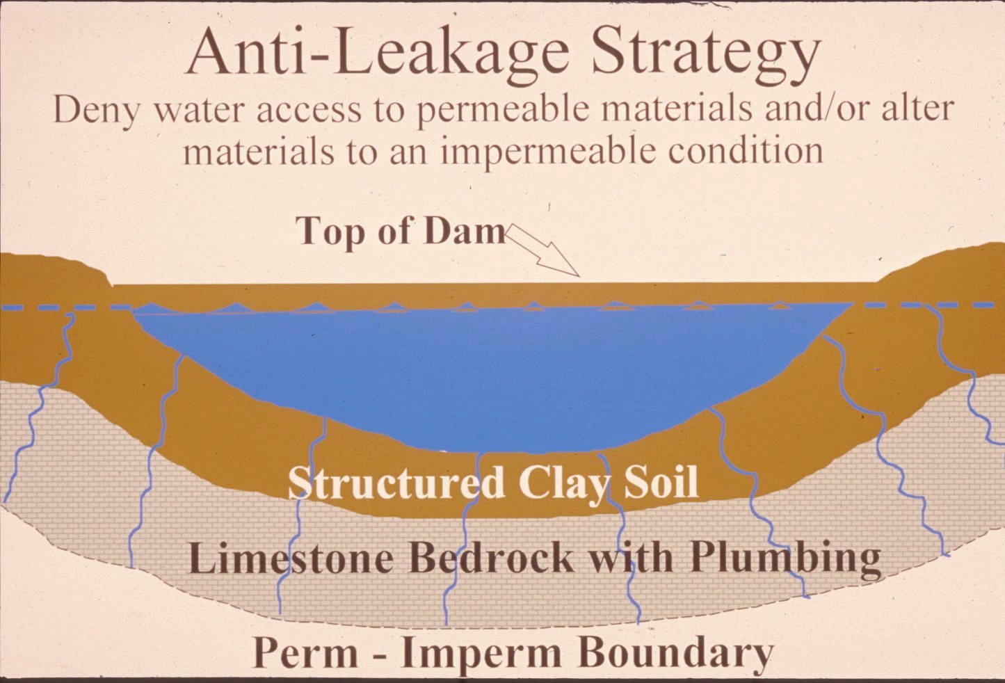
Successful
pond construction must prevent water from seeping through structured soils into
limestone solution channels below. A compacted clay liner, or artificial liner,
may prevent pond failure. Getting the basin filled with water as soon as
possible after construction prevents drying and cracking, and possible leakage,
of the clayey soil liner. Ponds constructed in dry weather are more apt to leak
than ponds constructed in wet weather. (Illustration by Paul Howell)
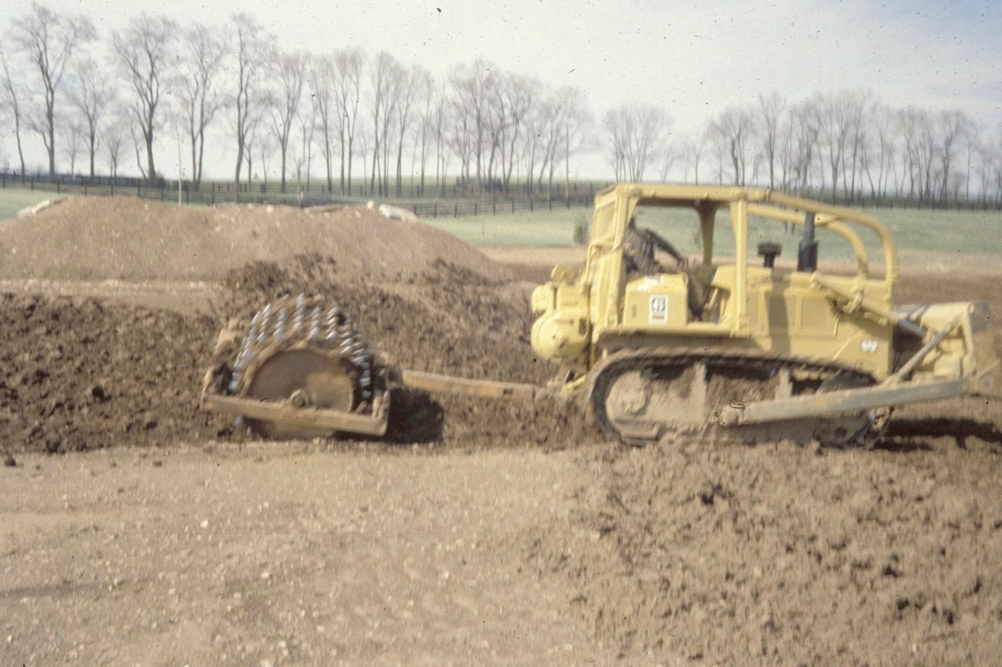
A
clayey soil pond liner is placed in loose, moist layers nine inches thick and
compacted in six passes with a sheepsfoot roller. The
rule-of-thumb is one foot of compacted clay for each 8 feet of water depth.
(Photo by Paul Howell)
Other
leakage prevention measures include synthetic liners, bentonite,
and asphaltic emulsions. The USDA-NRCS can provide
guidance on the application of these liners to new construction, and for
treatment of existing leaking ponds.
Dams
should be constructed of compacted clayey soils at slopes flatter than 3 units
horizontal to 1 unit vertical. Ponds with dam heights exceeding 25 feet, or
pond volumes exceeding 50 acre-feet require permits. Contact the Kentucky
Division of Water,
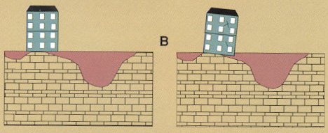
Sinkholes and Karst
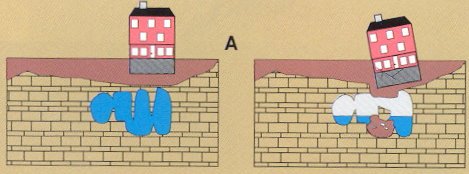
Limestone
terrain provides subsidence hazards that usually can be overcome by prior
planning and site evaluation. "A" shows construction above an open
cavern which later collapses. This is one of the most difficult situations to
detect, and the possibility of this situation beneath a structure warrants
insurance protection for homes built on karst
terrain.
"B"
is a situation where a heavy structure presumed to lie above solid bedrock
actually is partially supported on soft, residual clay soils that produce very gradual
subsidence and damage to the structure. This occurs where inadequate site
evaluation can be traced to lack of geophysical studies and inadequate core
sampling.
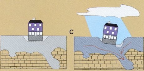
"C"
and "D" show the close relationship between hydrology and subsidence
hazards in limestone terrain. In "C", the house is situated on porous
fill (light shading) at a site where surface and groundwater drainage move
supporting soil (darker shading) into voids in limestone (blocks) below. The
natural process is then accelerated by infiltration through fill around the
home.
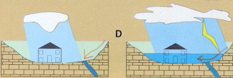
"D"
shows a karst site where normal rainfall is absorbed
by subsurface conduits, but water from an infrequent heavy storm cannot be
carried away quickly enough to prevent flooding of low-lying areas (American
Institute of Professional Geologists, 1993).
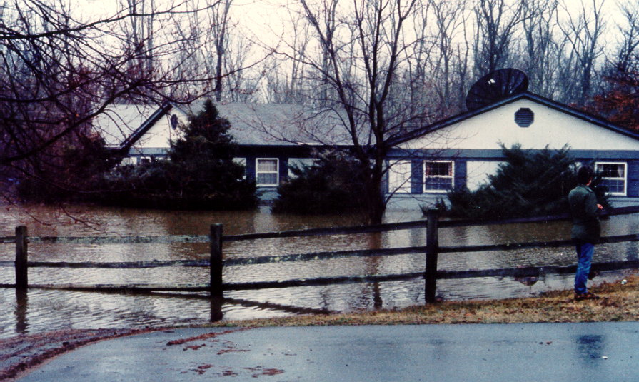
Flooding in a large karst
basin. Sinkhole swallets and solution
channels are not large enough to carry off the water from this large storm. The
problem is exacerbated by development. Often the only solution is to relocate
the homes out of the karst flood plain. Photo courtesy of Jim Currens.
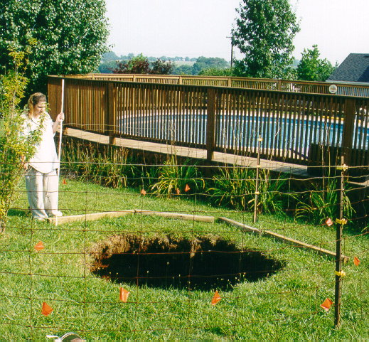
Sinkhole cover
collapse. After perhaps years of slow settlement, soils over bedrock solution channels
collapse rapidly and wash out, leaving sinkholes such as this. This phenomenon
occurs throughout the Inner Bluegrass karst
landscape. Photo courtesy of Jim Currens.
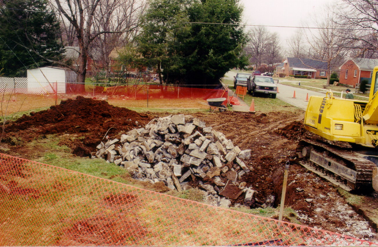
Attempt
to fill in a cover-collapse sinkhole in
Radon
Radon
gas, although not widely distributed in
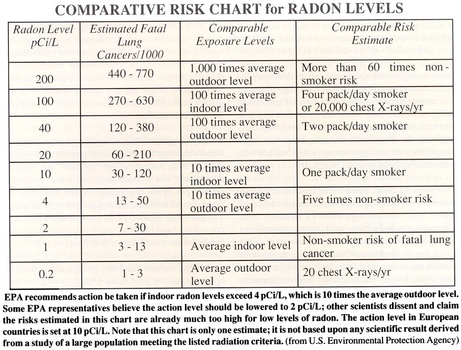
Mapped Surface Faults
Faults
are common geologic structures across
References
American
Carey, D.I., and Stickney,
J.F., 2001, Ground-water resources of
Currens, J.C., and Ray, J.A., 1996, Karst groundwater basins in the
Johnson, C.G., and Hopkins,
H.T., 1966, Engineering geology of
McDonald, H.P., Keltner, D., Wood, P., Waters, B.A., and Whitaker, O.J.,
1985, Soil survey of Anderson and Franklin counties,
Paylor, R.L., Florea,
L.J., Caudill, M.J., and Currens, J.C., 2003, A GIS
coverage of sinkholes in karst areas of
Copyright
2003 by the University of