Butler County, Kentucky
The Green
River
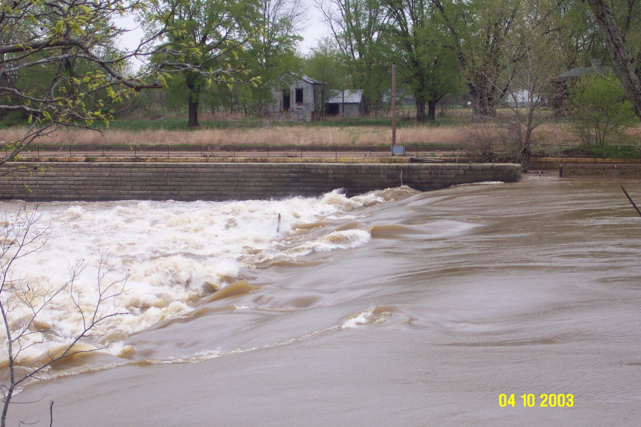
Lock
No. 3 located on the Green River. The Green River pool level is maintained by the dam located at
Lock No. 3. This pool level is vital because Butler
County utilizes the Green
River for drinking water throughout the entire county.
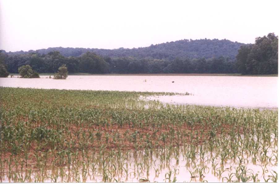
Green River flooding of an early corn crop. (Photo
courtesy of Greg Drake, Butler County Agriculture and Natural Resources Agent.)
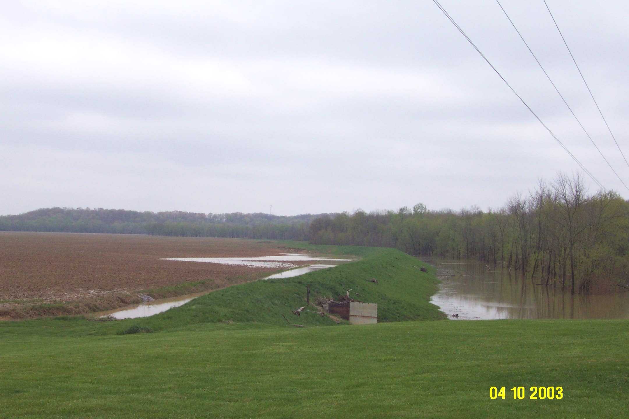
An
earthen levy was constructed around this low lying rowcrop
field to hold back floodwater from the Green River.
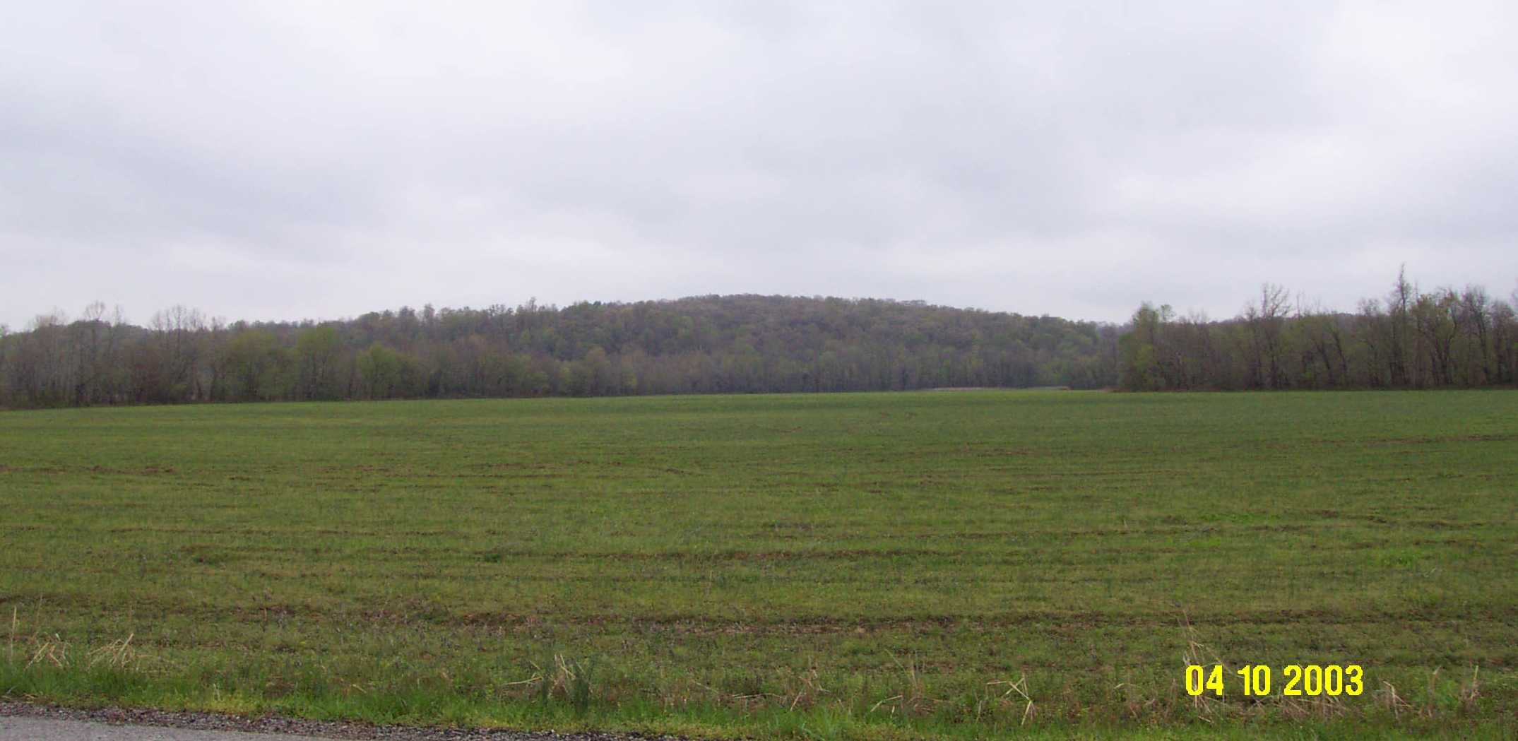
Physiography
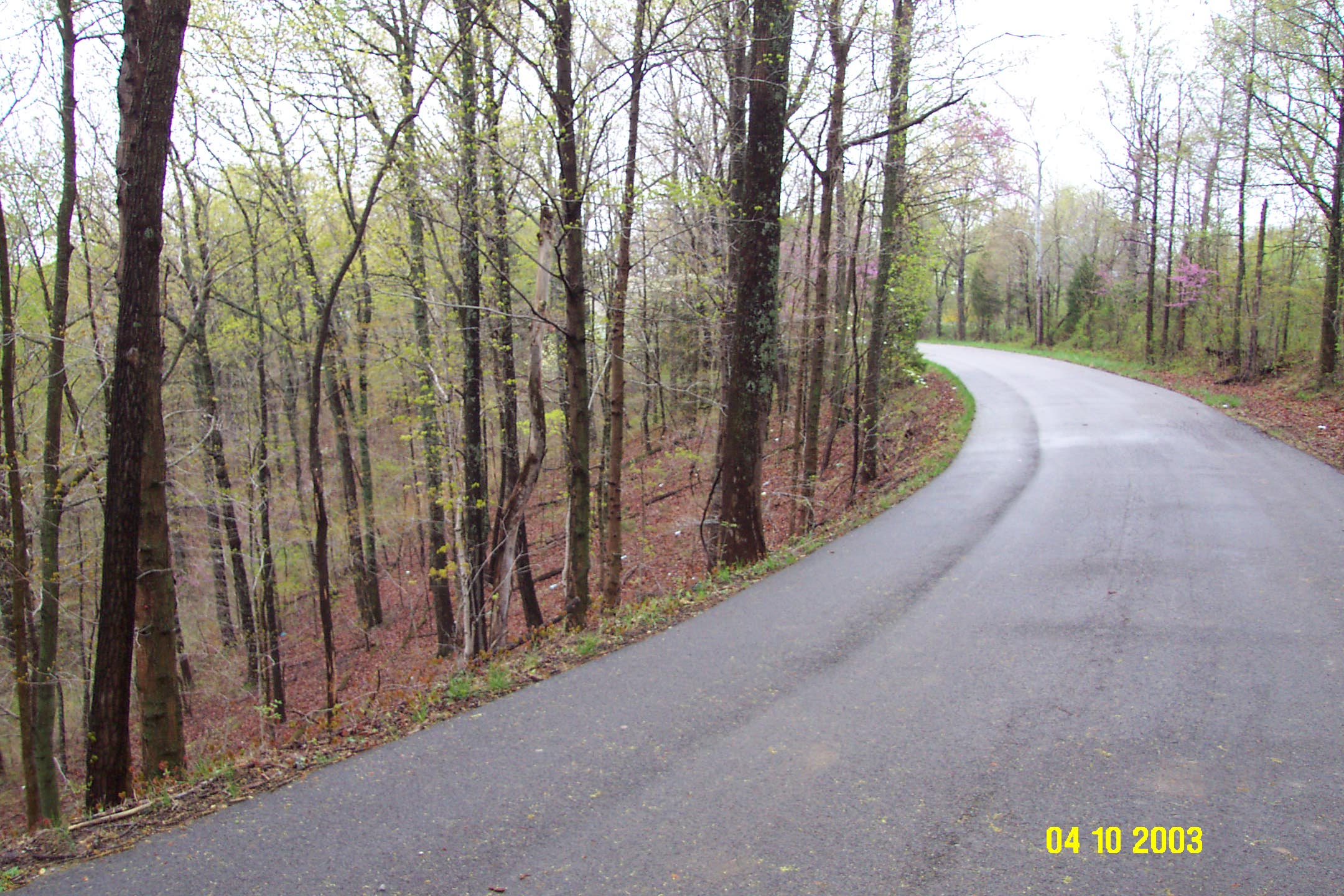
Butler County is dominated by the
Caseyville Hills ecoregion (Woods and others, 2002),
characterized by steep uplands (above) and broad, flat lowlands (below), which
are subject to flooding.
Resources
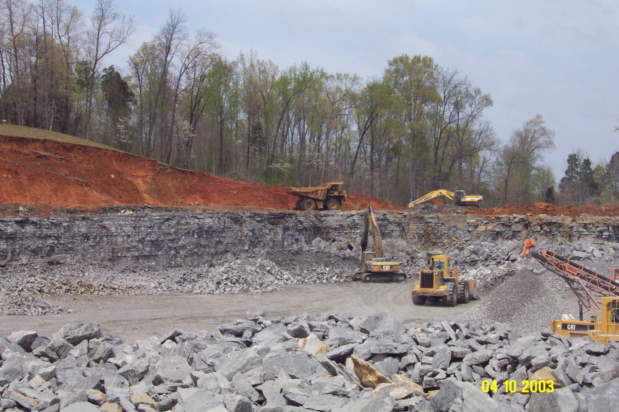
The
Yukon Valley Minerals limestone quarry is the only active quarry in Butler County.
Approximately 30 feet of overburden is being removed to mine the Glen Dean
Limestone, which is approximately 25 feet thick at this location.
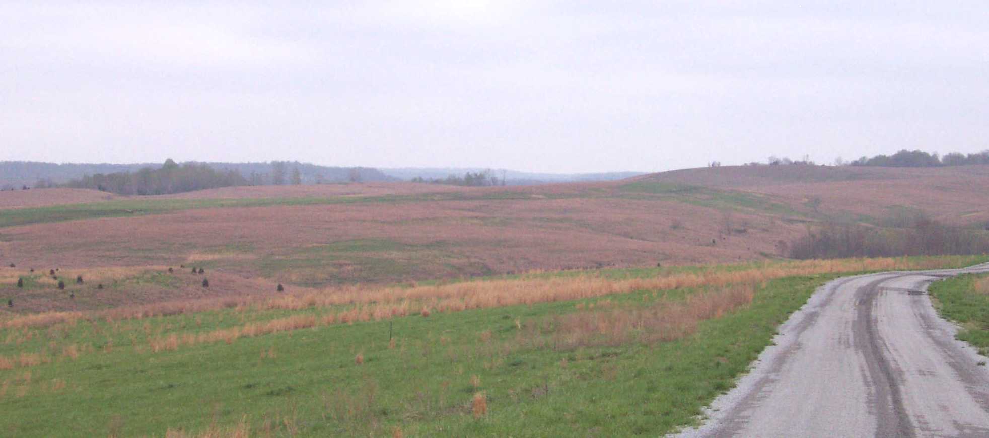
Approximately
10% of Butler County consists of reclaimed surface
coal mine land (above). There are currently no active surface or deep coal
mines in Butler County.
Groundwater
In
the northern two-thirds of Butler
County most wells from
depths of less than 300 feet are adequate for a domestic supply. Wells located
in the Green River flood plain can produce as
much as 100 gallons of hard water per minute. Most wells obtain their water
from thick sandstone layers and will yield as much as 60 gpm.
In the southern third of the county only a few wells yield enough water for a
domestic supply. In the central section of the county moderately mineralized
water may be obtained locally from deep sandstone formations at depths of 1,200
feet. Generally, ground water is hard to very hard and iron and salt may be
present in objectionable amounts. Often ground water becomes saltier with
depth. For more information about ground-water resources in the county, see
Carey and Stickney (2001).
Geologic Hazards
Faults
are common geologic structures across Kentucky,
and have been mapped in many of the Commonwealth's counties. The faults shown
on this map are part of the Pennyrile Fault System,
which is considered not to be active. However, earthquake damage in Butler County
is still a possibility. Soil creep, slumps, and landslides occurring along
steep slopes may occur from erosion or ground motion associated with a strong
earthquake. Areas associated with alluvium are subject to liquefaction during a
strong earthquake event. These areas are also subject to flooding. Soils
derived from alluvium deposits may have a moderate to high shrink swell
capacity, which may affect structural foundations and roads. Surface coal mine
(strip mine) areas are prone to settle after reclamation, which also may affect
structural foundations and roads. Strip mine areas also lack soil structure,
which inhibits the growth of vegetation during summer months. Strip mine areas
are not shown. In areas where coal seams outcrop, shallow underground mines
maybe present. These shallow mines are represented on the map as adits. These mines may cause localized ground instability
due to mine subsidence.
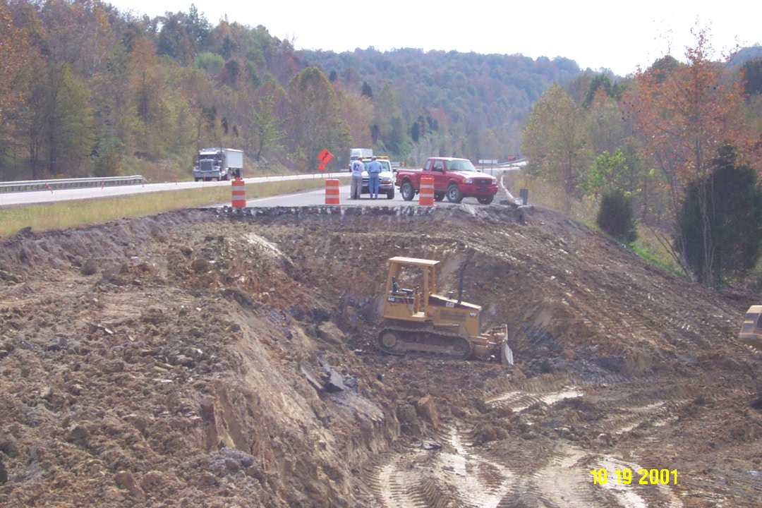
The
above picture is an example of how water retaining fill
material destabilized part of the William
H. Natcher Parkway in Butler County.
Upon saturation the original fill material consisting of Rock Unit 3 on the map
became unstable causing a landslide, which created a large breach in the
parkway.
References
Carey, D.I., and Stickney,
J.F., 2001, Ground-water resources of Butler
County, Kentucky:
Kentucky Geological Survey Open-File Report OF-01-16, 24 p.
Mitchell, M.J., 2001, Soil
survey of Butler and Edmonson counties, Kentucky: U.S.
Department of Agriculture, Natural Resources Conservation Service, 312 p.
Paylor, R.L., Florea,
L.J., Caudill, M.J., and Currens, J.C., 2003, A GIS
coverage of sinkholes in karst areas of Kentucky, in
preparation, metadata and shapefiles of highest
elevation closed contours, 1 CDROM.
Thompson, M.F., Plauche, S.T., and Crawford, M.M., 2003, Geologic map of
the Beaver Dam 30 x 60 minute quadrangle: Kentucky, Kentucky
Geological Survey, ser. 12, Geologic Map 1, scale 1:100,000.
Woods, A.J., Omernik, J.M., Martin, W.H., Pond, G.J., Andrews, W.M.,
Call, S.M., Comstock, J.A., and Taylor, D.D., 2002, Ecoregions
of Kentucky (color poster with map, descriptive text, summary tables, and
photographs): Reston, VA., U.S. Geological Survey (map scale 1:1,000,000).
Copyright
2003 by the University of Kentucky,
Kentucky Geological Survey. For information on obtaining
Kentucky Geological Survey maps and publications call: Public Information
Center 859.257.3896. 877.778.7827 (toll free). View the KGS World Wide Web site
at: www.uky.edu/kgs