KARST HAZARDS
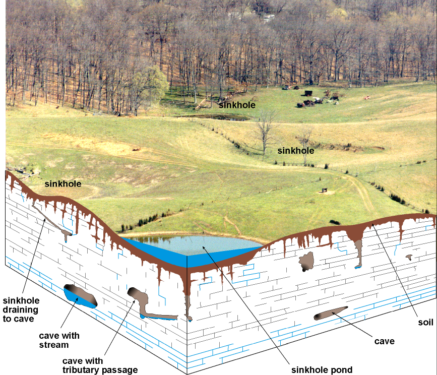
Never use sinkholes as
dumps. All waste, but especially pesticides, paints, household chemicals,
automobile batteries, and used motor oil, should be taken to an appropriate
recycling center or landfill.
Make sure runoff from
parking lots, streets, and other urban areas is routed through a detention
basin and sediment trap to filter it before it flows into a sinkhole.
Make sure your home septic
system is working properly and that it's not discharging sewage into a crevice
or sinkhole.
Keep cattle and other
livestock out of sinkholes and sinking streams. There are other methods of
providing water to livestock.
See to it that sinkholes
near or in crop fields are bordered with trees, shrubs, or grass "buffer
strips." This will filter runoff flowing into sinkholes and also keep
tilled areas away from sinkholes.
Construct waste-holding
lagoons in karst areas carefully, to prevent the
bottom of the lagoon from collapsing, which would result in a catastrophic emptying
of waste into the groundwater.
If required, develop a
groundwater protection plan (410KAR5:037) or an agricultural waterquality plan (KRS224.71) for your land use.
(From Currens,
2001)
DRAINAGE AND
SUBSIDENCE
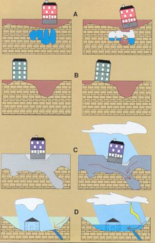
Limestone terrain can be
subject to subsidence hazards, which usually can be overcome by prior planning
and site evaluation. "A" shows construction above
an open cavern, which later collapses. This is one of the most difficult
situations to detect, and the possibility of this situation beneath a structure
warrants insurance protection for homes built on karst
terrain.
In "B," a heavy
structure presumed to lie above solid bedrock actually is partially supported
on soft, residual clay soils that subside gradually, resulting in damage to the
structure. This occurs where inadequate site evaluation can be traced to lack
of geophysical studies and inadequate core sampling.
"C" and
"D" show the close relationship between hydrology and subsidence
hazards in limestone terrain. In "C," the house is situated on porous
fill (light shading) at a site where surface and groundwater drainage move
supporting soil (darker shading) into voids in limestone (blocks) below. The
natural process is then accelerated by infiltration through fill around the
home.
"D" shows a karst site where normal rainfall is absorbed by subsurface
conduits, but water from infrequent heavy storms cannot be carried away quickly
enough to prevent flooding of
low-lying areas.
Adapted
from AIPG (1993).
CONSTRUCTION IN KARST
AREAS
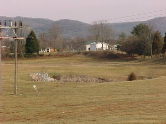
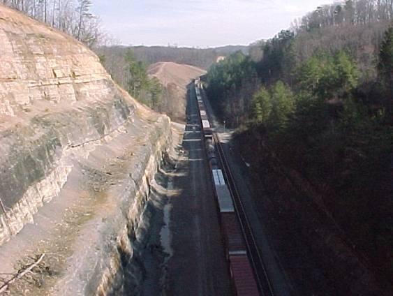
A large
sinkhole along Highway 27 near
Sinkholes found near any construction
project, whether industrial or residential, must be
carefully
considered and require special management.
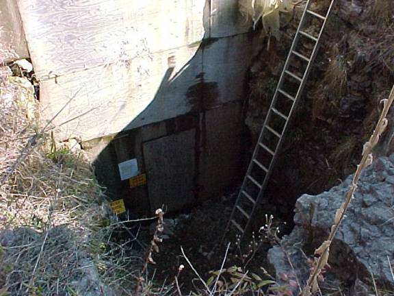
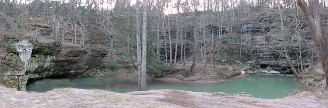
This is one of several entrances to
There are many caves in
drainage system
typical of well-developed karst geology.
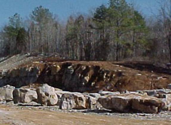
Excavation
of large limestone blocks near the southwestern abutment construction
site of the new Highway 90 bridge over the
Short Creek, near Stab,
where a section of
an underground river is exposed at the surface.
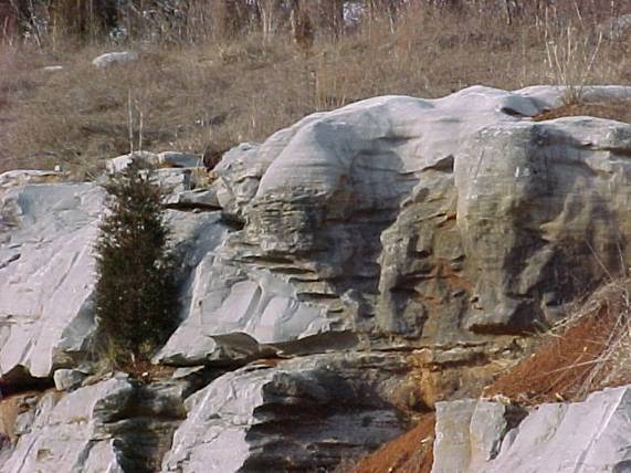
Typical karst geology indicated by highly weathered limestone at
the soil-bedrock
interface on the
new
A large inactive landfill
near
in a karst geology setting (sinkholes, springs, caves and
underground streams) requires
very careful
planning.
road cut of Pennsylvanian-aged rocks (sandstones and shales) and Mississippian-
aged rocks (shales and limestones).
MAPPED SURFACE FAULTS
Faults are common geologic
structures across
GROUNDWATER
Limestone and siltstone are
the prominent rock types found in the western two-thirds of
openings in karst areas. In the
low-lying areas in western
In the eastern third of the
county, the geology changes to sandstone and shales.
Less than half of the wells drilled in the eastern end of the county will
produce enough water for a domestic supply. In low-lying areas bordering
streams very few wells yield enough water for a domestic supply except in the
limited area south of Burnside, where most wells are adequate for a domestic
supply, especially from wells that penetrate large solution channels within the
limestone bedrock.
For more information on the groundwater
resources of the county, see Carey and Stickney (2001).
RESOURCES
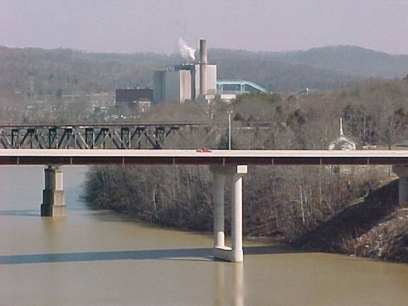
John Sherman
Cooper Power Plant is located on the
This plant
uses over 600,000 tons of coal per year, with sources in eastern
and
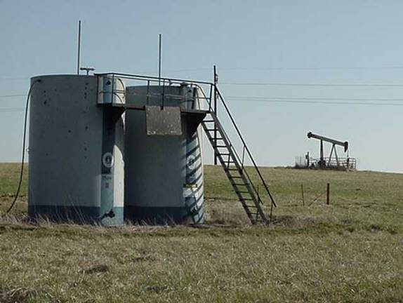
The
from the Knox Formation, at depths of around 1900 feet. Many
of these wells produced
hundreds of barrels per day in initial production, but most
(including Zimmerman #2
shown here) are now producing a few barrels per day on
timers.
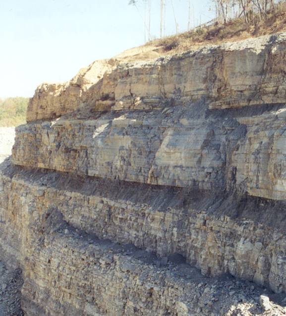
This highwall in a limestone quarry near Shopville
shows the variability of rock types
within a single formation (Slade Formation). Dolomite, limestone and shale layers
are visible.
RADON
Radon gas, although not
widely distributed in
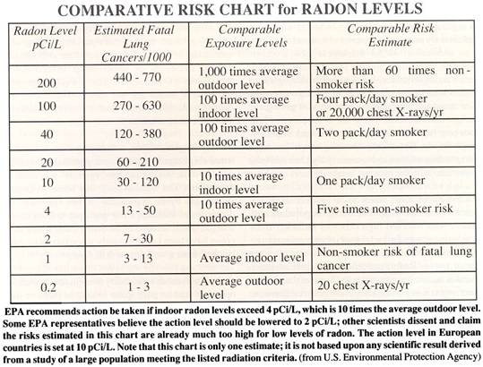
.