Jefferson County,
Kentucky
KARST GEOLOGY
The term "karst" refers to a landscape characterized by
sinkholes, springs, sinking streams (streams that disappear underground), and
underground drainage through solution-enlarged conduits or caves. Karst landscapes form when slightly acidic water from rain
and snow-melt seeps through soil cover into fractured and soluble bedrock
(usually limestone, dolomite, or gypsum). Sinkholes are depressions on the land
surface where water drains underground. Usually circular and often
funnel-shaped, they range in size from a few feet to hundreds of feet in
diameter. Springs occur when water emerges from underground to become surface
water. Caves are solution-enlarged fractures or conduits
large enough for a person to enter.

In metropolitan areas where residential
construction is common, care must be taken to ensure that septic systems are
correctly installed to avoid polluting local streams and groundwater. In
WATER QUALITY
The Floyd’s Fork Creek
drainage basin contains a mapped wetland area in east-central
SOURCE-WATER
PROTECTION AREAS
Source-water
protection areas are those in which activities are likely to affect the quality
of the drinking-water source. For more information, see
kgsweb.uky.edu/download/water/swapp/swapp.htm.
CONSTRUCTION MATERIALS
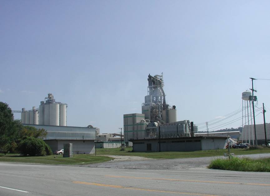
The Kosmos
Cement Plant was founded in 1905, and the nearby community of Kosmosdale (formerly Riverview) was named after the
plant. About 720,000 tons of cement are produced by the plant annually.
RIVER TRAFFIC
River traffic influences
land use in
FLOODING
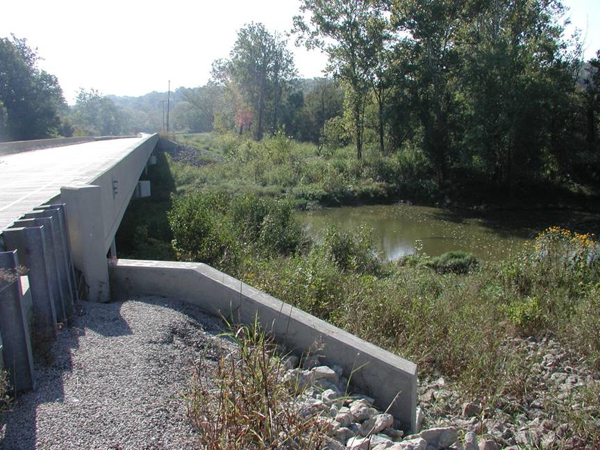
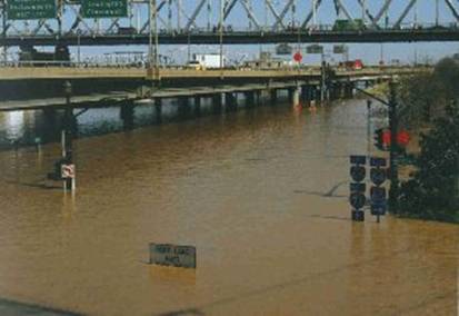
A 29-mile long system of
flood walls, gates, pumping stations, and levees allows for multiple land uses
in the Louisville-metro area. The flood walls were constructed following the
1937 flood when the river crested at 85.4 feet.


Growth of
the metropolitan
SLOPE STABILITY
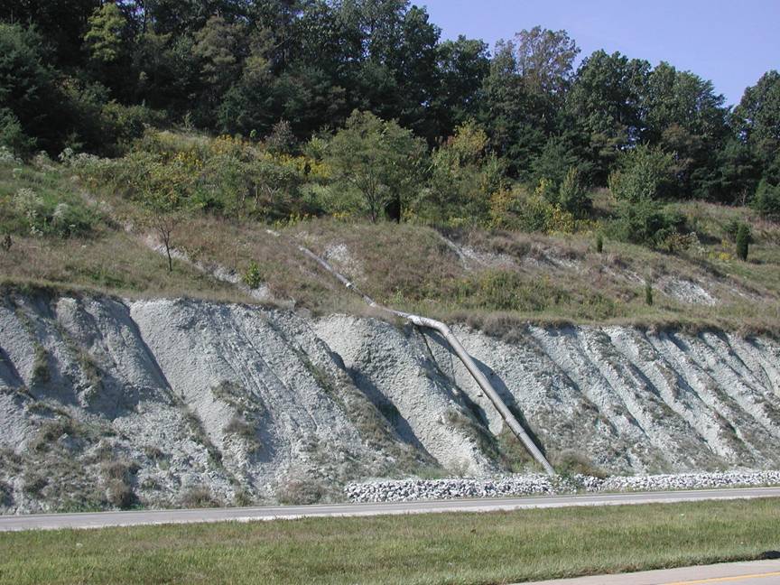
Drainpipes
and limestone riprap are used along the shale slopes of the Muldraugh
Escarpment to help prevent water infiltration and subsequent slope instability
onto the Gene Snyder expressway. Photograph by Bart Davidson,
EROSION CONTROL
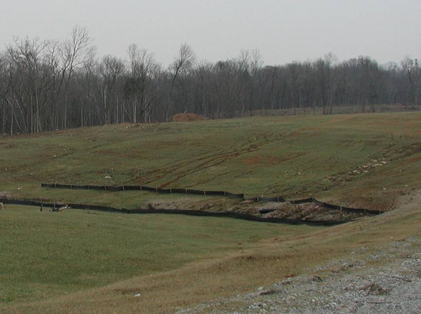
During
construction, erosion-control fences such as these may be needed to prevent
silt from entering local streams. Photo by Bart Davidson,

Riprap
drainage control and erosion protection. Photo by Stephen Greb,
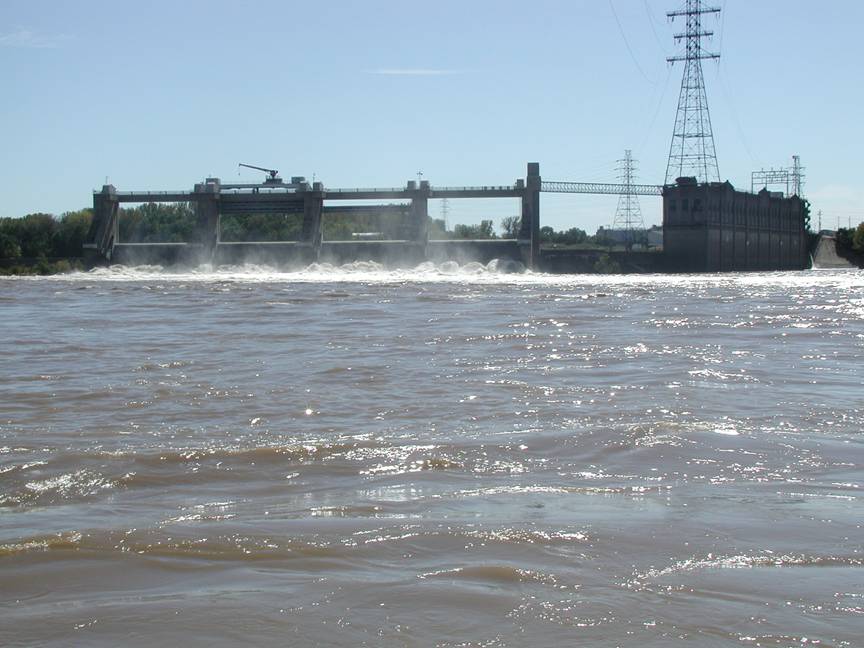
POWER PRODUCTION
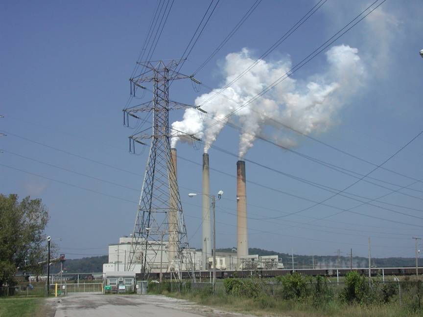
Large
cities such as
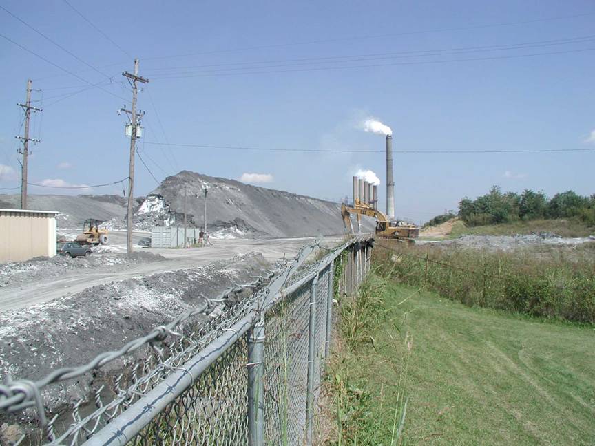
A sister
power station to Mill Creek, the Cane Run Power Station burns 1.3 million tons
of coal per year, all shipped by rail. The plant produces gypsum as a
by-product that must be disposed of in environmentally safe landfills. Photograph by Steve Greb,
GROUNDWATER
The alluvium along the
Water is hard or very hard
but otherwise of good quality. Groundwater in upland areas may contain salt or
hydrogen sulfide, especially at depths greater than 100 feet.
For more information on
groundwater in the county, see Carey and Stickney (2001).
POND CONSTRUCTION
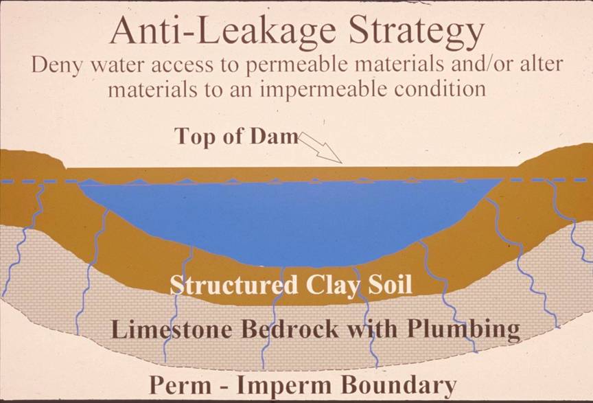
Successful pond construction
must prevent water from seeping through structured soils into limestone
solution channels below. A compacted clay liner, or artificial liner, may
prevent pond failure. Getting the basin filled with water as soon as possible
after construction prevents drying and cracking, and possible leakage, of the
clayey soil liner. Ponds constructed in dry weather are more apt to leak than
ponds constructed in wet weather. Illustration by Paul
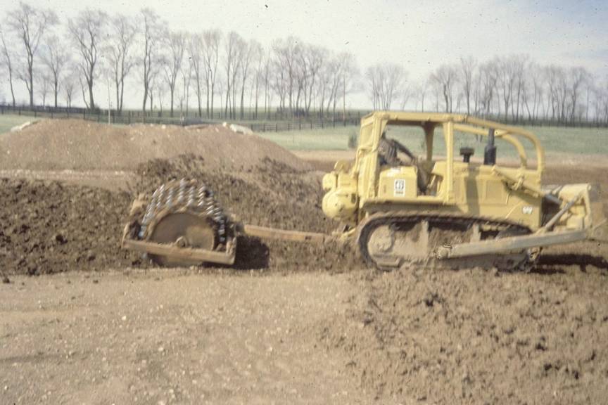
A pond liner consisting of
clayey soil is placed in loose, moist layers and compacted with a sheepsfoot roller. A geotechnical engineer or geologist should
be consulted about the requirements of a specific site. Other leakage
prevention measures include synthetic liners, bentonite,
and asphaltic emulsions. The
Dams should be constructed
of compacted clayey soils at slopes flatter than 3 units horizontal to 1 unit
vertical. Ponds with dam heights exceeding 25 feet, or pond volumes exceeding
50 acre-feet, require permits. Contact the
CITY OF
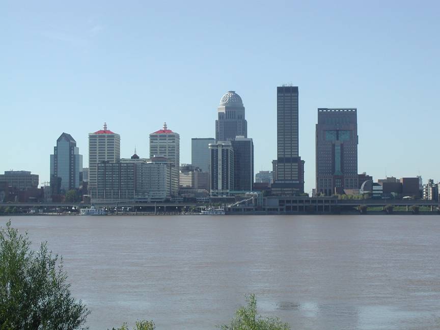
Situated on the Ohio River,