Hopkins County, Kentucky
GEOLOGIC HAZARDS
Hopkins County is located near the New Madrid and Wabash Valley
Seismic Zones. Although the faults in the county are not considered active,
precautions for earthquakes should be considered. Approximately 13 major
earthquakes were recorded in the Madisonville
area from 1974 to 2000. Earthquake prediction is not a defined part of
seismology, but geologists and engineers know that earthquakes will cause
damage, depending on magnitude, distance from the epicenter, and local geology.
Areas of thick alluvium, lacustrine deposits, and other
unconsolidated sediments are prone to the most damage because of ground-motion
amplification and liquefaction. Liquefaction is the process which rock becomes
saturated or loses shear strength, and is temporarily transformed into a fluid
mass, resulting in structural damage.
Flooding is also a geologic hazard in Hopkins County. Areas underlain by alluvium are
subject to regular flooding (Beck and others, 2004). The Green
River borders the extreme northeastern part of the county and also
has the potential for flooding. Urban development on or near both of these
areas intensifies runoff, so flooding potential should be considered when
planning.
Potential engineering problems can be associated with
some clay shales beneath coals and with lacustrine deposits high in clay content. Small landslides
and slumps occur locally on steep slopes where these deposits are prevalent.
Where clay-shale deposits are overlain by massive sandstone, slumping is most common
where joints in the sandstone parallel the slope. Excavations in shale, for
roads or building foundations, may oversteepen the
slope and undercut the overlying sandstone, causing slides to occur, especially
when the material is saturated with water. Outwash and lacustrine
deposits with high clay content present engineering problems because roads
built on them tend to yield and push out under heavy traffic. Lacustrine deposits have good to poor compaction and
moderate to high susceptibility to frost action. When the water table reaches
the surface, the shrink-swell potential of lacustrine
deposits is high.
Surface subsidence above abandoned underground coal
mines has caused structural damage in parts of the county. When
strata above mined-out coal beds collapse, resulting property loss can be
substantial. If the overlying strata are not of sufficient thickness and
strength, or the underclay is too soft, the result
will be surface movement, causing structural damage (Sergeant and others,
1988). Structural damage and property damage can include cracks in foundations,
cracks and depressions in roads, curvature of walls, collapse
of buildings, and damage to utility lines. The areas of working or abandoned
underground coal mines are shown on the map.
EARTHQUAKE HAZARDS
Peak ground acceleration at
the top of rock that will probably occur in the next 500 years in Kentucky

Although we do not know when
and where the next major earthquake will occur, we do know that an earthquake
will cause damage. Damage severity depends on many factors, such as earthquake
magnitude, the distance from the epicenter, and local geology. Information on
earthquake effects is obtained by monitoring earthquakes and performing
research. Such information is vital for earthquake hazard mitigation and risk
reduction.
The most important
information for seismic-hazard mitigation and risk reduction is ground-motion
hazard. One way of predicting ground-motion hazard is by determining the peak
ground acceleration (PGA) that may occur in a particular timeframe. The map
above shows the PGA at the top of bedrock that will likely occur within the next
500 years in Kentucky
(Street and others, 1996). It shows, as expected, that PGA would be greatest in
far western Kentucky
near the New Madrid Seismic Zone. Ground-motion hazard maps for the central United States
and other areas are available from the U.S. Geological Survey. These maps are
used to set general policies on mitigating damage. For example, maps produced by
the USGS in 1996 were used to determine seismic design in building codes. For
additional information pertaining to earthquake hazards visit the Kentucky
Geological Survey website at www.uky.edu/KGS/geologichazards/geologichazards.html
WATER RESOURCES

Lake Pee Wee is a
420-acre-lake constructed in the early 1950’s to supply drinking water to the
city of Madisonville. Currently, Lake Pee Wee provides drinking water
to approximately 65 percent of the county. The lake holds 1.355 billon gallons
of water and when necessary is recharged by pumping 9 million gallons of water
per day from the Green River. Photo by Glynn Beck,
Kentucky Geological Survey.
GROUNDWATER
About 2,300 people in Hopkins County
rely on private domestic water supplies: 1,200 use wells and 1,100 use other
sources. In Hopkins
County, most wells that
penetrate sandstones at depths of less than 300 feet are adequate for a
domestic supply. In the areas surrounding Nortonville and south of Richland, most wells
produce less than 100 gallons per day at depths of less than 300 feet. In
southwestern Hopkins County, south of Charleston, a thin, highly faulted zone
running east_west yields unpredictable amounts of
water to drilled wells. Generally, groundwater is hard, and sometimes iron or
salt may be present in objectionable amounts. Often groundwater becomes saltier
with depth north of the highly faulted zone. For additional information, see
Carey and Stickney (2001).
EROSION CONTROL

During
construction, erosion-control fences such as these may be needed to prevent
silt from entering local streams. Photo by
Bart
Davidson, Kentucky
Geological Survey.

Riprap
drainage control and erosion protection. Photo by Stephen Greb, Kentucky
Geological Survey.
COAL RESOURCES

Coal mining is a vital part
of the Hopkins County economy. By 2000, approximately 5 to 10 million tons
of coal has been mined in
Hopkins County (both surface and underground). Original
coal resources for the county are estimated to be 5 to 10 billion tons. Photo by Glynn Beck, Kentucky
Geological Survey.

The Dotiki
IV surface mine in Hopkins County, which is one of six surface mines owned by Dotiki in western Kentucky
and southern Illinois.
The facility was constructed in 2003, and mines the W. Kentucky No. 9 coal. In
2003, Dotiki Mines was the largest producer of coal
in Kentucky
and the largest non-longwall coal producer in the
nation. Primary customers for coal produced at Dotiki
are Seminole Electric, Tennessee Valley Authority, Louisville Gas &
Electric, Western Kentucky Energy, Tampa Electric, and Henderson Municipal. Photo courtesy of Doug Blair.
AGRICULTURE

Traditional agriculture is a
major part of the Hopkins
County economy. Of the 353,433 acres in Hopkins County,
61,062 were used to grow corn, soybeans, and tobacco (Kentucky Agriculture
Statistics, 2002–2003). Photo by Glynn Beck,
Kentucky Geological Survey.

The presence of clayey to silty soils allows water to stand in row-crop fields.
Fields are tiled in order to improve surface drainage in low-lying areas. Photo by George Kelley, Hopkins County Agriculture and Natural
Resources agent.
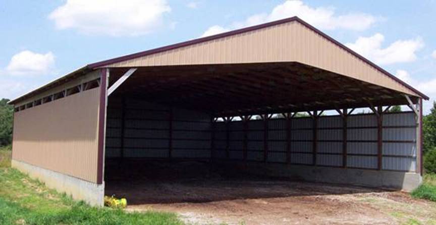
Poultry-litter storage buildings
are used to assist farmers in meeting nutrient-management and water-quality
guidelines set by the Kentucky Agriculture Water Quality Authority. Currently,
approximately 150 chicken houses are in Hopkins County,
and each poultry farm has at least one litter storage building. The above
building is located on the Doug Brown Farm. Photo by Glynn Beck, Kentucky
Geological Survey.

Peppers (nontraditional
crop) are growing next to burley tobacco (a traditional crop) on the Brumfield
Farm. Commercial vegetable growing on black plastic with irrigation is just one
of the non-traditional agricultural practices that have increased over the last
5 years in Hopkins
County. Traditional
agriculture such as corn, soybeans, and tobacco is still a major part of the Hopkins County economy, however. Photo by Glynn Beck,
Kentucky Geological Survey.
PUBLIC HEALTH

The Trover
Foundation and Regional Medical Center
is located in Madisonville and is the largest employer in Hopkins County. The Regional
Medical Center
serves 12 surrounding counties in western Kentucky. Photo by Glynn Beck, Kentucky
Geological Survey.