KARST HAZARDS
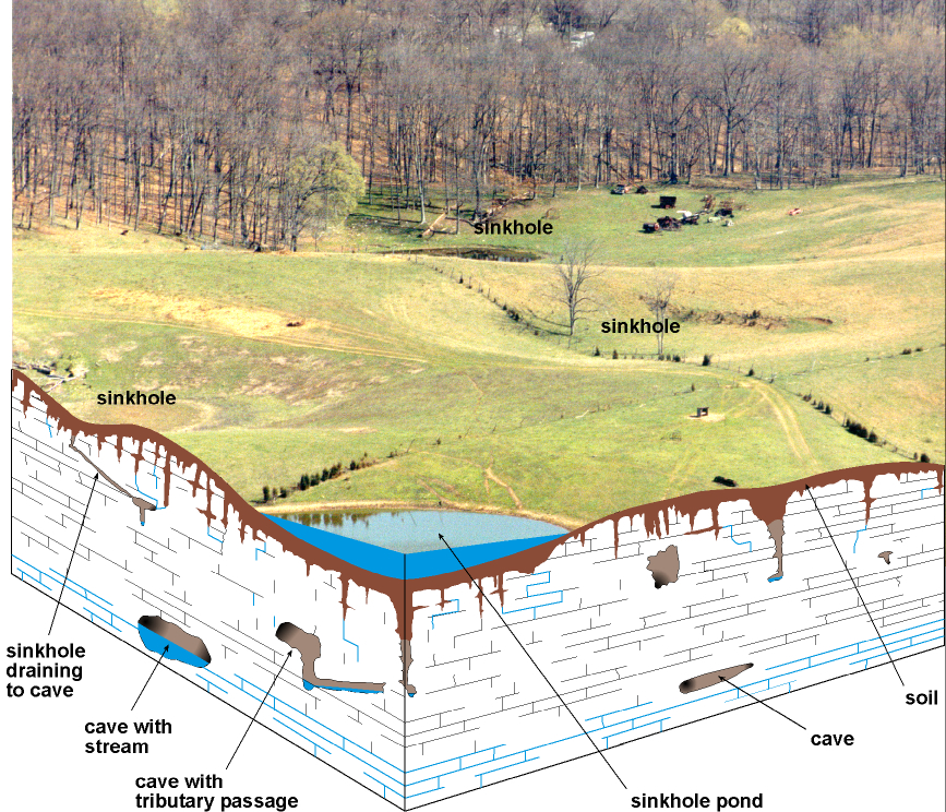
Never use sinkholes as
dumps. All waste, but especially pesticides, paints, household chemicals,
automobile batteries, and used motor oil, should be taken to an appropriate
recycling center or landfill.
Make sure runoff from
parking lots, streets, and other urban areas is routed through a detention
basin and sediment trap to filter it before it flows into a sinkhole.
Make sure your home septic
system is working properly and that it's not discharging sewage into a crevice
or sinkhole.
Keep cattle and other
livestock out of sinkholes and sinking streams. There are other methods of
providing water to livestock.
See to it that sinkholes
near or in crop fields are bordered with trees, shrubs, or grass "buffer
strips." This will filter runoff flowing into sinkholes and also keep
tilled areas away from sinkholes.
Construct waste-holding
lagoons in karst areas carefully, to prevent the
bottom of the lagoon from collapsing, which would result in a catastrophic emptying
of waste into the groundwater.
If required, develop a
groundwater protection plan (410KAR5:037) or an agricultural waterquality plan (KRS224.71) for your land use.
(From Currens,
2001)
DRAINAGE AND
SUBSIDENCE
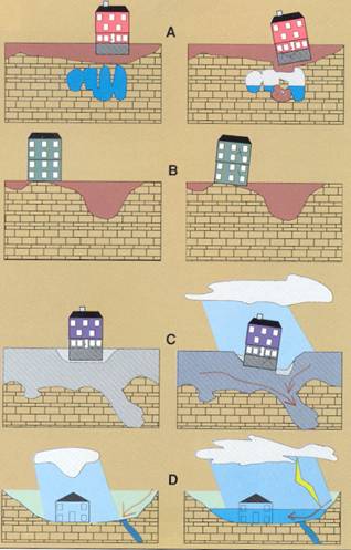
Limestone terrain can be
subject to subsidence hazards, which usually can be overcome by prior planning
and site evaluation. "A" shows construction above
an open cavern, which later collapses. This is one of the most difficult
situations to detect, and the possibility of this situation beneath a structure
warrants insurance protection for homes built on karst
terrain.
In "B," a heavy
structure presumed to lie above solid bedrock actually is partially supported
on soft, residual clay soils that subside gradually, resulting in damage to the
structure. This occurs where inadequate site evaluation can be traced to lack
of geophysical studies and inadequate core sampling.
"C" and
"D" show the close relationship between hydrology and subsidence
hazards in limestone terrain. In "C," the house is situated on porous
fill (light shading) at a site where surface and groundwater drainage move
supporting soil (darker shading) into voids in limestone (blocks) below. The
natural process is then accelerated by infiltration through fill around the
home.
"D" shows a karst site where normal rainfall is absorbed by subsurface
conduits, but water from infrequent heavy storms cannot be carried away quickly
enough to prevent flooding of
low-lying areas.
Adapted
from AIPG (1993).
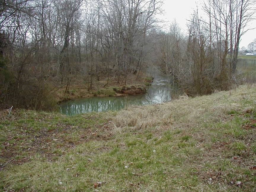
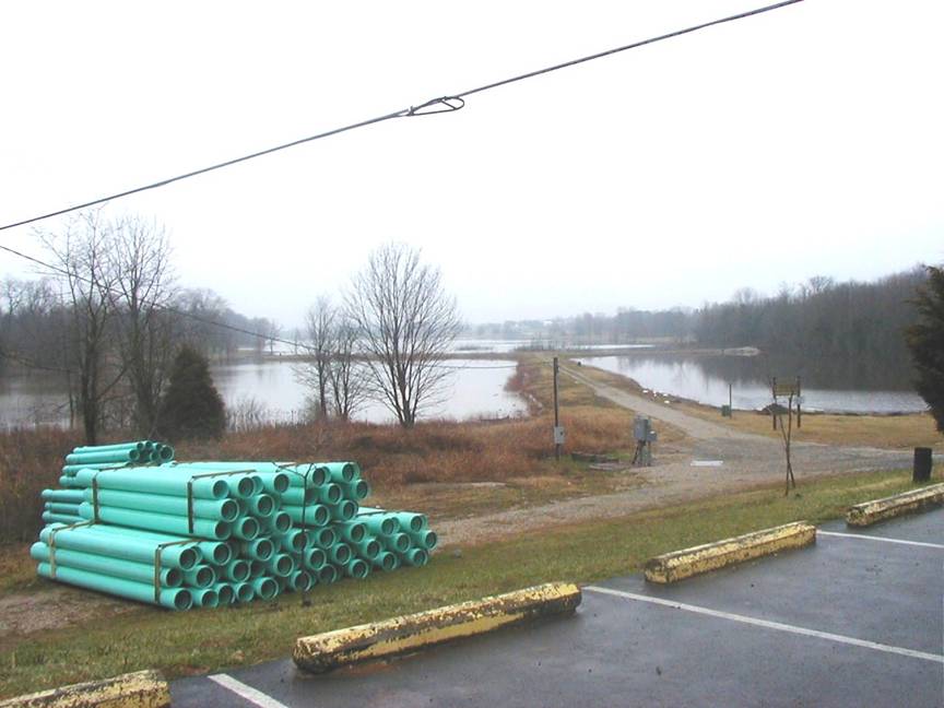
Alluvial areas may be
subject to flooding. For information on flooding in the county, contact the
Floodplain Management Branch,
Division
of Water, 502.564.3410.
CONSTRUCTION IN KARST
AREAS
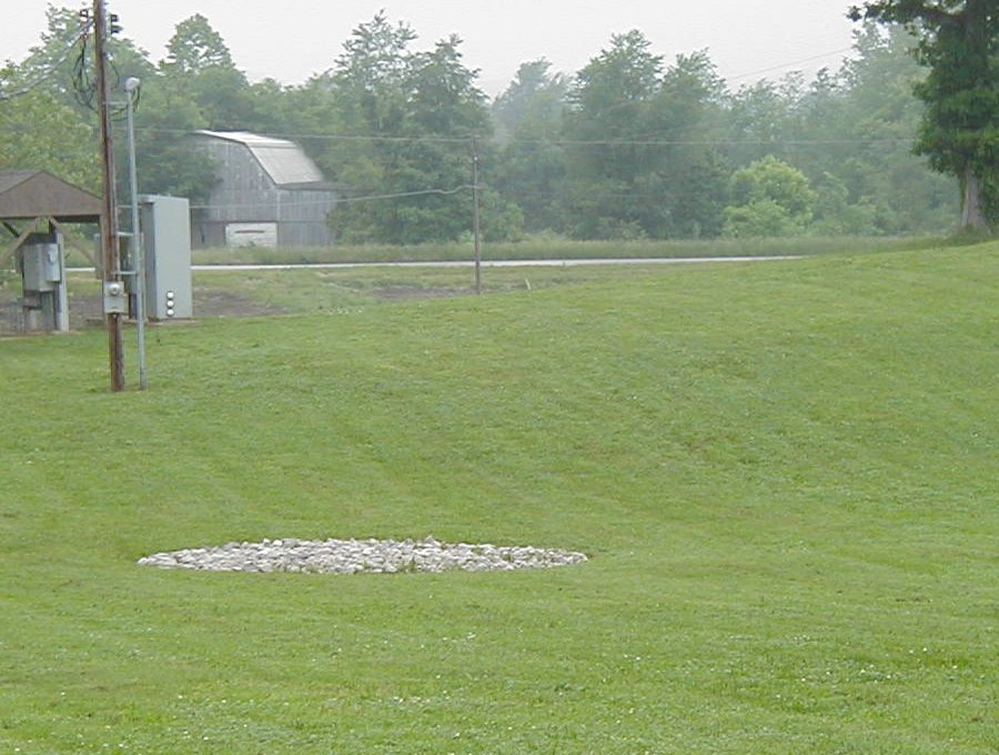
Karst geology (sinkholes, underground streams, springs and
caves) is prevalent in
POND CONSTRUCTION
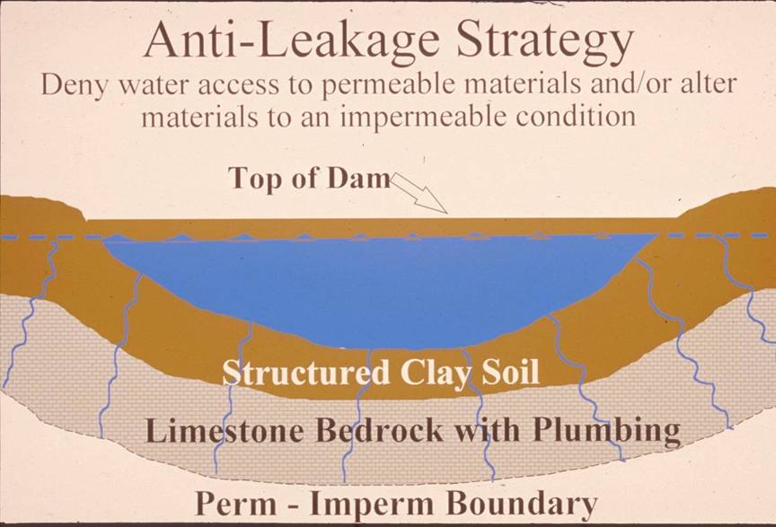
Successful pond construction
must prevent water from seeping through structured soils into limestone
solution channels below. A compacted clay liner, or artificial liner, may
prevent pond failure. Getting the basin filled with water as soon as possible after
construction prevents drying and cracking, and possible leakage, of the clayey soil
liner. Ponds constructed in dry weather are more apt to leak than ponds constructed
in wet weather. Illustration by Paul
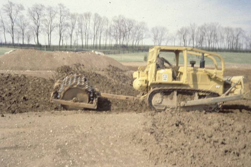
A clayey-soil pond liner is placed in loose,
moist layers and compacted with a sheepsfoot roller.
A geotechnical engineer or geologist should be consulted regarding the requirements
of a specific site. Other leakage prevention measures include synthetic liners,
bentonite, and asphaltic
emulsions. The U.S. Department of Agriculture-Natural Resources Conservation
Service can provide guidance on the application of these liners to new construction,
and for treatment of existing leaking ponds. Photo by Paul
Dams should be constructed
of compacted clayey soils at slopes flatter than 3 units horizontal to 1 unit
vertical. Ponds with dam heights exceeding 25 feet, or pond volumes exceeding
50 acre-feet, require permits. Contact the Kentucky Division of Water,
RESOURCES
Much of
Pirtle
Spring supplies much of the raw water for Hardin County Water District #1.
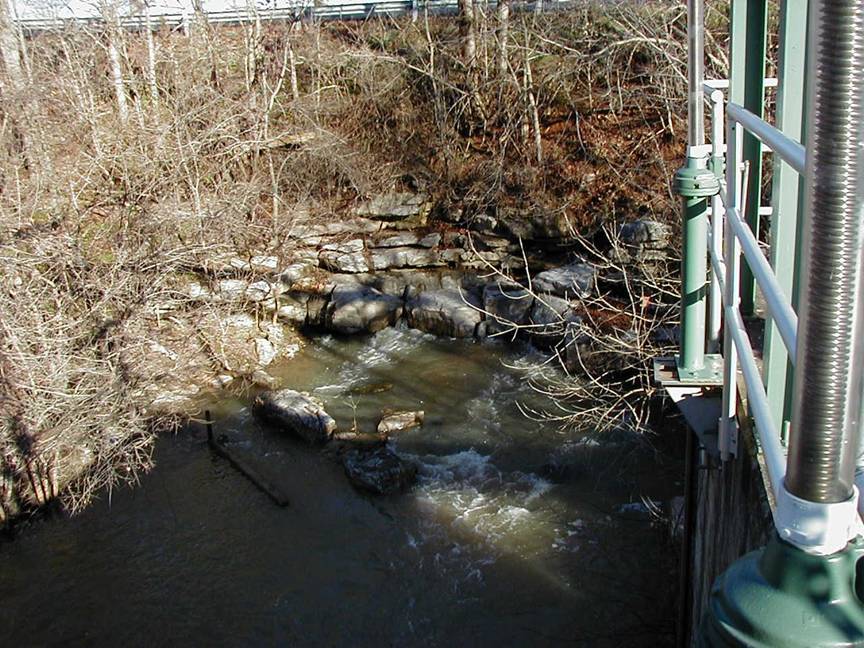
GROUNDWATER
In karst
areas, such as
Delineation of source water
protection areas is the process of defining the area of land in which
activities are likely to impact the quality of the drinking water source. For
more information, see http://kgs.uky.edu/kgsweb/download/misc/swapp.pdf
In northern
enough for a domestic supply, except in a few lowland areas
bordering streams, where a few wells meet the supply needs for domestic use.
Springs with flows ranging
from a few gallons per minute to 3,128 gpm are found
throughout the county. Many of the springs are of the depression type, and
yield more than 100 gpm when pumped. For more about
the groundwater resources of the county, see Carey and Stickney (2001).
 \
\
TAR SANDS
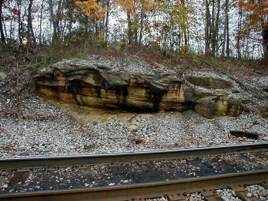
Naturally occurring
petroleum can be found in some sandstone outcrops in
MINERAL RESOURCES

A natural cave is exposed in
the E-town quarry north of White Mills, which mines limestone from the Ste.
Genevieve and St. Louis Formations.
NATURAL RESOURCES
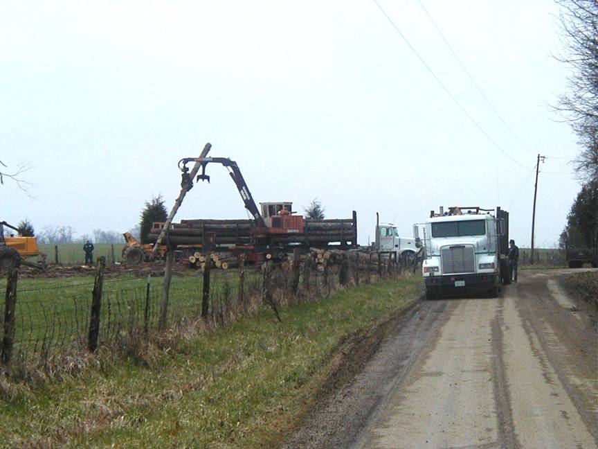
Logging has become a more
common activity in
GEOLOGY
Approaching
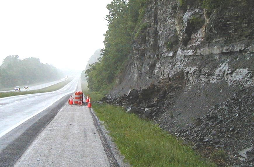
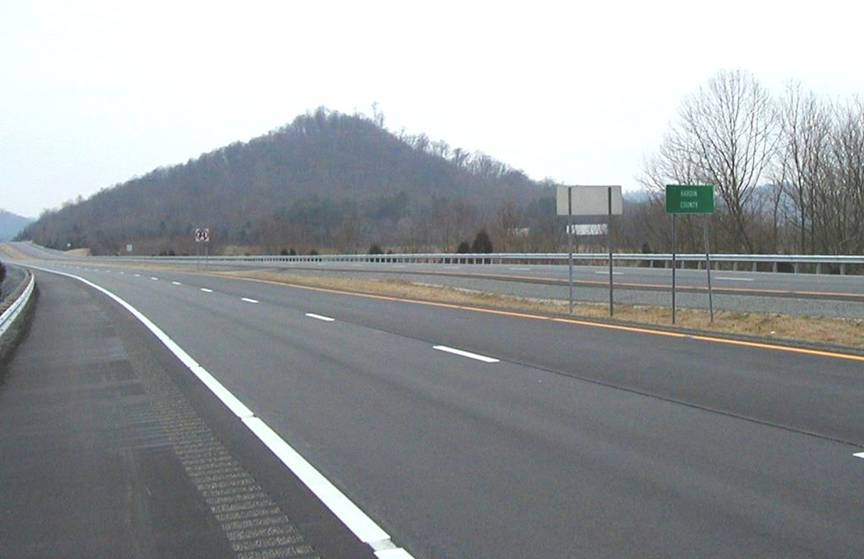
Rockslides are relatively
common in road cuts along the
MAPPED SURFACE FAULTS
Faults are common geologic
structures across
Faults may be associated
with increased fracturing of bedrock in the immediately adjacent area. This
fracturing may influence slope stability and groundwater flow in these limited
areas.